
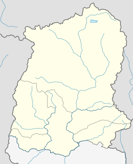
Teesta River, is a 315 km (196 mi) long river that rises in the eastern Himalayas, flows through the Indian states of Sikkim and West Bengal through Bangladesh and enters the Bay of Bengal. It drains an area of 12,370 km2 (4,780 sq mi). In India, it flows through North Sikkim, East Sikkim, Kalimpong district, Darjeeling District, Jalpaiguri District, Cooch Behar districts and the cities of Rangpo, Jalpaiguri and Mekhliganj. It joins the Jamuna River at Fulchhari in Bangladesh.

The Rangeet or Rangit is a tributary of the Teesta river, which is the largest river in the Indian state of Sikkim. The Rangeet river originates in the Himalayan mountains in West Sikkim district. The river also forms the boundary between Sikkim and Darjeeling district. A perennial river, it is fed by the melting snow of the Himalayas in early summer and the monsoon rains in June–September. It is popular among rafting enthusiasts owing to its turbulent waters. The river flows past the towns of Jorethang, Pelling and Legship. During its final few kilometres, it joins the Teesta River at a confluence known as Tribeni, which is a popular picnic spot. The Rangeet river has an NHPC hydropower plant with a capacity of 60 megawatts (80,000 hp) capacity in Sikkim.

Rangpo is a town in East Sikkim district in the Indian state of Sikkim. The town borders West Bengal and is situated along the Teesta river and Rangpo River. It is the first town in Sikkim on NH 10 that links Siliguri to Gangtok. It is about 300 m above sea level with a sub-tropical climate. It is the Gateway to Sikkim and all vehicles entering Sikkim have to stop here. Foreign tourists require documents to enter Sikkim state and have to show them at the border police post.

The Lachen River is a tributary of the Teesta River in the state of Sikkim, India. It is one of the two main tributaries of the Teesta along with the Lachung River, which rise on opposite sides of the Donga Range in neighbouring Bhutan and converge in Chungthang in the North Sikkim district.
The Lachung River is a tributary of the Teesta River located in the East Indian state of Sikkim. It is a chief tributary of the Teesta, which is an important river in Sikkim along with Rangeet River. The village of Lachung is perched on the craggy bank of the river approximately 23 kilometres (14 mi) from Chungthang. It is at Chungthang where the Lachung and Lachen rivers converge and give rise to the Teesta. The river is 2,500 metres (8,200 ft) above sea level.

Zemu Glacier is the largest glacier in the Eastern Himalaya. It is about 26 kilometres (16 mi) in length and is located at the base of Kangchenjunga in the Himalayan region of Sikkim, India. The Zemu Glacier drains the east side of Kanchenjunga, the world's third highest mountain. The glacier is the source of water for numerous rivers, as it feeds them when it melts. One of them is the Teesta River, which has garnered large attention in the past few years because of a proposed 3500 MW hydropower plant. At the moment the Government of Sikkim has only been able to run a 510 MW plant on the river. Owing to the location of the river in an earthquake prone area, the hydropower plants will be a run of the river project.

Chungthang is a town in North Sikkim district in the Indian state of Sikkim. It is situated at the confluence of the Lachen and Lachung rivers, which combine to form the Teesta River. Located at a distance of 95 kilometres (59 mi) from the state capital Gangtok, the Indian Army has a major forward base with a medical centre in Chungthang.

Menmecho Lake is a mountain lake located in East Sikkim district in the state of Sikkim, India. It lies on the way to the Jelepla Pass and is situated at a distance of 20 kilometres (12 mi) ahead of the Lake Tsomgo. It is the source of the river Rangpo chu, a tributary of the Teesta River. This lake also supplies water to Jaldhaka River which originates from nearby place. The waters of the lake are sourced by melting snow in summer, and the monsoon in the wet season.

River Rangpo is a river in the Indian state of Sikkim. A tributary of the Teesta River, it originates from Menmecho Lake and flows through Rongli and Pakyong subdivision villages in East Sikkim towards Rorathang and Rangpo. The river demarcates the border between Sikkim and West Bengal from Rorathang to Rangpo. At the town of Rangpo the river joins river Teesta. River Rangpo is the third largest river of Sikkim after Teesta and Rangeet.
The Ranikhola is a river in Sikkim, India, that flows near the state capital Gangtok. It is a tributary of the Teesta River. The Mangar queen committed suicide on this river after the death of her husband at Mangarzong in 1642, so this river is named Ranikhola.

Singtam is a town in East Sikkim district in the Indian state of Sikkim about 30 kilometres (19 mi) from the state capital Gangtok. The town lies on the bank of river Teesta and Rani khola. Weekly market(haat bazar) is conducted on every Friday in the town.

Sevoke is a town near Siliguri in the Darjeeling district of West Bengal state of India on the border with Sikkim state. It is a part of Dooars. Many army and BSF camps are located in the area. The Mahananda Wildlife Sanctuary is situated in this area. National Highway NH10 passes through the town. National Highway NH10 connects this town to Gangtok.
Legship is a small town in west district of the Indian State of Sikkim. Legship is the gateway to West Sikkim. It is located on the main road connecting West Sikkim with the rest of the state, on the banks of river Rangit. The place is in fact a main crossing point of roads from Yuksam, Tashiding, Kewzing, Rabangla, Gangtok, Jorethang, Pelling, Gayzing and other places.
The Lhonak River is a tributary of the Teesta River in the Indian state of Sikkim.

Rangit Dam, which forms the headworks of the Rangit Hydroelectric Power Project Stage III, is a run-of-the-river power project on the Ranjit River, a major tributary of the Tista River in the South Sikkim district of the Northeastern Indian state of Sikkim. The project's construction was completed in 1999. The project is fully functional since 2000. The project was built at a cost of Rs 4922.6 million. The average annual power generation from the 60 MW project is 340 GWh with firm power of 39 MW.
Rorathang is a small town situated in the East District of Sikkim. Rorathang is one of the important Industrial hub of sikkim hosting many companies in the town and nearby areas like Cipla Pharmaceuticals, Golden Cross Pharmaceuticals, Lupin Pharmaceuticals, Zuventus Healthcare, Zydus Healthcare, Zydus Pharmaceuticals, Swiss Garnier Pharmaceuticals, Kingfisher Beer Factory, Indichem Pharmaceuticals, Alkem Laboratories, Gati Hydro Electric Power Project, Savi Healthcare, Northeast Pharma Packaging Company, Malu Electrodes Private Limited, DRAIPL etc.
Majitar is a small urban village in East Sikkim in the Indian state of Sikkim. The nearest towns are Rangpo and Singtam. It is about 200 metres (660 ft) above sea level giving it a sub-tropical climate.
Pangolakha Wildlife Sanctuary is a wildlife reserve in the East Sikkim district of the state of Sikkim in India. It is about 28 kilometres (17 mi) east of Rorathang and about 40 kilometres (25 mi) by road from Rangpo city. The total notified area of the park is around 124 square kilometres (48 sq mi) while inside the wildlife sanctuary there are a few hamlets: Aritar, Dakline Lingtam, Phadamchen, Dzuluk, Gnathang Monastery Kupup. This wildlife sanctuary is linked to the forests of Neora Valley National Park of West Bengal as well as forests of Samtse, Bhutan. The area that comes under this biosphere has been declared in 1999 as a wildlife sanctuary under biogeographic province category 2C.
Dikchu is a small town in the East Sikkim district of the Indian state of Sikkim. The town lies about 1 kilometre (0.62 mi) upstream of the confluence of the Dikchu River with the Teesta River and is the site of the 96 MW Dikchu Hydroelectric Power Project. Dikchu is the last town of East Sikkim that lies on the North Sikkim Highway connecting Singtam to Chungthang, after crossing the town we enter North Sikkim.
Rangli is a small town in the East Sikkim district of the Indian state of Sikkim. It lies on the banks of Rangpo River around 69 kilometres (43 mi) by road south of the state capital Gangtok. Rongli is also the headquarter of Rongli Subdivision of East Sikkim.
