Related Research Articles

Gangtok is a city, municipality, the capital and the most populous city of the Indian state of Sikkim. It is also the headquarters of the Gangtok District. Gangtok is in the eastern Himalayan range, at an elevation of 1,650 m (5,410 ft). The city's population of 100,000 are from different ethnicities of Sikkimese people such as Indian Gorkhas, Bhutia and Lepchas. Within the higher peaks of the Himalayas and with a year-round mild temperate climate, Gangtok is at the centre of Sikkim's tourism industry.

Teesta River is a 414 km (257 mi) long river that rises in the Pauhunri Mountain of eastern Himalayas, flows through the Indian states of Sikkim and West Bengal and subsequently enters Bangladesh through Rangpur division. In Bangladesh, it falls into Brahmaputra River which after meeting some other major rivers of Bengal delta finally falls into the Bay of Bengal. It drains an area of 12,540 km2 (4,840 sq mi). In India, it flows through Mangan District, Gangtok District, Pakyong District, Kalimpong district, Darjeeling District, Jalpaiguri District, Cooch Behar districts and the cities of Rangpo, Jalpaiguri and Mekhliganj. In Bangladesh, it flows through Lalmonirhat District, Rangpur District, Kurigram District and Gaibandha District. It joins the Brahmaputra River at Phulchhari Upazila in Bangladesh. 305 km (190 mi) of the river lies in India and 109 km (68 mi) in Bangladesh. Teesta is the largest river of Sikkim and second largest river of West Bengal after the Ganges.
Gangtok District, is an administrative district of the Indian state of Sikkim. It was renamed in 2021 as a result of administrative reorganisation of the state, which also saw three subdivisions of the East Sikkim district spawned off as a separate Pakyong district.

Rangpo is a Municipal town in Pakyong district in the Indian state of Sikkim. The town borders West Bengal's Kalimpong district and is situated along the Teesta river and Rangpo River. It is the first town of Sikkim lying on National Highway 10 that links Siliguri to Gangtok. It is about 300 m above sea level with a sub-tropical climate. It is the 'Gateway to Sikkim' and all vehicles entering Sikkim have to stop at the Rangpo Police check-post. Foreign tourists require documents to enter Sikkim state and have to show them at the police check post.

The Jaldhaka River (Pron:/ˌdʒælˈdɑːkə/), also known as Dichu, a tributary of Brahmaputra is a trans-boundary river flowing through India, Bhutan and Bangladesh with a length of 233 kilometres. It originates from the Bitang Lake at Kupup, Gangtok District, Sikkim, near the Jelep La pass below Dongkya Mountain Range. It flows through Pakyong District of Sikkim, India and then passes through forests of Samtse District of Bhutan where it flows for around 40 Kilometres and than re-enters India at Bindu, Kalimpong district. Further it passes through Neora Valley National Park, Chapramari Wildlife Sanctuary & Gorumara National Park in West Bengal alongwith cities and towns like Jhalong, Dhupguri, Falakata, Mathabhanga and flows through Kalimpong, Jalpaiguri and Cooch Behar districts in West Bengal, India. Than the river enters Bangladesh at Mogolhat, Lalmonirhat District of Rangpur Division. It is known as Dharla River in Bangladesh and flows through towns like Kolaghat, Phulbari and Kurigram City and Passes southwards until the Dharla debouches into the Brahmaputra River at Bagua Anantpur of Kurigram District. Due to the river's wandering over several international borders, only a small length of the river lies in Bangladesh and Bhutan and most of its path lies in India. In some places, this river is also known as Mansai river and Singhimari river.

River Rangpo is a river in the Indian state of Sikkim. A tributary of the Teesta River, it originates from Menmecho Lake near Dzuluk and flows through Rongli and Pakyong subdivision villages in Pakyong District towards Rorathang, Kumrek and Rangpo. The river demarcates the border between Pakyong District of Sikkim and Kalimpong district of West Bengal from Rorathang to Rangpo. At the town of Rangpo the river joins river Teesta. River Rangpo is the third largest river of Sikkim after Teesta and Rangeet. Atal Setu Bridge the longest roadway bridge of sikkim lies over River Rangpo.

Singtam is a town which lies mostly in Gangtok District and partly in Pakyong District in the Indian state of Sikkim about 30 kilometres (19 mi) from the state capital Gangtok. The town lies on the banking of the rivers Teesta and Ranikhola, which join together just below the town. NH10 and NH510 meet in Singtam. The Indreni Bridge and Sherwani Bridge over the river Teesta are in the town. Singtam District Hospital, the district hospital of Pakyong District, lies at Golitar, Singtam.

Sevoke is a small town near Siliguri in the Darjeeling district of West Bengal state of India near the border with Sikkim state. Situated in Dooars, Sevoke lies on the bank of River Teesta and has two bridges − namely Coronation Bridge and Sevoke Railway Bridge over it. Indian Army and Border Security Force camps are located in the area. The Mahananda Wildlife Sanctuary is situated in this area. National Highway NH10 passes through the town and connects Sevoke town to Gangtok and Siliguri. National Highway 17 originates from Sevoke near Coronation Bridge and terminates in Guwahati.

Roro Chu is a river in the Indian state of Sikkim that flows near Gangtok. It flows into the river Ranikhola at Ranipul. The combined river, known as Ranikhola, flows into the Teesta at Singtam.

Rhenock is a town in the Pakyong District in Sikkim, India, located on the border with the Kalimpong district of West Bengal. It lies 63 kilometres east of Gangtok, and 47 kilometres north of Kalimpong on the way to Jelepla Pass at an altitude of 1,040 metres. The word Rhe-nock means Black Hill. Situated in the extreme east of Sikkim, Rhenock witnessed the establishment of the first police outpost in the state.
Ranipool is a small suburban town located in the bank of river Ranikhola at the junction of National Highway 10 and National Highway 717A in Gangtok District of the Indian state of Sikkim. It is 12 km before from Gangtok main town. It has three roads which lead to Singtam, Pakyong and Gangtok. It falls under the Gangtok Municipal Corporation. It is named after the Bridge which Connects the National highway to Gangtok and holds quite a significant role in traffic communications.
Rorathang is a town situated in the bank of Rangpo River on National Highway-717A, in Pakyong District of Sikkim, India.

Majitar is the fastest growing urban village in Pakyong District in the Indian state of Sikkim. The nearest towns are Rangpo and Singtam.
National Highway 10 is a national highway in North East India that connects Indo/Bangladesh border via Siliguri to Gangtok. It passes through the Indian states of West Bengal and Sikkim.The highway is being maintained by the National Highways and Infrastructure Development Corporation Limited (NHIDCL) from Rangpo to Ranipool in the state of Sikkim.

Dikchu is a small town in the Gangtok District of the Indian state of Sikkim. The town lies at the confluence of the Dikchu River with the Teesta River and is the site of the 96 MW Dikchu River Hydroelectric Power Project as well as 510 MW Teesta V Hydroelectric Power Project. Dikchu is the last town of Gangtok District that lies on the North Sikkim Highway connecting Singtam to Chungthang, after crossing the town we enter Mangan District. Small market north of river Dikchu also lies on Mangan District.
Rongli or Rangli is a town in the Pakyong District of the Indian state of Sikkim. It lies on the banks of Rangpo River around 69 kilometres (43 mi) by road south of the state capital Gangtok. Rongli is also the headquarter of Rongli Subdivision of Pakyong District. Rongli is one of the oldest market of Sikkim that lies on the trade route between Kalimpong and Tibet.
Kalimpong district is a district in the state of West Bengal, India. Originally known as Dalingkot tehsil, the region was alternatively under the control of Sikkim and Bhutan. In 1865, it was annexed from Bhutan by British India under the Treaty of Sinchula, and administered as a subdivision of the Darjeeling district from 1916 to 2017. In 2017, it was carved out as a separate district to become the 21st district of West Bengal.
Sivok-Rangpo Railway Line is a line currently under construction to connect the Indian states of West Bengal and Sikkim. It branches out from New Jalpaiguri–Alipurduar–Samuktala Road line at Sivok railway station, Sevoke Town near Siliguri in Darjeeling district and runs through villages and towns of Kalimpong district of West Bengal and terminates in Rangpo Railway Station in Rangpo, Pakyong District of Sikkim. In the second phase of construction, this line will be extended till Gangtok, the capital of Sikkim, and later to the Nathu La pass, along the border with Tibet. This railway line lies under Northeast Frontier Railway zone Alipurduar railway division. The total length of this railway line is 44.96 Kilometres.
Pakyongdistrict is a district in the Indian state of Sikkim, administered from Pakyong. The district was formed in 2021 from three former subdivisions of the East Sikkim district, viz., Pakyong Subdivision, Rangpo Subdivision and Rongli Subdivision. The remaining Gangtok Subdivision of the former district was named as the Gangtok district, which now bounds the Pakyong district in the northwest. In addition, the district is now bounded by the Kalimpong district of West Bengal, Bhutan, and the Namchi district of Sikkim.
Makha is an important town lying on the bank of Teesta River in Gangtok district of Sikkim, India. Makha lies between Singtam and Dikchu.
References
- ↑ "Gangtok Tourism". india.com.
- ↑ "Sikkim's Hydel Story the journey from 50KW in 1927, 30MW in 1994, to 2,200 MWS in 2018". 4 April 2018.
| State symbols | |
|---|---|
| Topics | |
| Administration | |
| Districts | |
| Towns | |
| Rivers | |
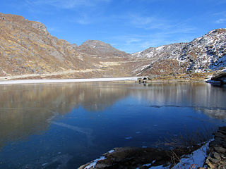
| Lakes | |
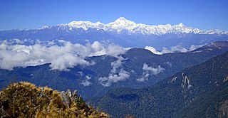
| Glaciers | |
| See also | |
Coordinates: 27°15′36″N88°33′16″E / 27.2601°N 88.5545°E
| | This article related to a location in the Indian state of Sikkim is a stub. You can help Wikipedia by expanding it. |