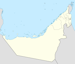
The Shihuh is an Arab tribe living in the United Arab Emirates (UAE) and Oman. In the singular, the name is Al Shehhi, a common family name in the UAE and Oman today. Inhabiting the northern part of the Hajar Mountain range, specifically in the Ruus Al Jibal, the tribe has long been influential in the affairs of both the east and west coast settlements of the northern UAE and Oman and has fiercely maintained both its identity and independence.
Masfout is a village that forms part of the eponymous exclave of Masfout in Ajman, one of the seven emirates forming the United Arab Emirates. It is surrounded by Ras Al Khaimah, the Dubai exclave of Hatta and Oman. It is only accessible from Ajman itself by crossing territories of Sharjah, Ras Al Khaimah, and Oman.
Ghalilah is the name of a settlement in Ras Al Khaimah, in the United Arab Emirates (UAE). The location of a major desalination plant, Ghalilah also gives its name to the Wadi Ghalilah, the location of the 'Stairway to Heaven' hike.
Bani Shatair is a tribal name, originating in Ras Al Khaimah, in the United Arab Emirates (UAE) and in areas of Northern Oman.
Bithnah is a village in Fujairah, United Arab Emirates (UAE), long occupying a strategic location in the Wadi Ham, which is the only natural link to the interior of the UAE and the Persian Gulf from the East Coast city, and Emirate of Fujairah.
The Bani Qitab is a tribe of the United Arab Emirates (UAE). The singular form of the name, Al Ketbi, is a common family name in the Northern UAE today. Consisting of a settled southern section and a nomadic northern section, the tribe was long influential in the conduct of affairs in the interior of the Trucial States. The Northern branch mostly settled in the inland towns of Dhaid and Al Falayah.
The Na'im is an Arab tribe in the United Arab Emirates. The tribe is also present in other gulf countries.
Bani Hadiyah is a tribal name, originating in Ras Al Khaimah, in the United Arab Emirates (UAE) and in areas of Northern Oman.
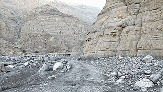
Wadi Qor is a seasonal watercourse in the Hajar Mountains of Ras Al Khaimah, in the United Arab Emirates. The wadi runs from the mountain village of Al Qor, near the Dubai exclave of Hatta, through the villages of Huwaylat, Rafaq and Al Nasla before crossing the Omani border and fanning out to the Batinah plain and the Gulf of Oman north of the Omani coastal village of Bu Baqarah.
Tayyibah is a large village in the Hajar Mountains of Fujairah, United Arab Emirates. It is notable for its hiking trails, its Heritage Museum and the Al Qalaa Lodge, an Emirati heritage themed guest house.
The Habus are a tribe of Ras Al Khaimah, in the United Arab Emirates (UAE). They mostly settled the area around Khatt, Fahlain and the Hajar Mountain wadis to the East of the city of Ras Al Khaimah. They are often associated with the Hajar Mountain tribes of the Shihuh and Dhahuriyiin, with whom the Habus were frequently neighbours and with whom the Habus shared a number of cultural similarities and traditions. The Habus have also adopted the distinctive Shehhi dialect of Arabic.

Jabal ar Raḩraḩ is a peak in the Al Hajar Mountains, northeast of the United Arab Emirates, in the Emirate of Ras al Khaimah.
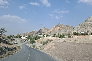
Musaibat is a small agricultural and livestock village, located in the northeast of the United Arab Emirates (UAE), in the Al Hajar Mountains, Emirate of Ras al Khaimah.
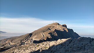
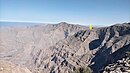
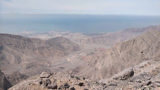
Jabal Raḩabah is a peak in the Al Hajar Mountains, northeast of the United Arab Emirates, in the Emirate of Ras Al Khaimah. At 1,543 m, it is one of the highest peaks in the UAE, located entirely within the territory of the Emirates

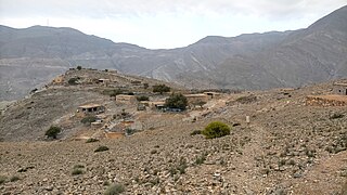
Yinainir is a small, semi-abandoned village, located in the northeast of United Arab Emirates (UAE), in the Al Hajar Mountains, Emirate of Ras al Khaimah, inaccessible by road.

The Wadi Jib is a valley or dry river, with intermittent flow, which flows almost exclusively during the rainy season, belonging to the river basin of Wadi Bih, north-east of the United Arab Emirates (UAE), in the Emirate of Ras al Khaimah.
The Wadi Litibah is a valley or dry river, with intermittent flow, flowing almost exclusively during the rainy season, located northeast of the United Arab Emirates, in the Emirate of Ras al Khaimah.

The Wadi Barut is a valley or dry river, with intermittent flow, which flows almost exclusively during the rainy season, located in the northeast of the United Arab Emirates, in the Emirate of Ras al Khaimah.
The Wadi Halhal is a valley or dry river, with intermittent flow, which flows almost exclusively during the rainy season, located in the northeast of the United Arab Emirates, in the Emirate of Ras al Khaimah.