Rattray Marsh Conservation area | |
---|---|
Location | Ontario, Canada |
Nearest city | Mississauga |
Area | 94 acres |
Established | 1975 |
Governing body | Credit Valley Conservation (CVC; CVCA) |
Rattray Marsh Conservation Area, is 94 acres [1] of environmentally sensitive wetland situated along the shore of Lake Ontario in Canada. It is found on the west side of Jack Darling Memorial Park and is located in the city of Mississauga within the Regional Municipality of Peel. It is the last remaining lakefront marsh on the western end of Lake Ontario and is owned and managed by Credit Valley Conservation.
It has been designated an Area of Natural and Scientific Interest, Environmentally Significant Area, and a Provincially Significant Wetland since it was recognized internationally in an Important Biological Program in 1969. [2] The marsh provides a protected environment for many species of plants, birds, mammals, reptiles, and fish. It is a stopover for many migrating waterfowl. The diversity of the marsh also attracts many migrating songbirds. It features a shingle beach and pedestrian boardwalk overlooking a natural wetland.
The Marsh is named after Major James Rattray whose estate was on the property. [2] Upon his death in 1959, the future of the 148-acre property was debated between conservationists and developers. After 16 years of citizen activism for its preservation and the support from various conservation groups and individuals, the marsh was officially opened as a conservation area in 1975. [2]
The area was inhabited by the Mississauga people of the Wendake-Niowentsïo [3] territory before the settlers arrived. A treaty was signed between the Mississauga people and new settlers in 1805 for land from Etobicoke creek to Burlington Bay and other areas reaching up to the north of Dundas street. [2] In 1806, the land settlements started on various lots on the land. In 1851, the land including the marsh was sold to Mr. Thomas Slade. [2] After his death, the property was in the hands of the National Trust for sale. In 1861, Mr. Harris H. Fudger purchased some of the land upon which he built his mansion overlooking the marsh and the property was named Barrymede Farm. [2] The farm produced strawberries, raspberries, apples, pears, cherries, asparagus, and other vegetables. After the death of Mr Fudger, the National Trust sold the property to Major James Rattray in 1945. [2] Rattray permitted local residents to swim on his beach, walk along the edge of the lake, and also invited his bird-watcher friends to pursue their hobby. When Rattray died in 1969, a long struggle for the preservation of the Marsh began. Mr Frank Burton, the caretaker of Rattray estate, indicated that his late employer Major Rattray wished for the estate to be preserved intact. [2]
After the demise of Major Rattray in 1969, there was an interest from developers to develop luxury homes and a yacht basin on the property. The conservationists who saw the marsh as an environmental gem protested against it. Two representatives from the Department of Lands and Forests surveyed the area and commented that the plant diversity in the area was greater than in any provincial parks at the time. A committee led by Ruth Hussey wrote a letter to the Premier asking to encourage the Parks Integration Board to support the preservation of the Rattray Estate. However, the Park Integration Board informed the committee that the price could not be supported by the board for its acquisition and that it should come under the municipal corporation who had plans for development of several parks where people could camp. Camping on Rattray estate was highly undesirable by conservationists because of the unique characteristics of the area and its role in providing a habitat for many species. [2]
After all the conversation efforts failed, Mr. Brockington, sole executor and trustee of Rattray estate released the land for sale. Mr. Neiman purchased the entire estate in 1963. The conservation efforts continued after the sale and many groups like the South Peel Naturalist Club (SPNC) and Credit Valley Conservation Authority (CVCA) got involved in this local issue. [2]
Late in the year 1963, at the hearing between pro-conservation group and the supporters of private development, it was evident that CVCA would not be able to acquire the land due to not having enough funds. Mr Neiman’s plan suggested that for the completion of the project, the marsh was to be dredged and the walls banked to create a marina. Later at the Ratepayers association meeting, a great local opposition to this plan was seen. The development was temporarily halted because there were higher number of votes against the plan. [2]
Between 1962 and 1964, CVCA conducted studies with University of Toronto to assess the ecological value of the marsh. The study concluded that for the marsh to remain in good health there would need to be an adequate buffer zone of the higher lands and that acquiring the marsh portion alone would not be enough. During this time, private citizens formed a group called the Rattray Estate Preservation Committee for the purposes of purchasing the entire Rattray estate (including the buffer zone) so it would remain in its natural state as much as possible. They sought the help of Nature Conservancy of Canada, a country wide organization recently founded at the time, to raise the funds. Many individuals and organizations contributed to the cause and by May 1964 there were enough funds collected to buy a portion of the estate. [2]
In 1965, the committee asked the Toronto Township council to purchase a portion of the estate as well so that the entire area could be protected, which the council refused. The refusal is thought to be because of number of reasons, cost being a major one. Following this the Rattray Estate Preservation Committee dissolved and the Nature Conservancy of Canada gave their donors the option to either have their money returned or used for other conservation projects. [2]
In 1967, Mr. Neiman proceeded his development plans after the Toronto Township Council approved phase I of his plan in the Watersedge, Green Glade and Rattray Park Drive area. While the bulldozers were clearing the trees and flora for construction, an article was published by Bruce West in The Globe and Mail praising the conservation efforts for the marsh. This prompted Ruth Hussey to write a letter to the editor about the country's lack of interest in conservation. Following the popularity of that letter, Ruth Hussey formed a new citizen’s committee and created a petition to be sent to Township to reconsider the purchase of what remained of the Rattray Estate. While several proposals were being made and proposed by the committee the phase I of the development was completed and a portion of the estate cleared of its trees and vegetation. The local residents then reached out to the Mississauga Council, the newly formed town, to acquire what remained of the Rattray Estate. [2]
In 1971, CVCA was doing studies on the marsh ecology and on the advice of the experts purchased 24.2 acres of marsh, the portion that was proposed for marina. Mr. Dennis Veal, the biologist who conducted the study, helped arouse awareness and support from the citizens for the remaining 56.7 acres essential for buffer zone. [2]
In 1972, a planning board meeting was held with representation from provincial government, naturalists, conservation organization, local citizens and Mr. Neiman. There was a recommendation made to purchase the rest of the property, but the progress was slow. [2]
In 1973, Lake Ontario rose due to heavy rains, resulting in flooding of low-lying Rattray lands which pointed to the fact that the phase II houses would be under water at flood periods. The flood caused a drop in property price to almost half of its original price. [4] Following the flood, Mr. Neiman offered to sell it to the Town of Mississauga but there was no immediate action from the council until Dr. Martin Dobkin was elected as a new mayor who proposed that the CVCA should acquire the property on behalf of the City of Mississauga. After some negotiation with Mr. Neiman, and financial support from citizens, CVCA purchased the property and the Rattray Marsh Conservation Area was officially opened on October 5, 1975. [2]
Rattray Marsh Preservation Committee continued to meet to discuss maintenance, restoration and other matters for continual preservation of the Rattray marsh. In 1979, the committee was formally named as Rattray Marsh Protection Association (RMPA) [5] working in co-operation with the CVCA, City of Mississauga, Region of Peel and other groups, to continue to protect the natural resources of Rattray Marsh.
Members of RMPA addressed concerns posed by any new development in the Marsh. They played an important role in proposing an alternate plan for installing sewers so that they were not installed in the conservation area. [2] They also addressed the environmental impact of proposed land use surrounding the marsh such as bicycle paths and other developments in Jack Darling Memorial park next-door, both of which could have disturbed the tranquility of the marsh. [2] The group also organizes nature walks, annual clean up days and other maintenance efforts in the marsh. The Association has received a number of awards for its efforts. RMPA joined the Credit Valley Conservation in 2009 as a volunteer fundraising committee. [5]
Ruth Hussey (1915-1984) [6] was an environmentalist, veterinarian, president of South Peel Naturalists Club, and a volunteer for the Scouting movement. [2] She played an important role in the preservation of Rattray Marsh and had acquired an immense knowledge of marsh and its life. [4] In 1990, The Rattray Marsh Protection Association published Ruth Hussey’s detailed account of the marsh history and its natural history in the book titled “Rattray Marsh Then and Now” co-ordinated by Judith M. Goulin, who finished the book after Ruth Hussey died in 1984. [2]
Among the many awards received by Ruth Hussey was the Carl Nunn Media Conservation Award from the Federation of Ontario Naturalists for her dedication to conservation of Marsh. [6] A large granite boulder at the Old Poplar Row entrance to the Rattray Marsh has been installed by RMPA to pay tribute to Ruth Hussey’s efforts in preserving the Marsh. The stone says “Because of her, Rattray marsh is ours.”
Rattray marsh has ecologically degraded over the years due to urbanization of the surrounding area. The urbanization has resulted in sediment build-up in the Sheridan Creek, a portion of which flows through the marsh. [1] The sediment built up affects the water quality and quantity that results in the increase of invasive plants and species such as Carp in the Rattray Marsh. [1] The urban development around the marsh and paved surfaces has also resulted in faster run off of rain water which carries more soil and nutrients as it goes in to the marsh. [7] Excess nutrients degrade the health of marsh and reduce the diversity of wetland vegetation. [7]
In the beginning of 2013, CVC started a phased removal of excess sediment from marsh which resulted in more observation of species at risk like Least Bittern. There are initiatives such as Low Impact Development and Greening Corporate Grounds that are pursued to help reduce sediment from surrounding areas and restore the marsh ecosystem. [8]
Several of the biogeographic influences such as the marsh’s proximity to the limits of Carolinian Zone, its proximity to the Lake Ontario, its southerly temperate nature, and its cool acidic northerly nature all determine the native flora of Rattray marsh. [2] This diversity of climate and conditions creates an environment for a variety of significant plant species. There are 428 species of plants recorded at Rattray Marsh according to Credit Valley Conservation. [4] Among the plants found in Rattray Marsh there are trees such as Yellow Birch, Red Oaks, White Pine, as well as plants such as Horsetail, Cattails, wild Grapevine, Jewelweed, Goldenrod, Staghorn Sumac, Queen Anne’s lace and many wildflowers such as Asters and Trillium, Ontario’s provincial flower.
In 2008, the Emerald Ash Borer, an invasive insect that is known to kill Ash trees native to North America was identified in the city of Mississauga. [9] This invasion of Ash Borer destroyed many species of Ash trees in the area including those at Rattray Marsh. Some of the dead ash trees impacted by emerald ash borer were cut down for the safety of wildlife, visitors and staff. Downed logs are placed in various locations to provide habitat for wildlife.
A number of native trees and shrubs were planted in place by Credit Valley Conservation. The remaining ash trees were injected with an environmentally safe bio-insecticide treatment to prevent them from getting infected with emerald ash borer. [10]
The variety of plants and natural food sources found in Rattray Marsh provides an important habitat for many species of birds. [8] The marsh is also a stopping point for many of the migratory bird species in spring and fall including various species of songbirds, waterfowl, birds of prey and shorebirds. According to Credit Valley Conservation, there are 227 species of birds found in the Rattray Marsh. [4] Following the Emerald Ash Borer infection and destruction of trees, several native plants have been planted in the Marsh to provide food sources for birds while removing invasive species like Buckthorn. [8] Nests of uncommon species like Great Horned Owl and Eastern Screech Owl have also been spotted in the marsh in 2021 and 2022 respectively. [8] Due to wide variety of birds found in Rattray marsh, it is often frequented by bird watchers and bird photographers.
According to the Rattray Marsh Environmental Study report from August 2009, out of the 218 bird species sighted between 1975 and 2007, 84 hold Priority Conservation Status, 81 are Species of Conservation Concern, 47 are considered Area sensitive for habitat requirements, and 40 are considered Provincially Rare. [7] Bird listing at the time had identified 62 species not recorded since 1984. [7]
There are 26 [4] species of mammals found in the Rattray marsh including White Tailed Deer, Red Fox, Muskrat, Beaver, Striped Skunk, Coyote, Mink and other species (many of which are nocturnal by nature.) [2] Temporary fences were installed in some areas in 2022 to prevent deer from grazing on new trees and shrubs planted to restore the conservation area. [8]
Many fish use the wetland for breeding, feeding and shelter and move into the marsh from Lake Ontario during spawning season. There are 11 species of fish found in the Rattray marsh. [4] In April and May, White Suckers are found swimming upstream to spawn. The fish migration times in the marsh are often dependent on the operation of the shingle bar affected by the variation in water level. During lower water levels, the shingle bar cuts off the flow between Lake Ontario and the marsh. While White Suckers are native to marsh, invasive species like Carp are most often seen splashing near the surface of the water.
Rattray marsh is home to 18 [4] species of reptiles and amphibians amongst which are a various species of toads, frogs, turtles, snakes, and salamanders. All species of turtles found in Ontario are currently considered species at risk. [8] The most common turtles found in the marsh are Midland Painted turtles and Snapping turtles, with an occasional sighting of Map turtles and Blanding’s turtle. [8]
The Thousand Islands – Frontenac Arch region or the Frontenac Axis is an exposed strip of Precambrian rock in Canada and the United States that links the Canadian Shield from Algonquin Park with the Adirondack Mountain region in New York, an extension of the Laurentian mountains of Québec. The Algonquin to Adirondacks region, which includes the Frontenac Axis or Arch, is a critical linkage for biodiversity and resilience, and one with important conservation potential. The axis separates the St. Lawrence Lowlands and the Great Lakes Lowlands. It has many distinctive plant and animal species. It is one of four ecoregions of the Mixedwood Plains.
The Mississippi River is a tributary of the Ottawa River in Eastern Ontario, Canada which has no relation with the Mississippi River in the United States. It is 200 kilometres (120 mi) in length from its source at Mackavoy Lake, has a drainage area of 4,450 square kilometres (1,720 sq mi), and has a mean discharge of 40 cubic metres per second (1,400 cu ft/s). There are more than 250 lakes in the watershed.
Southwick Beach State Park is a New York State park that lies along an unusual stretch of sandy beach on the eastern shore of Lake Ontario. The park is 464 acres (188 ha) in size with a 3,500 foot (1,100 m) length of beach, and is visited annually by about 100,000 people. Immediately to the south is the Lakeview Wildlife Management Area, which extends the publicly accessible beach by several miles. They are in the Town of Ellisburg in Jefferson County, New York south of the lakeside community of Jefferson Park.
Drummond/North Elmsley is a township in eastern Ontario, Canada in Lanark County. It is situated on the north shore of the Rideau River between the town of Perth and the town of Smiths Falls. It is a predominantly rural municipality. The township offices are located in the hamlet of Port Elmsley.
Martin Lyon Dobkin is a physician and former politician in Ontario, Canada. He was elected on October 1, 1973, as the first Mayor of the new City of Mississauga, Ontario, and served as Mayor from 1973 to 1976. He was the inaugural mayor of the newly amalgamated City of Mississauga, which had combined the former Towns of Mississauga, Port Credit and Streetsville. He lost re-election just three years later. He was originally trained as a medical doctor and he continued his practice during the time he was mayor. He continues to work as a doctor although a car accident in 2003 reduced his activities.
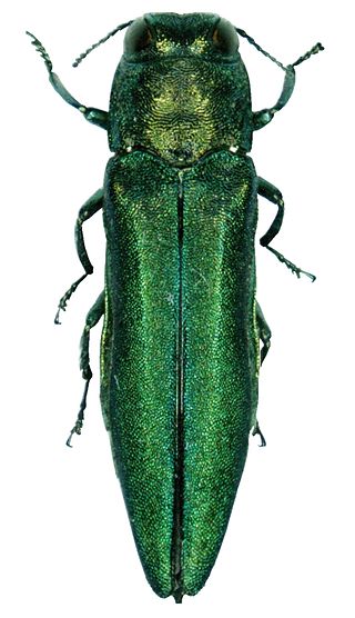
The emerald ash borer, also known by the acronym EAB, is a green buprestid or jewel beetle native to north-eastern Asia that feeds on ash species. Females lay eggs in bark crevices on ash trees, and larvae feed underneath the bark of ash trees to emerge as adults in one to two years. In its native range, it is typically found at low densities and does not cause significant damage to trees native to the area. Outside its native range, it is an invasive species and is highly destructive to ash trees native to Europe and North America. Before it was found in North America, very little was known about emerald ash borer in its native range; this has resulted in much of the research on its biology being focused in North America. Local governments in North America are attempting to control it by monitoring its spread, diversifying tree species, and through the use of insecticides and biological control.
The Credit River is a river in southern Ontario, which flows from headwaters above the Niagara Escarpment near Orangeville and Caledon East to empty into Lake Ontario at Port Credit, Mississauga. It drains an area of approximately 1,000 square kilometres (390 sq mi). The total length of the river and its tributary streams is over 1,500 kilometres (930 mi).
Royal Botanical Gardens (RBG) is headquartered in Burlington owning extensive environmental protection areas, historic sites and culturally relevant gardens in Hamilton, Ontario, Canada. It is one of the major tourist attractions between Niagara Falls and Toronto, as well as a significant local and regional horticultural, education, conservation, and scientific resource. The mandate is derived by a Provincial Act of 1941 centred on human interaction with the natural world and protection of environmentally significant lands that form the western tip of Lake Ontario. Royal Botanical Gardens spans an area of about 10 km by 4 km, dominated by two coastal wetlands, and glacial-carved landscapes that extend from the lake up to the Niagara Escarpment plateau. The various gardens and natural areas are accessed through nine public entrance locations. It is one of several Prescribed Public Bodies listed under the Ontario Heritage Act.
Clarkson, also called Clarkson Village, is a neighbourhood in the city of Mississauga, Ontario, Canada, situated in the southwest corner of the city, along the shore of Lake Ontario. It is bordered by Lake Ontario to the south, Oakville to the west, Erindale and Erin Mills to the north, and Lorne Park to the east.
Cootes Paradise is a property of the Royal Botanical Gardens at the western end of Lake Ontario, and a remnant of the larger 3700 acre Dundas Marsh Crown Game Preserve established by the Province of Ontario in 1927. It is a 600 hectare environmental protection and education area, dominated by a 4.5km long rivermouth wetland, representing the lake's western terminus. It is found on the west side of Hamilton Harbour and is located in the municipality of Hamilton, Ontario, Canada.
Fraxinus profunda, the pumpkin ash, is a species of ash (Fraxinus) native to eastern North America, where it has a scattered distribution on the Atlantic coastal plain and interior lowland river valleys from the Lake Erie basin in Ontario and New York west to Illinois, southwest to Missouri and southeast to northern Florida. It grows in bottomland habitats, such as swamps, floodplains and riverbanks. It is threatened by the emerald ash borer, an invasive insect which has caused widespread destruction of ash trees in eastern North America.
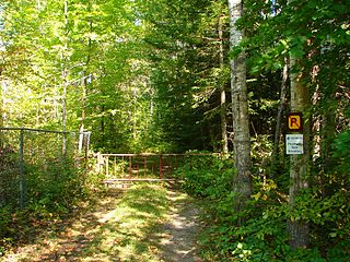
Westmeath Provincial Park is a provincial park on the Ottawa River in Renfrew County, Ontario, Canada. Located on the section of the river known as Bellows Bay, it features a long sandy beach and an active sandspit. It is one of the most pristine sand dune and wetland complexes along the southern Ottawa River.
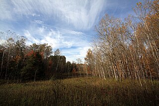
Happy Valley Forest is a 6.48 square kilometre provincially significant ecological area, classified as an Area of Natural and Scientific Interest by the Ontario Ministry of Natural Resources. It consists of an upland forest on steeply rolling topography, various wooded swamps, and minor wetland areas. A few small kettle ponds are also present.
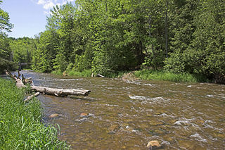
Credit Valley Conservation (CVC) is one of 36 conservation authorities in Ontario, Canada, responsible for protecting, restoring, and managing natural resources at the watershed level. CVC operates within the Credit River watershed and smaller adjacent watersheds that drain directly into Lake Ontario, as well as along a section of the Lake Ontario shoreline. Together, these areas make up CVC's jurisdiction. CVC is a member of Conservation Ontario.
James Campbell National Wildlife Refuge is a National Wildlife Refuge on the island of Oʻahu, Hawaii. It was established in 1976 to permanently protect an ecologically-intact unit and to provide habitat for native and migratory fauna and native flora. It established critical habitat for Hawaii's four endangered waterbirds, the ʻalae kea, koloa maoli, ʻalae ʻula, and āeʻo and many migratory seabirds, endangered and native plant species, and the endangered Hawaiian monk seal and green sea turtle. It also provides increased wildlife-dependent public uses and flood control within the refuge and the local community.
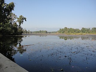
Ghodaghodi Tal is a Ramsar site in western Nepal. It was established in August 2003 it covers an area of 2,563 h (9,230 ks) in Kailali District at an elevation of 205 m (673 ft) on the lower slopes of the Siwalik Hills. It was declared as a bird sanctuary in March 2022.
The fauna of Louisiana is characterized by the region's low swamplands, bayous, creeks, woodlands, coastal marshlands and beaches, and barrier islands covering an estimated 20,000 square miles, corresponding to 40 percent of Louisiana's total land area. Southern Louisiana contains up to fifty percent of the wetlands found in the Continental United States, and are made up of countless bayous and creeks.
Located in the southern part of British Columbia, Columbia National Wildlife Area was established to protect its wetlands and as a temporary home for migratory birds travelling to South America. The National Wildlife Area (NWA) is divided into four unit areas: Wilmer, Spillimacheen, Brisco and Harrogate, which are home to many diverse species of animals and plants which are significant in Canada.
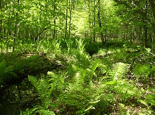
The Keddy Nature Sanctuary consists of approximately one square mile of forest and wetland on the very edge of the Canadian shield, just an hour west of Ottawa on the east side of Lanark County, in Ontario, Canada. It is mostly second growth temperate deciduous forest, interspersed with wetlands and beaver ponds, as well as sedge-dominated rock-ridges. A central ridge has more than twenty hectares of hemlock forest. There are also old fields that remain from pastures created in the previous century. Parts of this property, as well as adjoining lands, are designated as the Scotch Corners Provincially Significant Wetland. The property is one of several protected by the Mississippi Madawaska Land Trust.
The Torrance Barrens is a conservation area and dark-sky preserve in the District Municipality of Muskoka in Central Ontario, Canada. The reserve consists of Crown Lands in the municipalities of Gravenhurst and Muskoka Lakes. It is notable as the first dark-sky preserve in Canada and for its geological and environmental features.