Red Brook (Stony Brook tributary)

Last updated
Red Brook
Physical characteristics
Main source Coalbed Swamp in Forkston Township, Wyoming County, Pennsylvania
2,210 feet (670 m)
River mouth Stony Brook in Forkston Township, Wyoming County, Pennsylvania near Kasson Brook
1,568 feet (478 m)
41°28′35″N76°11′06″W / 41.4764°N 76.1851°W / 41.4764; -76.1851 Coordinates: 41°28′35″N76°11′06″W / 41.4764°N 76.1851°W / 41.4764; -76.1851
Length 1.7 miles (2.7 km)
Basin features
Progression Stony Brook → Mehoopany CreekSusquehanna RiverChesapeake Bay
Basin size 1.86 square miles (4.8 km2)

Red Brook is a tributary of Stony Brook in Wyoming County, Pennsylvania, in the United States. It is approximately 1.7 miles (2.7 km) long and flows through Forkston Township. [1] The watershed of the stream has an area of 1.86 square miles (4.8 km2). The stream has been named one of the best places for hiking in Wyoming County and features waterfalls, cascades, cliffs, and boulders. Its headwaters are in Coalbed Swamp, a combined boreal conifer swamp and shrub swamp.

Tributary stream or river that flows into a main stem river or lake

A tributary or affluent is a stream or river that flows into a larger stream or main stem river or a lake. A tributary does not flow directly into a sea or ocean. Tributaries and the main stem river drain the surrounding drainage basin of its surface water and groundwater, leading the water out into an ocean.

Wyoming County, Pennsylvania County in the United States

Wyoming County is a county located in the U.S. state of Pennsylvania. As of the 2010 census, the population was 28,276. Its county seat is Tunkhannock. It was created in 1842 from part of Luzerne County.

Forkston Township, Wyoming County, Pennsylvania Township in Pennsylvania, United States

Forkston Township is a township in Wyoming County, Pennsylvania, United States. The population was 397 at the 2010 census.

Contents

Course

Red Brook begins on Dutch Mountain in Coalbed Swamp, in Forkston Township. It flows northeast for a short distance before turning east-southeast and entering a valley. After several tenths of a mile, the stream turns east-northeast for several tenths of a mile. It then reaches its confluence with Stony Brook. [1]

Red Brook joins Stony Brook 1.86 miles (2.99 km) upstream of its mouth. [2]

Geography and geology

The elevation near the mouth of Red Brook is 1,568 feet (478 m) above sea level. [3] The elevation near the stream's source is 2,210 feet (670 m) above sea level. [1]

River mouth end of a river

A river mouth is the part of a river where the river debouches into another river, a lake, a reservoir, a sea, or an ocean.

Sea level Average level for the surface of the ocean at any given geographical position on the planetary surface

Mean sea level (MSL) is an average level of the surface of one or more of Earth's oceans from which heights such as elevation may be measured. MSL is a type of vertical datum – a standardised geodetic datum – that is used, for example, as a chart datum in cartography and marine navigation, or, in aviation, as the standard sea level at which atmospheric pressure is measured to calibrate altitude and, consequently, aircraft flight levels. A common and relatively straightforward mean sea-level standard is the midpoint between a mean low and mean high tide at a particular location.

River source The starting point of a river

The source or headwaters of a river or stream is the furthest place in that river or stream from its estuary or confluence with another river, as measured along the course of the river.

Geographical features along Red Brook include two large waterfalls, a number of smaller cascades, large boulders (some of which are covered with moss), and cliffs. [4] The headwaters of the stream are located in Coalbed Swamp, which is part of a complex of wetlands at the summit of Dutch Mountain. [1] [5]

Waterfall Place where water flows over a vertical drop in the course of a river

A waterfall is an area where water flows over a vertical drop or a series of steep drops in the course of a stream or river. Waterfalls also occur where meltwater drops over the edge of a tabular iceberg or ice shelf.

Moss division of plants

Mosses are small flowerless plants that typically grow in dense green clumps or mats, often in damp or shady locations. The individual plants are usually composed of simple leaves that are generally only one cell thick, attached to a stem that may be branched or unbranched and has only a limited role in conducting water and nutrients. Although some species have conducting tissues, these are generally poorly developed and structurally different from similar tissue found in vascular plants. Mosses do not have seeds and after fertilisation develop sporophytes with unbranched stalks topped with single capsules containing spores. They are typically 0.2–10 cm (0.1–3.9 in) tall, though some species are much larger. Dawsonia, the tallest moss in the world, can grow to 50 cm (20 in) in height.

Wetland A land area that is permanently or seasonally saturated with water

A wetland is a distinct ecosystem that is inundated by water, either permanently or seasonally, where oxygen-free processes prevail. The primary factor that distinguishes wetlands from other land forms or water bodies is the characteristic vegetation of aquatic plants, adapted to the unique hydric soil. Wetlands play a number of functions, including water purification, water storage, processing of carbon and other nutrients, stabilization of shorelines, and support of plants and animals. Wetlands are also considered the most biologically diverse of all ecosystems, serving as home to a wide range of plant and animal life. Whether any individual wetland performs these functions, and the degree to which it performs them, depends on characteristics of that wetland and the lands and waters near it. Methods for rapidly assessing these functions, wetland ecological health, and general wetland condition have been developed in many regions and have contributed to wetland conservation partly by raising public awareness of the functions and the ecosystem services some wetlands provide.

Hydrology and watershed

The watershed of Red Brook has an area of 1.94 square miles (5.0 km2). [2] The stream is entirely within the United States Geological Survey quadrangle of Dutch Mountain. [3] Its mouth is located near Kasson Brook. [2] The designated use of the stream is for aquatic life. [6]

Drainage basin Area of land where precipitation collects and drains off into a common outlet

A drainage basin is any area of land where precipitation collects and drains off into a common outlet, such as into a river, bay, or other body of water. The drainage basin includes all the surface water from rain runoff, snowmelt, and nearby streams that run downslope towards the shared outlet, as well as the groundwater underneath the earth's surface. Drainage basins connect into other drainage basins at lower elevations in a hierarchical pattern, with smaller sub-drainage basins, which in turn drain into another common outlet.

United States Geological Survey Scientific agency of the United States government

The United States Geological Survey is a scientific agency of the United States government. The scientists of the USGS study the landscape of the United States, its natural resources, and the natural hazards that threaten it. The organization has four major science disciplines, concerning biology, geography, geology, and hydrology. The USGS is a fact-finding research organization with no regulatory responsibility.

Quadrangle (geography) large area in geology or geography

In geology or geography, the word "quadrangle" usually refers to a United States Geological Survey (USGS) 7.5-minute quadrangle map, which are usually named after a local physiographic feature. The shorthand "quad" is also used, especially with the name of the map; for example, "the Ranger Creek, Texas quad map". These maps are one-quarter of the older 15-minute series. On a quadrangle map, the north and south limits of the quadrangle are not straight lines, but are actually curved to match Earth's lines of latitude on the standard projection. The east and west limits are usually not parallel as they match Earth's lines of longitude. In the United States, a 7.5 minute quadrangle map covers an area of 49 to 70 square miles.

Red Brook is not designated as an impaired waterbody. [6]

History and recreation

Red Brook was entered into the Geographic Names Information System on August 2, 1979. Its identifier in the Geographic Names Information System is 1199361. [3]

Historical features in the vicinity of Red Brook include an old railroad grade and the remains of an old camp. The stream has been named one of the top ten places for hiking in Wyoming County. It has been described by Jeff Mitchell as "A special place in Wyoming County." [4] Logging was probably done in the Coalbed Swamp area of the stream's watershed in the 1890s, but it is currently in good condition. [5]

Biology

Coalbed Swamp, which is in the watershed of Red Brook, is listed on the Wyoming County Natural Areas Inventory. [1] [5] This swamp is home to part of the largest population of yellow-bellied flycatchers in Pennsylvania. [7] The swamp has an area of 140 acres (57 ha), about half of which is a boreal conifer swamp dominated by red spruce. The rest of the area consists of a shrub swamp dominated by blueberry bushes, leatherleaf, and sedges. [5]

See also

Related Research Articles

Mehoopany Creek tributary of the Susquehanna River

Mehoopany Creek is a tributary of the Susquehanna River in Sullivan and Wyoming counties, Pennsylvania, in the United States. It is approximately 26.8 miles (43.1 km) long. In Sullivan County the creek flows through Colley Township and in Wyoming County it flows through Forkston Township and Mehoopany Township. The stream's watershed has an area of 123 square miles (320 km2). Its major tributaries include Stony Brook and North Fork Mehoopany Creek.

Stony Brook is a tributary of Mehoopany Creek in Wyoming County, Pennsylvania, in the United States. It is approximately 4.3 miles (6.9 km) long and flows through North Branch township and Forkston Township. The brook has a tributary known as Red Brook. Logging was done in the upper reaches of the watershed of Stony Brook in the early 1900s.

Roaring Brook (Hunlock Creek tributary) river in United States of America

Roaring Brook is a tributary of Hunlock Creek in Luzerne County, Pennsylvania, in the United States. It is approximately 5.0 miles (8.0 km) long and flows through Ross Township and Hunlock Township. The watershed of the stream has an area of 6.17 square miles (16.0 km2). It has one named tributary, which is known as Lewis Run. Additionally, a dammed pond known as Harris Pond is located at the stream's headwaters. The Roaring Brook Swamp, which is listed as a Locally Significant Area on the Luzerne County Natural Areas Inventory, is also located in the watershed.

Roaring Run (Bowman Creek tributary) river in the United States of America

Roaring Run is a tributary of Bowman Creek in Wyoming County, Pennsylvania, in the United States. It is approximately 4.9 miles (7.9 km) long and flows through Forkston Township, Noxen Township, and Monroe Township. It has two named tributaries: Newton Run and South Branch Roaring Run. The watershed of Roaring Run has an area of 11.4 square miles (30 km2). It is designated as a High-Quality Coldwater Fishery and a Migratory Fishery and the stream is Class A Wild Trout Waters. The surficial geology in its vicinity consists of alluvium, alluvial terrace, alluvial fan, bedrock, Wisconsinan Till, and Wisconsinan Ice-Contact Stratified Drift. A bridge carrying Pennsylvania Route 29 crosses the stream.

South Branch Roaring Run is a tributary of Roaring Run in Wyoming County, Pennsylvania, in the United States. It is approximately 2.0 miles (3.2 km) long and flows through Noxen Township and Forkston Township. The watershed of the stream has an area of 3.31 square miles (8.6 km2). The surficial geology in its vicinity consists of bedrock, Wisconsinan Till, Wisconsinan Bouldery Till, Wisconsinan Ice-Contact Stratified Drift, and alluvium. South Branch Roaring Run is classified as Class A Wild Trout Waters.

Cider Run (Bowman Creek tributary) river in United States of America

Cider Run is a tributary of Bowman Creek in Wyoming County, Pennsylvania, in the United States. It is approximately 2.5 miles (4.0 km) long and flows through Forkston Township and Noxen Township. The watershed of the stream has an area of 3.77 square miles (9.8 km2). The stream is not designated as an impaired waterbody. Its watershed is classified as Exceptional Value waters and a Migratory Fishery and the stream is designated as a Wilderness Trout Stream.

Fox Hollow is a tributary of Mehoopany Creek in Wyoming County, Pennsylvania, in the United States. It is approximately 0.8 miles (1.3 km) long and flows through Mehoopany Township. The watershed of the stream has an area of 1.83 square miles (4.7 km2). The Fox Hollow Swamp is listed on A Natural Areas Inventory of Wyoming County.

Rogers Hollow is a tributary of Mehoopany Creek in Wyoming County, Pennsylvania, in the United States. It is approximately 2.2 miles (3.5 km) long and flows through Mehoopany Township. The watershed of the creek has an area of 2.44 square miles (6.3 km2). The creek is classified as a Coldwater Fishery and is in the vicinity of Mehoopany Mountain and Doll Mountain.

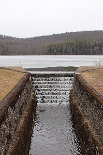
Bowman Hollow is a tributary of Mehoopany Creek in Wyoming County, Pennsylvania, in the United States. It is approximately 2.2 miles (3.5 km) long and flows through Forkston Township. The watershed of the stream has an area of 3.08 square miles (8.0 km2). The stream flows over a highly secluded waterfall known as the Bowman Hollow Falls.

White Brook

White Brook is a tributary of Mehoopany Creek in Wyoming County, Pennsylvania, in the United States. It is approximately 1.8 miles (2.9 km) long and flows through North Branch Township and Forkston Township, in Wyoming County, Pennsylvania, in the United States. The stream's watershed has an area of 1.75 square miles (4.5 km2). The stream is classified as a High-Quality Coldwater Fishery. It has a small waterfall and a hiking path is located nearby.

Scouten Brook is a tributary of Mehoopany Creek in Wyoming County, Pennsylvania, in the United States. It is approximately 2.2 miles (3.5 km) long and flows through Forkston Township. The watershed of the stream has an area of 2.66 square miles (6.9 km2). The stream is designated as a High-Quality Coldwater Fishery and has wild trout. It is one of five large brooks to cut through South Mountain.

Kasson Brook is a tributary of Mehoopany Creek in Wyoming County, Pennsylvania, in the United States. It is approximately 2.7 miles (4.3 km) long and flows through Forkston Township. The watershed of the stream has an area of 4.53 square miles (11.7 km2). The stream is not designated as an impaired waterbody and is classified as a High-Quality Coldwater Fishery. It is one of several streams to cut through South Mountain.

Henry Lott Brook is a tributary of Mehoopany Creek in Wyoming County, Pennsylvania, in the United States. It is approximately 2.4 miles (3.9 km) long and flows through Forkston Township. The watershed of the stream has an area of 2.68 square miles (6.9 km2). The stream is not designated as an impaired waterbody and it is classified as a High-Quality Coldwater Fishery. It is one of five large tributaries of Mehoopany Creek to cut through the Mehoopany Creek-Bowman Creek watershed divide.

Somer Brook is a tributary of Mehoopany Creek in Wyoming County, Pennsylvania, in the United States. It is approximately 3.7 miles (6.0 km) long and flows through Noxen Township and Forkston Township. The watershed of the stream has an area of 4.48 square miles (11.6 km2). The stream is not designated as an impaired waterbody and is classified as a High-Quality Coldwater Fishery. Fauna that have been observed in the stream's vicinity include northern water shrews and trout.

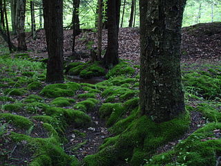
Becker Brook is a tributary of Mehoopany Creek in Wyoming County, Pennsylvania, in the United States. It is approximately 2.6 miles (4.2 km) long and flows through Forkston Township. The watershed of the stream has an area of 2.33 square miles (6.0 km2). The stream is designated as a High-Quality Coldwater Fishery. It is small and secluded, with a swamp known as the Becker Brook Swamp at its headwaters.

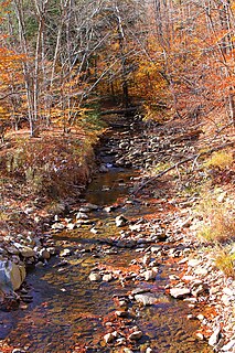
South Brook is a tributary of Mehoopany Creek in Luzerne County and Wyoming County, in Pennsylvania, in the United States. It is approximately 6.0 miles (9.7 km) long and flows through Ross Township and Lake Township, Luzerne County, Pennsylvania in Luzerne County and Forkston Township in Wyoming County. The watershed of the stream has an area of 10.1 square miles (26 km2). Wild trout are present in the stream and it has one named tributary, which is known as Opossum Brook.

Opossum Brook is a tributary of South Brook in Luzerne County and Wyoming County, in Pennsylvania, in the United States. It is approximately 4.0 miles (6.4 km) long and flows through Ross Township in Luzerne County and Forkston Township in Wyoming County. The watershed of the stream has an area of 5.13 square miles (13.3 km2). The stream is classified as a High-Quality Coldwater Fishery and has wild trout. The stream has a number of wetlands in its watershed and in some areas is good for birdwatching.

Bellas Brook is a tributary of Mehoopany Creek in Wyoming County, Pennsylvania, in the United States. It is approximately 2.3 miles (3.7 km) long and flows through Forkston Township. The watershed of the stream has an area of 2.71 square miles (7.0 km2). The stream is not designated as an impaired waterbody and is classified as a High-Quality Coldwater Fishery.

Cherry Ridge Run is a tributary of Mehoopany Creek in Luzerne County and Wyoming County, in Pennsylvania, in the United States. It is approximately 1.6 miles (2.6 km) long and flows through Fairmount Township in Luzerne County and Forkston Township in Wyoming County. The watershed of the stream has an area of 1.66 square miles (4.3 km2). The stream is not designated as an impaired waterbody and has a 16 acres (6.5 ha) pond known as Wild Fowl Pond.

Coffee Brook is a tributary of Barnes Brook in Wyoming County and Sullivan County, in Pennsylvania, in the United States. It is approximately 1.1 miles (1.8 km) long and flows through North Branch Township in Wyoming County and Colley Township in Sullivan County. The watershed of the stream has an area of 0.86 square miles (2.2 km2). The stream itself has a high gradient and primarily flows through forested lands. Access is difficult due to a lack of nearby roads and extensive private property signs in the area.

References

  1. 1 2 3 4 5 United States Geological Survey, The National Map Viewer , retrieved July 21, 2017
  2. 1 2 3 Pennsylvania Gazetteer of Streams (PDF), November 2, 2001, p. 118, retrieved July 21, 2017
  3. 1 2 3 Geographic Names Information System, Feature Detail Report for: Red Brook , retrieved July 21, 2017
  4. 1 2 Jeff Mitchell (February 2, 2011), "Top 10 places to hike in Wyoming County", Wyoming County Press Examiner, retrieved July 21, 2017
  5. 1 2 3 4 Pennsylvania Natural Heritage Program (1995), A Natural Areas Inventory of Wyoming County, Pennsylvania (PDF), retrieved July 21, 2017
  6. 1 2 United States Environmental Protection Agency, 2006 Waterbody Report for Red Brook , retrieved July 21, 2017
  7. Douglas A. Gross (May 20, 2002), The Status, Distribution, and Conservation of the Yellow-Bellied Flycatcher (PDF), p. 2, retrieved July 21, 2017