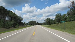
Redding Township, Michigan | |
---|---|
Coordinates: 44°01′53″N85°01′38″W / 44.03139°N 85.02722°W | |
Country | United States |
State | Michigan |
County | Clare |
Established | 1891 |
Government | |
• Supervisor | Bruce Scarbrough |
• Clerk | Susie Brower |
Area | |
• Total | 35.43 sq mi (91.76 km2) |
• Land | 34.90 sq mi (90.39 km2) |
• Water | 0.53 sq mi (1.37 km2) |
Elevation | 1,053 ft (321 m) |
Population | |
• Total | 459 |
• Density | 13.2/sq mi (5.1/km2) |
Time zone | UTC-5 (Eastern (EST)) |
• Summer (DST) | UTC-4 (EDT) |
ZIP code(s) | |
Area code | 989 |
FIPS code | 26-67600 [3] |
GNIS feature ID | 1626959 [4] |
Redding Township is a civil township of Clare County in the U.S. state of Michigan. The population was 459 at the 2020 census. [2]
According to the U.S. Census Bureau, the township has a total area of 35.43 square miles (91.76 km2), of which 34.90 square miles (90.39 km2) is land and 0.53 square miles (1.37 km2) (1.50%) is water. [8]
The Muskegon River flows southwest through the center of the township.
As of the census [3] of 2000, there were 526 people, 219 households, and 153 families residing in the township. The population density was 14.9 per square mile (5.8/km2). There were 497 housing units at an average density of 14.1 per square mile (5.4/km2). The racial makeup of the township was 97.15% White, 0.57% African American, 0.38% Asian, 0.38% from other races, and 1.52% from two or more races. Hispanic or Latino of any race were 0.57% of the population.
There were 219 households, out of which 26.0% had children under the age of 18 living with them, 53.4% were married couples living together, 6.8% had a female householder with no husband present, and 30.1% were non-families. 24.7% of all households were made up of individuals, and 11.0% had someone living alone who was 65 years of age or older. The average household size was 2.40 and the average family size was 2.79.
In the township the population was spread out, with 24.1% under the age of 18, 6.7% from 18 to 24, 25.9% from 25 to 44, 27.8% from 45 to 64, and 15.6% who were 65 years of age or older. The median age was 42 years. For every 100 females, there were 104.7 males. For every 100 females age 18 and over, there were 108.9 males.
The median income for a household in the township was $24,438, and the median income for a family was $28,864. Males had a median income of $25,469 versus $26,000 for females. The per capita income for the township was $14,687. About 16.5% of families and 19.4% of the population were below the poverty line, including 20.2% of those under age 18 and 11.7% of those age 65 or over.
The entire township is served by Marion Public Schools to the northwest in the village of Marion in Osceola Township. [9]
Franklin Township is a civil township of Clare County in the U.S. state of Michigan. The population was 730 at the 2020 census.
Frost Township is a civil township of Clare County in the U.S. state of Michigan. The population was 1,038 at the 2020 census.
Hamilton Township is a civil township of Clare County in the U.S. state of Michigan. The population was 1,785 at the 2020 census.
Harrison is a city in and county seat of Clare County in the U.S. state of Michigan. The population was 2,150 at the 2020 census.
Sheridan Township is a civil township of Clare County in the U.S. state of Michigan. The population was 1,548 at the 2020 census.
Summerfield Township is a civil township of Clare County in the U.S. state of Michigan. The population was 459 at the 2020 census.
Bingham Township is a civil township of Clinton County in the U.S. state of Michigan. As of the 2010 census, the township had a population of 2,859.
Vevay Township is a civil township of Ingham County in the U.S. state of Michigan. The population was 3,537 at the 2010 census. The township is part of the Lansing–East Lansing metropolitan area and mostly surrounds the city of Mason, but the two are administered autonomously.
Algoma Township is a civil township of Kent County in the U.S. state of Michigan. The population was 12,055 at the 2020 census, which is a large increase from 9,932 at the 2010 census.
Courtland Township is a civil township of Kent County in the U.S. state of Michigan. The population was 7,678 at the 2010 census, which was an increase from 5,817 at the 2000 census.
Grattan Township is a civil township of Kent County in the U.S. state of Michigan. As of the 2010 census, the township population was 3,621.
Spencer Township is a civil township of Kent County in the U.S. state of Michigan. The population was 3,960 at the 2010 census.
Fork Township is a civil township of Mecosta County in the U.S. state of Michigan. The population was 1,627 at the 2020 census.
Greenwood Township is a civil township of Oceana County in the U.S. state of Michigan. As of the 2000 census, the township population was 1,154.
Bagley Township is a civil township of Otsego County in the U.S. state of Michigan. The population was 5,886 at the 2010 census.
Lake Township is a civil township of Roscommon County in the U.S. state of Michigan. The population was 1,119 at the 2020 census.
Freedom Township is a civil township of Washtenaw County in the U.S. state of Michigan. The population was 1,428 at the 2010 census.
Cherry Grove Township is a civil township of Wexford County in the U.S. state of Michigan. The population was 2,421 at the 2020 census.
Colfax Township is a civil township of Wexford County in the U.S. state of Michigan. The population was 897 at the 2020 census.
Greenwood Township is a civil township of Wexford County in the U.S. state of Michigan. The population was 633 at the 2020 census.