Redstone River (Haliburton County, Ontario)

Last updated
Redstone River
Canada Southern Ontario relief location map.jpg
Red pog.svg
Location of the mouth of the Redstone River in southern Ontario.
Location
Country Canada
Province Ontario
Region Central Ontario
County Haliburton
Municipality Dysart et al
Physical characteristics
SourceUpper Redstone Lake
  coordinates 45°20′51″N78°26′38″W / 45.34750°N 78.44389°W / 45.34750; -78.44389
  elevation464 m (1,522 ft)
Mouth Green Lake on the Gull River
  coordinates
45°06′27″N78°37′47″W / 45.10750°N 78.62972°W / 45.10750; -78.62972 Coordinates: 45°06′27″N78°37′47″W / 45.10750°N 78.62972°W / 45.10750; -78.62972
  elevation
308 m (1,010 ft)
Basin features
River system Great Lakes Basin
Tributaries 
  leftHarburn Creek
  rightEyre Creek (Ontario)

The Redstone River is a river in the municipality of Dysart et al, Haliburton County in central Ontario, Canada that flows from southern Algonquin Provincial Park to the Gull River.

River Natural flowing watercourse

A river is a natural flowing watercourse, usually freshwater, flowing towards an ocean, sea, lake or another river. In some cases a river flows into the ground and becomes dry at the end of its course without reaching another body of water. Small rivers can be referred to using names such as stream, creek, brook, rivulet, and rill. There are no official definitions for the generic term river as applied to geographic features, although in some countries or communities a stream is defined by its size. Many names for small rivers are specific to geographic location; examples are "run" in some parts of the United States, "burn" in Scotland and northeast England, and "beck" in northern England. Sometimes a river is defined as being larger than a creek, but not always: the language is vague.

Dysart et al, Ontario United township in Ontario, Canada

The United Townships of Dysart, Dudley, Harcourt, Guilford, Harburn, Bruton, Havelock, Eyre and Clyde, commonly known as the Municipality of Dysart et al, is a municipality in Haliburton County in Central Ontario, Canada. The original townships were of the Canadian Land and Emigration Company. At 61 letters or 68 non-space characters, the municipality has the longest name of any place in Canada.

Central Ontario Secondary region in Ontario, Canada

Central Ontario is a secondary region of Southern Ontario in the Canadian province of Ontario that lies between Georgian Bay and the eastern end of Lake Ontario.

Contents

Course

The river begins at Upper Redstone Lake in southern Algonquin Provincial Park. It flows southwest through the Haliburton Forest to Eyre Lake where it takes in the right tributary Eyre Creek, then through Little Redstone Lake to Redstone Lake where it takes in the left tributary Harburn Creek. The waters of the lake exit through two outflows. At the southeast, the East Redstone Dam controls the outflow to and is the source of the East Redstone River, which flows downstream over the East Redstone River Dam to Eagle lake on the Gull River. At the southwest, the West Redstone Dam controls the outflow to the Redstone River, which flows west then southwest to its mouth at Green Lake also on the Gull River but further downstream, west of the community of West Guilford and just north of Ontario Highway 118. The Gull River flows as part of the Trent–Severn Waterway via the Trent River to Lake Ontario. Since the Gull River system flows to the summit of the waterway at Balsam Lake, its tributaries including Redstone River serve as an important water flow control reservoir.

Haliburton Forest privately owned forest in Ontario, Canada

The Haliburton Forest & Wild Life Reserve Ltd. is a privately owned forest, comprising 300 square kilometres (120 sq mi) in Haliburton County, Ontario, Canada. It is about 270 kilometres (170 mi) northeast of Toronto, and just south of and abutting Algonquin Provincial Park.

Redstone Lake (Haliburton County) lake in Canada

Redstone Lake is a lake located in geographic Guilford Township in the Municipality of Dysart et al, Haliburton County in Central Ontario, Canada. It is in the Great Lakes Basin and is part of the Gull River system. At its longest, it is approximately 6.5km.

Ontario Highway 118 highway in Ontario

King's Highway 118, commonly referred to as Highway 118, is a provincially maintained highway in the Canadian province of Ontario. The route travels across South-Central Ontario between Highway 11 near Bracebridge and Highway 28 near Bancroft

Tributaries

See also

Related Research Articles

York River (Ontario) river in Canada

The York River is a river in Renfrew County, Hastings County and Haliburton County in Ontario, Canada. The river is in the Saint Lawrence River drainage basin, and flows from the southern extension of Algonquin Provincial Park to the Madawaska River.

Bonnechere River river in Canada

The Bonnechere River is a river in the Saint Lawrence River drainage basin in Nipissing District and Renfrew County in eastern and northeastern Ontario, Canada. The river flows from Algonquin Provincial Park to the Ottawa River east and north of the town of Renfrew. The river's name is thought to come from the French "bonne chère" meaning "good cheer".

Opeongo River river in Nipissing District, Ontario, Canada

The Opeongo River is a river in the Saint Lawrence River drainage basin in Nipissing District in northeastern Ontario, Canada. The river is entirely within Algonquin Provincial Park and Opeongo River Provincial Park, except for a small portion around Victoria Lake, and is a left tributary of the Madawaska River.

Opeongo Lake lake in Nipissing District, Ontario, Canada

Opeongo Lake is a lake in the Saint Lawrence River drainage basin in the geographic townships of Bower, Dickson, Preston and Sproule in the Unorganized South Part of Nipissing District in Northeastern Ontario, Canada. It is the largest lake in Algonquin Provincial Park and the source of the Opeongo River. The lake's name comes from the Algonquian word opeauwingauk meaning "sandy narrows".

Barron River (Ontario) river in Canada

The Barron River is a river in the Saint Lawrence River drainage basin in Nipissing District and Renfrew County, Ontario, Canada. It flows from Clemow Lake in northern Algonquin Provincial Park and joins the Petawawa River, whose southern branch it forms, in the municipality of Laurentian Hills, near the municipality of Petawawa.

Black Sturgeon River (Thunder Bay District) river in Canada

The Black Sturgeon River is a river in Thunder Bay District, Northwestern Ontario, Canada, located west of the Nipigon River, that flows to Lake Superior.

Cedar Lake (Nipissing District) lake in Nipissing District, Ontario, Canada

Cedar Lake is a lake in the geographic townships of Boyd, Deacon and Lister in the Unorganized south part of Nipissing District in northeastern Ontario, Canada. The lake is in the Saint Lawrence River drainage basin and is entirely within Algonquin Provincial Park; it is a popular entry point for canoe trips into the interior of the park as the community of Brent, located on the lake, is connected by Brent Road to Ontario Highway 17. Other places on the lake are Acanthus and Government Park.

Gull River (Balsam Lake) river in Haliburton County, Ontario, Canada

The Gull River is a river in Algonquin Highlands and Dysart et al, Haliburton County and the single-tier municipality of Kawartha Lakes in south-central Ontario, Canada. It is in the Trent River and Lake Ontario drainage basins, and flows from southern Algonquin Provincial Park to Balsam Lake on the Trent–Severn Waterway.

Head Lake (Haliburton County) lake in Ontario, Canada

Head Lake is a lake in the village of Haliburton, in Haliburton County, Ontario, Canada. Haliburton Village is in south central Ontario, about 25 km (15 mi) east of the village of Minden and approximately 50 km (31 mi) south-west of the panhandle of Algonquin Park. From Ontario's largest city, Toronto, it is just over 200 km (124 mi) to Haliburton, and from the national capital of Ottawa, it is about 300 km (186 mi).

Bitter Lake (Ontario) lake in Ontario, Canada

Bitter Lake is a lake in the Trent River and Lake Ontario drainage basins located in the municipality of Dysart et al, Haliburton County, Ontario, Canada, about 15 kilometres (9 mi) northwest of the community of Haliburton.
Boshkung Lake Lake in Haliburton County, Ontario, Canada

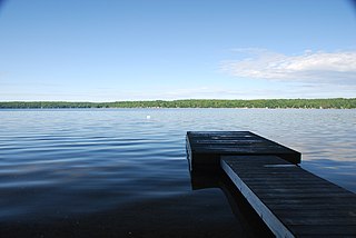
Boshkung Lake, also known by its historic name Lake Boshkung, or affectionately as 'Big Boshkung', is a lake in the township of Algonquin Highlands, Haliburton County in Central Ontario, Canada. It is located near Buttermilk Falls, has been a common cottage and recreation destination with a rich history that includes logging, camping, and even some farming activities.

Daisy Lake (Nipissing District)

Daisy Lake is a lake in the geographic townships of Butt and McCraney in the Unorganized South Part of Nipissing District, Ontario, Canada. The lake is in the Ottawa River drainage basin and is entirely within Algonquin Provincial Park.

Grand Lake (Nipissing) lake in Ontario, Canada

Grand Lake is a lake in the Ottawa River drainage basin in the geographic townships of Barron and Stratton in the Unorganized South Part of Nipissing District in Northeastern Ontario, Canada.

Little Madawaska River (Ontario) river in Canada

The Little Madawaska River is a river in the Saint Lawrence River drainage basin in the Unorganized South Part of Nipissing District in northeastern Ontario, Canada. The river is entirely within Algonquin Provincial Park, and is a right tributary of the Petawawa River and not a tributary of the nearby Madawaska River.

Nipissing River river in Canada

The Nipissing River is a river in the Saint Lawrence River drainage basin in the Unorganized South Part of Nipissing District in northeastern Ontario, Canada. The river is entirely within Algonquin Provincial Park, and is a left tributary of the Petawawa River.

Tim River river in Canada

The Tim River is a river in the Saint Lawrence River drainage basin in the Unorganized South Part of Nipissing District in northeastern Ontario, Canada. The river is entirely within Algonquin Provincial Park, and is a left tributary of the Petawawa River.

Big East River river in Canada

The Big East River is a river in Muskoka District and Nipissing District in Northeastern Ontario, Canada. The river is in the Great Lakes Basin, is a left tributary of the Muskoka River, and flows from Algonquin Provincial Park to Huntsville.

Irondale River river in Canada

The Irondale River is a river in Haliburton County in Central Ontario, Canada. It is part of the Great Lakes Basin, and is a left tributary of the Burnt River.

References

The Department of Natural Resources, operating under the FIP applied title Natural Resources Canada (NRCan), is the ministry of the government of Canada responsible for natural resources, energy, minerals and metals, forests, earth sciences, mapping and remote sensing. It was created in 1995 by amalgamating the now-defunct Departments of Energy, Mines and Resources and Forestry. Natural Resources Canada (NRCan) works to ensure the responsible development of Canada's natural resources, including energy, forests, minerals and metals. NRCan also uses its expertise in earth sciences to build and maintain an up-to-date knowledge base of our landmass and resources. To promote internal collaboration, NRCan has implemented a departmental wide wiki based on MediaWiki. Natural Resources Canada also collaborates with American and Mexican government scientists, along with the Commission for Environmental Cooperation, to produce the North American Environmental Atlas, which is used to depict and track environmental issues for a continental perspective.

The Atlas of Canada is an online atlas published by Natural Resources Canada that has information on every city, town, village, and hamlet in Canada. It was originally a print atlas, with its first edition being published in 1906 by geographer James White and a team of 20 cartographers. Much of the geospatial data used in the atlas is available for download and commercial re-use from the Atlas of Canada site or from GeoGratis. Information used to develop the atlas is used in conjunction with information from Mexico and the United States to produce collaborative continental-scale tools such as the North American Environmental Atlas.

Wikimedia Commons free-use media repository

Wikimedia Commons is an online repository of free-use images, sounds, other media, and JSON files. It is a project of the Wikimedia Foundation.