Republican, North Carolina | |
---|---|
Unincorporated community | |
Coordinates: 36°04′57″N77°03′36″W / 36.08250°N 77.06000°W Coordinates: 36°04′57″N77°03′36″W / 36.08250°N 77.06000°W | |
Country | United States |
State | North Carolina |
County | Bertie |
Elevation | 59 ft (18 m) |
Time zone | Eastern (EST) (UTC-5) |
• Summer (DST) | EDT (UTC-4) |
Area code(s) | 252 |
GNIS feature ID | 993243 [1] |
Republican is an unincorporated community in Bertie County, North Carolina, United States. The community is 8.6 miles (13.8 km) northwest of Windsor.
Bertie County is a county located in the northeast area of the U.S. state of North Carolina. As of the 2015 census, the population was 20,199. Its county seat is Windsor. The county was created in 1722 as Bertie Precinct and gained county status in 1739.
North Carolina is a state in the southeastern region of the United States. It borders South Carolina and Georgia to the south, Tennessee to the west, Virginia to the north, and the Atlantic Ocean to the east. North Carolina is the 28th-most extensive and the 9th-most populous of the U.S. states. The state is divided into 100 counties. The capital is Raleigh, which along with Durham and Chapel Hill is home to the largest research park in the United States. The most populous municipality is Charlotte, which is the second-largest banking center in the United States after New York City.
Windsor is a town in Bertie County, North Carolina, United States. The population was 3,630 at the 2010 census, up from 2,283 at the 2000 census. It is the county seat of Bertie County. Windsor is located in North Carolina's Inner Banks region.
The King-Freeman-Speight House, which is listed on the National Register of Historic Places, is located near Republican. [2]
King-Freeman-Speight House, also known as Francis Speight House, is a historic plantation house located at Republican, Bertie County, North Carolina. It was built in two sections, with the oldest built between 1808 and 1828. The older section forms the basis of the current rear wing. About 1828, a 2 1/2-story, Federal style, side-hall plan was added at a right angle to the original structure. The house was enlarged and remodeled in 1907. It has a two-story, two-bay addition and a two-story rear addition built in 1855. It features a hip roof front porch. Also on the property are the contributing two smokehouses, the kitchen, and an office. Noted landscape artist Francis Speight was born in the house in 1896.
The National Register of Historic Places (NRHP) is the United States federal government's official list of districts, sites, buildings, structures, and objects deemed worthy of preservation for their historical significance. A property listed in the National Register, or located within a National Register Historic District, may qualify for tax incentives derived from the total value of expenses incurred preserving the property.
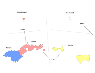
This is a list of the buildings, sites, districts, and objects listed on the National Register of Historic Places in American Samoa. There are currently 31 listed sites spread across the three districts of American Samoa. There are no sites listed on the unorganized atoll of Swains Island.
List of Registered Historic Places in Bristol County, Massachusetts:
Marshallton is an unincorporated community in Mill Creek Hundred, New Castle County, Delaware, United States. The community was founded in 1836 and is named for John Marshall, mill owner.
These are the National Registered Historic Places listings in Lowell, Massachusetts.
Covesville is an unincorporated community in Albemarle County, Virginia, United States. Covesville is located 15.7 miles (25.3 km) southwest of Charlottesville, Virginia and has a post office with ZIP code 22931.
This is a list of the National Register of Historic Places listings in Caroline County, Virginia.
Portsville is an unincorporated community in Sussex County, Delaware, United States. Portsville is located on the south bank of Broad Creek 0.8 miles (1.3 km) southwest of Bethel. The Portsville Lighthouse, which is listed on the National Register of Historic Places, is located in Portsville.
Woodland is an unincorporated community in Sussex County, Delaware, United States. Woodland is located on the Nanticoke River 3.8 miles (6.1 km) southwest of Seaford. Cannon's Ferry, which is listed on the National Register of Historic Places, is located in Woodland and is also known as the Woodland Ferry.
Mastens Corner is an unincorporated community in Kent County, Delaware, United States. Mastens Corner is located at the intersection of Hopkins Cemetery Road and Hills Market Road 3.8 miles (6.1 km) northwest of Harrington.
Laughlintown is an unincorporated community in Ligonier Township, Westmoreland County, Pennsylvania, United States. Laughlintown is located on U.S. Route 30 3 miles (4.8 km) southeast of Ligonier. Laughlintown has a post office with ZIP code 15655, which opened on May 16, 1825.
New Reading is an unincorporated community in Perry County, Ohio, United States. New Reading is 2.8 miles (4.5 km) west of Somerset. The Randolph Mitchell House, which is listed on the National Register of Historic Places, is located in New Reading.
Mason Springs is an unincorporated community in Charles County, Maryland, United States. Mason Springs is located at the junction of Maryland Route 224 and Maryland Route 225 1.8 miles (2.9 km) southeast of Potomac Heights. The community had a post office from 1890 to 1924.
Wallpack Center is an unincorporated community located within Walpack Township, Sussex County, New Jersey, United States. Wallpack Center is located in the Flat Brook Valley 6.7 miles (10.8 km) west of Branchville. Wallpack Center has a post office with ZIP code 07881.
Harbourton is a historic unincorporated community located within Hopewell Township in Mercer County, New Jersey, United States. It is located along County Route 579 at the intersection with Harbourton-Mount Airy Road. The community was added to the National Register of Historic Places in 1974.
Cloverhill or Clover Hill is an unincorporated community located at the intersection of the boundaries of East Amwell and Raritan townships in Hunterdon County and Hillsborough Township in Somerset County, in New Jersey, United States. It was added to the National Register of Historic Places in 1980.
Woodleaf is an unincorporated community in Rowan County, North Carolina, United States. The community is located on North Carolina Highway 801 9.5 miles (15.3 km) northwest of Salisbury. Woodleaf has a post office with ZIP code 27054.
Cypert is an unincorporated community in Phillips County, Arkansas, United States. The community is located on Arkansas Highway 318, 5.2 miles (8.4 km) south-southwest of Marvell.
Ashmead Village is an unincorporated community in Cheltenham Township, Montgomery County, Pennsylvania, United States. The George K. Heller School, which is listed on the National Register of Historic Places, is located in Ashmead Village.
This is a list of the National Register of Historic Places (NRHP) designated in northern Worcester County, Massachusetts. It includes listings from all Worcester County communities through which Massachusetts Route 2 passes, and those that lie to their north. This includes the communities of Ashburnham, Ashby, Athol, Fitchburg, Gardner, Harvard, Lancaster, Leominster, Lunenburg, Phillipston, Royalston, Templeton, Westminster, and Winchendon. National Register listings for other communities in the county are listed elsewhere.
Republican is an unincorporated community in Faulkner County, Arkansas, United States. The community is located along local roads in the northeast part of the county, 3.9 miles (6.3 km) northwest of Greenbrier.
This article about a location in Bertie County, North Carolina is a stub. You can help Wikipedia by expanding it. |