
An oil well is a boring in the Earth that is designed to bring petroleum oil hydrocarbons to the surface. Usually some natural gas is released as associated petroleum gas along with the oil. A well that is designed to produce only gas may be termed a gas well. Wells are created by drilling down into an oil or gas reserve that is then mounted with an extraction device such as a pumpjack which allows extraction from the reserve. Creating the wells can be an expensive process, costing at least hundreds of thousands of dollars, and costing much more when in hard to reach areas, e.g., when creating offshore oil platforms. The process of modern drilling for wells first started in the 19th century, but was made more efficient with advances to oil drilling rigs during the 20th century.
In petroleum exploration and development, formation evaluation is used to determine the ability of a borehole to produce petroleum. Essentially, it is the process of "recognizing a commercial well when you drill one".

In the oil and gas industry, the term wireline usually refers to the use of multi-conductor, single conductor or slickline cable, or "wireline", as a conveyance for the acquisition of subsurface petrophysical and geophysical data and the delivery of well construction services such as pipe recovery, perforating, plug setting and well cleaning and fishing. The subsurface geophysical and petrophysical information results in the description and analysis of subsurface geology, reservoir properties and production characteristics.
Well logging, also known as borehole logging is the practice of making a detailed record of the geologic formations penetrated by a borehole. The log may be based either on visual inspection of samples brought to the surface or on physical measurements made by instruments lowered into the hole. Some types of geophysical well logs can be done during any phase of a well's history: drilling, completing, producing, or abandoning. Well logging is performed in boreholes drilled for the oil and gas, groundwater, mineral and geothermal exploration, as well as part of environmental and geotechnical studies.
A mud engineer works on an oil well or gas well drilling rig, and is responsible for ensuring the properties of the drilling fluid, also known as drilling mud, are within designed specifications.
Exploration geophysics is an applied branch of geophysics and economic geology, which uses physical methods, such as seismic, gravitational, magnetic, electrical and electromagnetic at the surface of the Earth to measure the physical properties of the subsurface, along with the anomalies in those properties. It is most often used to detect or infer the presence and position of economically useful geological deposits, such as ore minerals; fossil fuels and other hydrocarbons; geothermal reservoirs; and groundwater reservoirs.

A petroleum reservoir or oil and gas reservoir is a subsurface accumulation of hydrocarbons contained in porous or fractured rock formations.

In geotechnical engineering, drilling fluid, also called drilling mud, is used to aid the drilling of boreholes into the earth. Often used while drilling oil and natural gas wells and on exploration drilling rigs, drilling fluids are also used for much simpler boreholes, such as water wells. One of the functions of drilling mud is to carry cuttings out of the hole.
Logging while drilling (LWD) is a technique of conveying well logging tools into the well borehole downhole as part of the bottom hole assembly (BHA).
A drilling rig is used to create a borehole or well in the earth's sub-surface, for example in order to extract natural resources such as gas or oil. During such drilling, data is acquired from the drilling rig sensors for a range of purposes such as: decision-support to monitor and manage the smooth operation of drilling; to make detailed records of the geologic formations penetrated by a borehole; to generate operations statistics and performance benchmarks such that improvements can be identified, and to provide well planners with accurate historical operations-performance data with which to perform statistical risk analysis for future well operations. The terms measurement while drilling (MWD), and logging while drilling (LWD) are not used consistently throughout the industry. Although these terms are related, within the context of this section, the term MWD refers to directional-drilling measurements, e.g., for decision support for the wellbore path, while LWD refers to measurements concerning the geological formations penetrated while drilling.
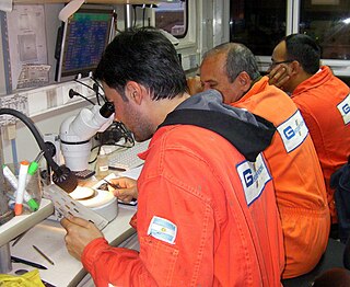
Mud logging is the creation of a detailed record of a borehole by examining the cuttings of rock brought to the surface by the circulating drilling medium. Mud logging is usually performed by a third-party mud logging company. This provides well owners and producers with information about the lithology and fluid content of the borehole while drilling. Historically it is the earliest type of well log. Under some circumstances compressed air is employed as a circulating fluid, rather than mud. Although most commonly used in petroleum exploration, mud logging is also sometimes used when drilling water wells and in other mineral exploration, where drilling fluid is the circulating medium used to lift cuttings out of the hole. In hydrocarbon exploration, hydrocarbon surface gas detectors record the level of natural gas brought up in the mud. A mobile laboratory is situated by the mud logging company near the drilling rig or on deck of an offshore drilling rig, or on a drill ship.
In petrophysics, Archie's law relates the in-situ electrical conductivity (C) of a porous rock to its porosity and fluid saturation of the pores:
Geosteering is the optimal placement of a wellbore based on the results of realtime downhole geological and geophysical logging measurements rather than three-dimensional targets in space. The objective is usually to keep a directional wellbore within a hydrocarbon pay zone defined in terms of its resistivity, density or even biostratigraphy. In mature areas, geosteering may be used to keep a wellbore in a particular section of a reservoir to minimize gas or water breakthrough and maximize economic production from the well. In the process of drilling a borehole, geosteering is the act of adjusting the borehole position on the fly to reach one or more geological targets. These changes are based on geological information gathered while drilling. Originally only a projected target would be aimed for with crude directional tools. Now the advent of rotary steerable tools and an ever-increasing arsenal of geophysical tools enables well placement with ever-increasing accuracy. Typically a basic tool configuration will have directional and inclination sensors, along with a gamma ray tool. Other options are neutron density, look ahead seismic, downhole pressure readings et al. Due to the vast volume of data generated, especially by imaging tools, the data transmitted to surface is a carefully selected fraction of what is available. Data is collected in memory for a data dump when back on surface with the tool.
Petrophysics is the study of physical and chemical rock properties and their interactions with fluids.
Spontaneous potential log, commonly called the self potential log or SP log, is a passive measurement taken by oil industry well loggers to characterise rock formation properties. The log works by measuring small electric potentials between depths with in the borehole and a grounded electrode at the surface. Conductive bore hole fluids are necessary to create a SP response, so the SP log cannot be used in nonconductive drilling muds or air filled holes.
Sonic logging is a well logging tool that provides a formation’s interval transit time, designated as , which is a measure of a how fast elastic seismic compressional and shear waves travel through the formations. Geologically, this capacity varies with many things including lithology and rock textures, most notably decreasing with an increasing effective porosity and increasing with an increasing effective confining stress. This means that a sonic log can be used to calculate the porosity, confining stress, or pore pressure of a formation if the seismic velocity of the rock matrix, , and pore fluid, , are known, which is very useful for hydrocarbon exploration.
Density logging is a well logging tool that can provide a continuous record of a formation's bulk density along the length of a borehole. In geology, bulk density is a function of the density of the minerals forming a rock and the fluid enclosed in the pore spaces. This is one of three well logging tools that are commonly used to calculate porosity, the other two being sonic logging and neutron porosity logging
Spontaneous potentials are often measured down boreholes for formation evaluation in the oil and gas industry, and they can also be measured along the Earth's surface for mineral exploration or groundwater investigation. The phenomenon and its application to geology was first recognized by Conrad Schlumberger, Marcel Schlumberger, and E.G. Leonardon in 1931, and the first published examples were from Romanian oil fields.
In the field of formation evaluation, porosity is one of the key measurements to quantify oil and gas reserves. Neutron porosity measurement employs a neutron source to measure the hydrogen index in a reservoir, which is directly related to porosity. The Hydrogen Index (HI) of a material is defined as the ratio of the concentration of hydrogen atoms per cm3 in the material, to that of pure water at 75 °F. As hydrogen atoms are present in both water and oil-filled reservoirs, measurement of the amount allows estimation of the amount of liquid-filled porosity.