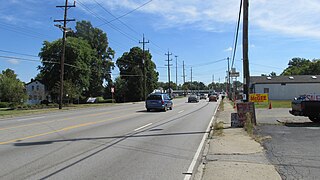
Withamsville is a census-designated place (CDP) in Pierce and Union townships of Clermont County, Ohio, United States. The population was 7,357 at the 2020 census.

Eaton Estates is an unincorporated community and census-designated place (CDP) in Lorain County, Ohio, United States. The population was 1,155 at the 2020 census.
Landisville is an unincorporated community and census-designated place (CDP) in East Hempfield Township, Lancaster County, Pennsylvania, United States. As of the 2010 census the population was 1,893. The community was once part of the Salunga-Landisville CDP, before splitting into two separate CDPs for the 2010 census, the other being Salunga.
East Earl is an unincorporated community and census-designated place (CDP) in East Earl Township, Lancaster County, Pennsylvania, United States. As of the 2010 census, it had a population of 1,144.

Richland Township is one of the twelve townships of Defiance County, Ohio, United States. The 2020 census found 3,063 people in the township.

Tiffin Township is one of twelve townships in Defiance County, Ohio, United States. The 2020 census reported 1,586 residents in the township.

Buford is an unincorporated community and census-designated place in central Clay Township, Highland County, Ohio, United States. The population was 306 at the 2020 census. It once had a post office, with the ZIP code 45110. The current ZIP code 45171 is for nearby Sardinia.

Refton is an unincorporated community and census-designated place (CDP) in Strasburg Township, Lancaster County, Pennsylvania, United States, with a ZIP code of 17560. The community is located along U.S. Route 222. As of the 2010 census, the population was 298.
Mace is an unincorporated community and census-designated place (CDP) in Walnut Township, Montgomery County, in the U.S. state of Indiana.
Oval is a census-designated place (CDP) in Limestone Township, Lycoming County, Pennsylvania, United States. As of the 2010 census, it had a population of 361. Oval is not a separately incorporated community, but is a part of Limestone Township.
Frizzleburg is an unincorporated community and census-designated place (CDP) in Lawrence County, Pennsylvania, United States. The population was 602 at the 2010 census.
Swartzville is an unincorporated community and census-designated place (CDP) in East Cocalico Township, Lancaster County, Pennsylvania, United States. As of the 2010 census, the population was 2,283.
Country Squire Lakes is an unincorporated community and census-designated place (CDP) in Geneva Township, Jennings County, Indiana, United States. As of the 2010 census it had a population of 3,571.
Kanauga is an unincorporated community and census-designated place (CDP) in Gallia County, Ohio, United States. As of the 2020 census it had a population of 185.

Pottery Addition is a census-designated place (CDP) in Jefferson County, Ohio, United States. Its population was 258 as of the 2020 census. The community is located along the Ohio River and is served by Ohio State Route 7.
Linwood is a hamlet and census-designated place (CDP) in the town of York, Livingston County, New York, United States. Its population was 74 as of the 2010 census. Linwood had a post office until February 6, 1993; it still has its own ZIP code, 14486.

Salem Heights is an unincorporated community and census-designated place (CDP) in Columbiana County, Ohio, United States. It was first listed as a CDP prior to the 2020 census, in which its population was 336. Salem Heights sits on the 1,275-foot (389 m) Blackburn Hill, separated from the city of Salem by the valley of the Middle Fork of the Little Beaver Creek. It is part of the Salem micropolitan area.
Suffield is an unincorporated community and census-designated place (CDP) in Suffield Township, Portage County, Ohio, United States. The population was 949 at the 2020 census. It was first listed as a CDP prior to the 2020 census.
Wilkshire Hills is an unincorporated community and census-designated place (CDP) in Tuscarawas County, Ohio, United States. It was first listed as a CDP in the 2020 census.
Nettle Lake is an unincorporated community and census-designated place (CDP) in Williams County, Ohio, United States, around the south end of the lake of the same name. It was first listed as a CDP following the 2010 census.


