
Parker is the county seat of La Paz County, Arizona, United States, on the Colorado River in Parker Valley. As of the 2020 census, the population of the city was 3,417.
Avondale is a city in Maricopa County, Arizona, United States, adjacent to Phoenix. As of the 2020 census, the population of the city was 89,334, up from 76,238 in 2010 and 35,883 in 2000.

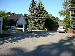
Rio Verde is a master-planned community just east of Scottsdale, in Arizona. It is also a census-designated place (CDP) in Maricopa County, Arizona, United States, located in the far, far northeast area of the whole Phoenix Metropolitan Area. The population was 2,210 as of the 2020 census, up from 1,811 at the 2010 census.
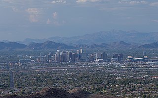
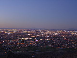
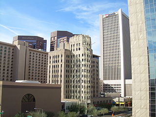
The Phoenix metropolitan area, also known as the Valley of the Sun, the Salt River Valley, metro Phoenix, or The Valley, is the largest metropolitan statistical area in the Southwestern United States, with its largest principal city being the city of Phoenix. It includes much of central Arizona. The United States Office of Management and Budget designates the area as the Phoenix–Mesa–Chandler Metropolitan Statistical Area (MSA), defining it as Maricopa and Pinal counties. It anchors the Arizona Sun Corridor megaregion along with the second-most populous metropolitan area in the state, the Tucson metropolitan area. The gross domestic product of the Phoenix metropolitan area was $255 billion in 2018, 16th highest amongst metro areas in the United States.
Anthem is a planned community partially located within Phoenix and partially located within New River, a census-designated place. The community is entirely located in Maricopa County, Arizona, United States, within the Phoenix Metropolitan Area. As of the 2020 census, the population of the Anthem was 23,190.

Ahwatukee Foothills is an urban village of Phoenix, Arizona. Ahwatukee forms the southernmost portion of Phoenix, and is considered part of the East Valley region of the Phoenix metropolitan area.

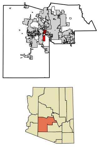
Laveen is a community in Maricopa County, Arizona, United States, situated eight miles (13 km) southwest of Downtown Phoenix, between South Mountain and the confluence of the Gila and Salt rivers. Parts of Laveen constitute an unincorporated community in Maricopa County, while the remainder falls within the city limits of Phoenix, constituting the city's "Laveen Village" an urban village within the city of Phoenix. Laveen Village is split between District 7 and District 8, both notable as minority-majority districts for the city. Although Laveen has been home to "pastoral alfalfa, cotton, and dairy farms" since the 1880s, housing and commercial developments have been increasingly urbanizing the area.
Deer Valley Unified School District #97 (DVUSD) is a Pre-K–12 school district, headquartered in Phoenix, Arizona, United States. DVUSD is the fifth largest school district in the state of Arizona, serving areas of Phoenix, Glendale, Peoria, Anthem, New River and numerous unincorporated areas of northwest Maricopa County. Situated within the Sonoran Desert, the District has grown from its modest beginnings as a county accommodation school located in New River in 1934 to 37 campuses serving 36,261 students: 15 K–6 elementary schools, 13 K–8 schools, three middle schools, and five comprehensive high schools, plus an online school and an alternative school. Early childhood education opportunities are offered through DVUSD Community Education Preschool/PreKindergarten, and Head Start. Twelve schools receive Title I funding. District facilities include District Office, Support Services Center, Transportation and Administrative Services.

North/Northwest Phoenix is a region in the city of Phoenix, Arizona. While the area with this name has no official separate status, it usually refers to the Urban Villages of Paradise Valley, North Mountain, Deer Valley, Desert View, and North Gateway.
South Phoenix is a region of Phoenix, Arizona. By one definition it encompasses an area south of the Salt River, north of Roeser Road, east of 24th Street, and west of 32nd Street.
Parkview is a residential neighbourhood in west Edmonton, Alberta, Canada. Parkview is one of the larger residential neighbourhoods in the city, and is located adjacent to the North Saskatchewan River Valley in the west portion of the City. The neighbourhood has good access to Whitemud Drive and Stony Plain Road, and the interior street layout is based on a modified grid network.
Laurier Heights is a residential neighbourhood in west Edmonton, Alberta, Canada overlooking the North Saskatchewan River valley. A portion of the neighbourhood along Buena Vista Road is located in the river valley, and this portion is sometimes called Buena Vista.
Central City Village is the urban village of Phoenix, Arizona, that includes the downtown area of the city. As of 2010, it had a population of 58,161 residents.

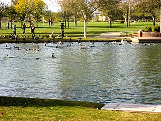
Rio Vista Pond is located in Rio Vista Park in south central Peoria, Arizona, United States, on Rio Vista Boulevard, just north of Thunderbird Road.
Many arterial roads in the Phoenix metropolitan area have the same name in multiple cities or towns. Some roads change names or route numbers across town borders, resulting in occasional confusion. For example, the road known as Apache Boulevard in Tempe continues east as Main Street in neighboring Mesa and then as Apache Trail in Apache Junction. Although Broadway Road maintains the same name through Goodyear, Avondale, Phoenix, Tempe, Mesa, and Apache Junction, each town uses a different reference point for address numbers.
Northeast Bakersfield is the northeast region of Bakersfield, California. It is roughly bounded by Panorama Drive and the Kern River to the north, Alfred Harrell Highway/Comanche Drive to the east, Edison Highway to the south, and Union Avenue to the west. The region of East Bakersfield is located within these boundaries but is usually not considered part of the Northeast. Instead, the Northeast wraps around the boundaries of East Bakersfield. Other boundaries are the city limits.
The Laveen Elementary School District is the K–8 school district for Laveen, an area of southwest Phoenix, Arizona, USA. It operates nine schools, serving about 7,500 students in 2023. Laveen ESD is one of 13 elementary school districts in the Phoenix area that feed into the Phoenix Union High School District.

Indian Mesa is a flat top hill whose sides are steep cliffs. Indian Mesa is located within the Lake Pleasant Regional Park grounds by the shores of Lake Pleasant and Agua Fria River in the Bradshaw Mountain Range. Lake Pleasant Regional Park is within the municipal boundaries of Peoria, Arizona. On top of the mesa there are ruins of a prehistoric Hohokam village which is monitored by the Arizona Site Stewards and considered an important archaeological site by the U.S. Bureau of Land Management. There is a small, steep and narrow path which begins at the skirt of the hill and leads to the top of the mesa.

Antares is an unincorporated community and census designated place (CDP) in Mohave County, Arizona, United States. As of the 2020 census, it had a population of 132. It exists along part of historic U.S. Route 66.
