
Porter is a town in Westchester Township, Porter County, in the U.S. state of Indiana. The population was 4,858 at the 2010 census. Porter is in the Indiana Dunes ecosystem, which played a role in the creation of The Nature Conservancy, and inspired conservation efforts.

Indiana Dunes National Park is a United States national park located in northwestern Indiana managed by the National Park Service. It was authorized by Congress in 1966 as the Indiana Dunes National Lakeshore and was redesignated as the nation's 61st national park on February 15, 2019. The park runs for about 20 miles (32 km) along the southern shore of Lake Michigan and covers 15,349 acres (6,212 ha). Along the lakefront, the eastern area is roughly the lake shore south to U.S. 12 or U.S. 20 between Michigan City, Indiana, on the east and the Cleveland-Cliffs steel plant on the west. This area's conservation scheme is enhanced by the older Indiana Dunes State Park. To the west of the steel plant lies West Beach and a small extension south of the steel mill continues west along Salt Creek to Indiana 249. The western area is roughly the shoreline south to U.S. 12 between the Burns Ditch west to Broadway in downtown Gary, Indiana. In addition, there are several outlying areas, including Pinhook Bog, in LaPorte County to the east; the Heron Rookery in Porter County, the center of the park; and the Hoosier Prairie State Nature Preserve and the Hobart Prairie Grove, both in Lake County, the western end of the park.

Indiana Dunes State Park is an Indiana State Park located in Porter County, Indiana, United States, 47 miles (75.6 km) east of Chicago. The park is bounded by Lake Michigan to the northwest and is surrounded by as well as within the authorized boundaries of Indiana Dunes National Park, a unit of the National Park Service; the NPS owns the water from the ordinary high water mark to 300 feet (91 m) offshore. The 1,530-acre (619.2 ha) Dunes Nature Preserve makes up the bulk of eastern part of the park, and includes most of the park's hiking trails and dune landscape. This was one of the first places Richard Lieber considered when establishing the Indiana State Park system. Like all Indiana state parks, there is a fee for entrance. Indiana Dunes State Park was established in 1925 and designated a National Natural Landmark in 1974.
A losing stream, disappearing stream, influent stream or sinking river is a stream or river that loses water as it flows downstream. The water infiltrates into the ground recharging the local groundwater, because the water table is below the bottom of the stream channel. This is the opposite of a more common gaining stream which increases in water volume farther downstream as it gains water from the local aquifer.

Twin Caves is a pair of cave entrances connected by a short river at the bottom of a sinkhole within the boundaries of Spring Mill State Park in Lawrence County, Indiana. The river is an exposed section of a mostly-underground stream that originates as Mosquito Creek several miles southeast of the park, which sinks into the Upper Twin Cave system. The stream then comes out briefly at Twin Caves, and flows into the Lower Twin Cave, re-emerging briefly at Bronson Cave shortly to the northwest, then flowing into the Shawnee Cave System. The stream finally emerges at the Donaldson Cave entrance as a short tributary of Mill Creek, still within the park.

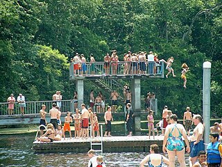
Cowles Bog is a 4,000-year-old wetland complex in Indiana Dunes National Park, near Chesterton, Indiana. It is named for Henry Chandler Cowles who did his pioneering work in ecology and ecological succession here. His work brought international attention to the area which led to efforts to preserve the Indiana Dunes. It was designated a National Natural Landmark in 1965. It contains bog, fen, marsh, wet meadow, swamp, and pond habitats.
The West Virginia spring salamander is a species of troglobitic salamander in the family Plethodontidae. It is endemic to West Virginia, the United States.

The Lost River is a river that rises in Vernon Township, Washington County, Indiana, and discharges into the East Fork of the White River in Lost River Township, Martin County, Indiana. The river's unusual hydrology has led to two of its features being named as National Natural Landmarks.
Unthanks Cave Natural Area Preserve is a 171-acre (69 ha) Natural Area Preserve in Lee County, Virginia. It protects the entrance to Unthanks Cave, which houses significant biological diversity and a wide variety of invertebrate life. The cave's streams drain a significant karst area south of the Powell River.

Cedars of Lebanon State Park is a state park in Wilson County, Tennessee, in the southeastern United States. It consists of 900 acres (364 ha) situated amidst the 9,420-acre (3,810 ha) Cedars of Lebanon State Forest. The park and forest are approximately 10 miles (16 km) south of Lebanon, Tennessee.

Bear Swamp Preserve is a Nature Conservancy preserve and National Natural Landmark in Westerlo, New York. It consists of a pond and surrounding 310 acres (1.3 km2) of swamp and woodland. It is recognized for its great laurel tree population. It has two nature trails totaling about two miles (3.2 km) in length.
Deer Lick Nature Sanctuary is a protected forest and gorge in Cattaraugus County, New York. The preserve is within Zoar Valley near Gowanda, and is managed by The Nature Conservancy.
Ironsides Island is an uninhabited rocky island in the Saint Lawrence River, and part of the Thousand Islands region near Alexandria Bay, New York. It is in both Jefferson and St. Lawrence counties. Most of the island lies in the town of Alexandria, in Jefferson County, while its northeasternmost corner lies in the town of Hammond, in St. Lawrence County. The island is located near Kring Point State Park.

The Mianus River Gorge is a 935-acre (3.78 km2) nature preserve in Bedford, New York jointly owned by The Nature Conservancy and Mianus River Gorge, Inc.. The first 60 acres (0.24 km2) were purchased by the Preserve, with help from the Conservancy, their first land preservation deal. It has grown over the years and is still managed by Mianus River Gorge, Inc. In March 1964, it was designated a National Natural Landmark for its old growth climax hemlock forest and the gorge of the Mianus River.

Hoosier Prairie is a unit of Indiana Dunes National Park in Lake County, Indiana. It began in the 1970s as wasteland that conservation organization found of a unique interest. From a core of 304 acres (123 ha), it has grown to 1,547 acres (626 ha) of important prairie habitat. The area was designated a National Natural Landmark in 1974 and a State Nature Preserve in 1977 The sandy soil creates a variety of habitats, from oak barrens, wet prairie, including sedge meadows and prairie marshes. More than 350 native species of vascular plants have been identified. A minimum of 43 species are uncommon in the State of Indiana.

Škocjan Caves is a cave system located in Slovenia. Recognized for its exceptional significance, Škocjan Caves was included on UNESCO’s list of natural and cultural World Heritage Sites in 1986. Škocjan Caves is a significant underground phenomenon on the Karst Plateau and in Slovenia. After gaining independence from Yugoslavia in 1991, Slovenia made a commitment to actively protect the Škocjan Caves area. To fulfill this commitment, Škocjan Caves Regional Park was established, along with its managing authority, the Škocjan Caves Park Public Service Agency.
Edward Ball Wakulla Springs State Park is a Florida State Park in Wakulla County, Florida, United States. This 6,000 acre (24 km2) wildlife sanctuary, located south of Tallahassee, is listed on the National Register of Historic Places, and designated a National Natural Landmark.

Newsome Sinks Karst Area is a privately owned karst formation in Morgan County, Alabama. It was listed as a National Natural Landmark in November 1973.

Heggie's Rock is a large granite outcropping in Columbia County, Georgia, United States. Declared a National Natural Landmark in 1980, the property was purchased by The Nature Conservancy in 1983.


