East Lothian is one of the 32 council areas of Scotland, as well as a historic county, registration county and lieutenancy area. The county was called Haddingtonshire until 1921.

Midlothian is a historic county, registration county, lieutenancy area and one of 32 council areas of Scotland used for local government. Midlothian lies in the east-central Lowlands, bordering the City of Edinburgh council area, East Lothian and the Scottish Borders.

Lothian is a region of the Scottish Lowlands, lying between the southern shore of the Firth of Forth and the Lammermuir Hills and the Moorfoot Hills. The principal settlement is the Scottish capital, Edinburgh, while other significant towns include Livingston, Linlithgow, Bathgate, Queensferry, Dalkeith, Bonnyrigg, Penicuik, Musselburgh, Prestonpans, Tranent, North Berwick, Dunbar, Whitburn and Haddington.

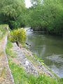
The River Tyne is a river in Scotland. It rises in the Moorfoot Hills in Midlothian near Tynehead to the south of Edinburgh, at the junction of the B6458 and the B6367. It continues approximately 30 miles northeast, and empties into the North Sea near Belhaven.

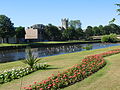
Dalkeith is a town in Midlothian, Scotland, on the River Esk. It was granted a burgh of barony in 1401 and a burgh of regality in 1540. The settlement of Dalkeith grew southwestwards from its 12th-century castle . Dalkeith has a population of 12,342 people according to the 2011 census.

The River Esk, also known as the Border Esk, is a river that rises in the Scottish region of Dumfries and Galloway before crossing the border to the English county of Cumbria and flowing into the Solway Firth.
Bonnyrigg is a town in Midlothian, Scotland, which is eight miles southeast of Edinburgh city centre, between the Rivers North and South Esk. The town had a population of 14,663 in the 2001 census which rose to 15,677 in the 2011 census, both figures based on the 2010 definition of the locality which, as well as Bonnyrigg and the adjacent settlement of Lasswade, includes Polton village, Poltonhall housing estate and modern development at Hopefield. The estimated population for 2018 is 18,120, the highest of any town in Midlothian. Along with Lasswade, Bonnyrigg is a twin town with Saint-Cyr-l'École, France.
The Pentland Hills are a range of hills southwest of Edinburgh, Scotland. The range is around twenty miles in length, and runs southwest from Edinburgh towards Biggar and the upper Clydesdale.

Lasswade is a village and civil parish in Midlothian, Scotland, on the River North Esk, nine miles south of Edinburgh city centre, contiguous with Bonnyrigg and between Dalkeith to the east and Loanhead to the west. Melville Castle lies to the north east. The Gaelic form is Leas Bhaid, meaning the "clump at the fort."

The Edinburgh and Dalkeith Railway was an early railway built to convey coal from pits in the vicinity of Dalkeith into the capital. It was a horse-operated line, with a terminus at St Leonards on the south side of Arthur's Seat.
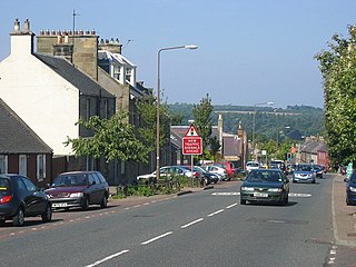
Pathhead village is a conservation area in Midlothian, Scotland.

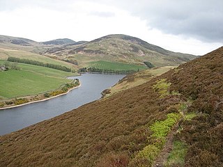
Gladhouse Reservoir, formerly known as Moorfoot Loch, is a reservoir in Midlothian, Scotland, five miles (8 km) south of Penicuik. It is the most southerly reservoir in Midlothian, as well as being the largest area of freshwater in the Lothians. It is used to supply Edinburgh with drinking water.
Glencorse Reservoir is a reservoir in Midlothian, Scotland, two miles west of Glencorse, in the Pentland Hills.
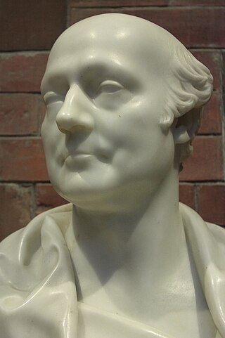
James Jardine was a Scottish civil engineer, mathematician and geologist. He was the first person to determine mean sea level. He built tunnels and bridges, including for the Innocent Railway, and built reservoirs including Glencorse, Threipmuir, Harlaw for Edinburgh Water Company, and Cobbinshaw for the Union Canal.
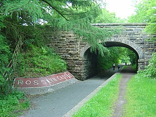
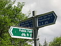
The Penicuik - Dalkeith Walkway, situated in the county of Midlothian in the east of Scotland, stretches for 9.5 miles along the former Edinburgh to Peebles railway. The route passes through many of Midlothian's historic towns and villages. The gentle gradient and nature of the route allows easy access for walkers, cyclists and horse riders to explore and enjoy the spectacular landscapes and visitor attractions of the county.
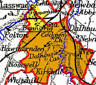
Cockpen is a parish in Midlothian, Scotland, containing at its north-west corner the town of Bonnyrigg, which lies two miles (3.2 km) south-west of Dalkeith. It is bounded on the west and north by the parish of Lasswade, on the east, by Newbattle and on the south by Carrington. It extends about three miles (4.8 km) from north to south and its greatest breadth is about 2+1⁄2 miles (4.0 km).
Glencorse is a parish of Midlothian, Scotland, lying 7 miles south of Edinburgh. It is bounded on the north-west by the former parish of Colinton now within the City of Edinburgh, to the north and west by Lasswade and to the south and west by Penicuik.
Edinburgh Water Company and its successors have provided a public water supply and latterly sewerage and sewage treatment services to the Scottish capital of Edinburgh since 1819. The original company was established to supply drinking water and did so until 1870, when it was taken over by a public Water Trust, with representatives from Edinburgh, Leith and Portobello. That in turn was taken over by Edinburgh Corporation and in 1975, responsibility passed to the Lothian Regional Council, as did the duty to provide sewerage and sewage treatment services. Both services were moved out of local authority control, and taken over by the East of Scotland Water Authority in 1996. The three Scottish regional water authorities were merged to form Scottish Water in 2002.