Rivière-du-Loup Town Hall

Last updated
Rivière-du-Loup Town Hall
Riviere-du-Loup - Hotel de Ville (1).jpg
General information
Architectural style Romanesque Revival
Address 189 Lafontaine Street
Town or city Rivière-du-Loup, Quebec
Country Canada
Coordinates 47°50′9″N69°32′12″W / 47.83583°N 69.53667°W / 47.83583; -69.53667 (Rivière-du-Loup Town Hall) Coordinates: 47°50′9″N69°32′12″W / 47.83583°N 69.53667°W / 47.83583; -69.53667 (Rivière-du-Loup Town Hall)
Opened 1916
Renovated 1972-73
Technical details
Floor count 2
Design and construction
Architect Georges Ouiment
Main contractor Lachance et Fils
Designated 1984
References
[1]

Rivière-du-Loup Town Hall is the seat of local government in Rivière-du-Loup, Quebec, Canada. It is located at 189 Lafontaine Street.

Seat of local government chief administrative building of a municipality

In local government, a city hall, town hall, civic centre, a guildhall, a Rathaus (German), or a municipal building, is the chief administrative building of a city, town, or other municipality. It usually houses the city or town council, its associated departments, and their employees. It also usually functions as the base of the mayor of a city, town, borough, or county/shire.

Rivière-du-Loup City in Quebec, Canada

Rivière-du-Loup is a small city on the south shore of the Saint Lawrence River in Quebec. The city is the seat for the Rivière-du-Loup Regional County Municipality and the judicial district of Kamouraska.

Quebec Province of Canada

Quebec is one of the thirteen provinces and territories of Canada. It is bordered to the west by the province of Ontario and the bodies of water James Bay and Hudson Bay; to the north by Hudson Strait and Ungava Bay; to the east by the Gulf of Saint Lawrence and the province of Newfoundland and Labrador; and to the south by the province of New Brunswick and the U.S. states of Maine, New Hampshire, Vermont, and New York. It also shares maritime borders with Nunavut, Prince Edward Island, and Nova Scotia. Quebec is Canada's largest province by area and its second-largest administrative division; only the territory of Nunavut is larger. It is historically and politically considered to be part of Central Canada.

It was designed by architect Georges Ouimet in incorporating references to the Arts and Crafts Movement and the Second Empire style. It was built by contractors Lachance et Fils and was completed in 1916. It was enlarged from 1972 to 1973. [1]
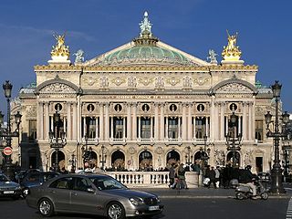
Second Empire architecture architectural style

Second Empire is an architectural style, most popular in the latter half of the 19th century and early years of the 20th century. It was so named for the architectural elements in vogue during the era of the Second French Empire. As the Second Empire style evolved from its 17th-century Renaissance foundations, it acquired a mix of earlier European styles, most notably the Baroque, often combined with mansard roofs and/or low, square-based domes.

It was designated as a National Historic Site of Canada on November 23, 1984. [1]

Related Research Articles

Saint-Louis-du-Ha! Ha! Parish municipality in Quebec, Canada

Saint-Louis-du-Ha! Ha! is a parish municipality in the Témiscouata Regional County Municipality in Quebec, near the south shore of the Saint Lawrence River in Canada. It is located southeast of Rivière-du-Loup and west of Cabano along the Trans-Canada Highway, about halfway to Edmundston in New Brunswick. The population of Saint-Louis-du-Ha! Ha! is 1,318. Its economy is mainly agricultural.

HMCS <i>Riviere du Loup</i> (K357)

HMCS Riviere du Loup was a modified Flower-class corvette that served with the Royal Canadian Navy during the Second World War. She fought primarily in the Battle of the Atlantic as a convoy escort. She was named for Rivière-du-Loup, Quebec.

Montmagny—LIslet—Kamouraska—Rivière-du-Loup Federal electoral district

Montmagny—L'Islet—Kamouraska—Rivière-du-Loup is a federal electoral district in Quebec, Canada, that has been represented in the House of Commons of Canada since 2004. Its population in 2006 was 97,492. It has the highest percentage of Catholics in Canada.

Rivière-du-Loup Regional County Municipality Regional county municipality in Quebec, Canada

Rivière-du-Loup is a regional county municipality in the Bas-Saint-Laurent region of Quebec, Canada. Its most important city is Rivière-du-Loup, which contains more than half of the population.

Témiscouata was a federal electoral district in Quebec, Canada, that was represented in the House of Commons of Canada from 1867 to 1979.

Quebec Route 132 highway in Quebec

Route 132 is the longest highway in Quebec. It follows the south shore of the Saint Lawrence River from the border with the state of New York in the hamlet of Dundee, west of Montreal to the Gulf of Saint Lawrence and circles the Gaspé Peninsula. This highway is known as the Navigator's Route. It passes through the Montérégie, Centre-du-Québec, Chaudière-Appalaches, Bas-Saint-Laurent and Gaspésie regions of the province.

Kamouraska—Rivière-du-Loup was a federal electoral district in Quebec, Canada, that was represented in the House of Commons of Canada from 1979 to 1997.

Kamouraska—Rivière-du-Loup—Témiscouata—Les-Basques was a federal electoral district in Quebec, Canada, that was represented in the House of Commons of Canada from 1997 to 2004.

CFTF-DT

CFTF-DT is a French language television station affiliated with V in Rivière-du-Loup, Quebec, Canada. It broadcasts a high-definition digital signal on UHF channel 29 from a transmitter near Chemin du Mont Bleu in Picard.

CIMT-DT Canadian TV station

CIMT-DT is a French language television station serving as an affiliate of TVA in Rivière-du-Loup, Quebec, Canada. It broadcasts a high-definition digital signal on VHF channel 9 from a transmitter near Chemin du Mont Bleu in Picard.

CKRT-DT

CKRT-DT is a French language television station affiliated with Ici Radio-Canada Télé in Rivière-du-Loup, Quebec, Canada. It broadcasts a high-definition digital signal on VHF channel 7 from a transmitter near Chemin du Mont Bleu in Picard.

Louiseville City in Quebec, Canada

Louiseville is a town in the Mauricie region of the province of Quebec in Canada. It is located near the mouth of the 'Rivière-du-Loup', on the north shore of Lac Saint-Pierre.

Rivière-du-Loup station railway station in Rivière-du-Loup, Canada

Rivière-du-Loup station is a railway station in Rivière-du-Loup, Quebec, Canada. Rivière-du-Loup is served by Via Rail's Ocean train. Previously, it was also served by the Montreal–Gaspé train. Both trains shared the same rail line between Montreal and Matapédia. Located on Rue Lafontaine, it is staffed and offers limited wheelchair accessibility.

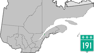
Quebec Route 191 highway in Quebec

Quebec Route 191 is a provincial highway in the Canadian province of Quebec. This route provides a link connecting Quebec Autoroute 20 and Quebec Autoroute 85 from Rivière-du-Loup and Cacouna and a direct link for areas east of Rivière-du-Loup towards the southern part of the Bas-Saint-Laurent region, New Brunswick and Maine.

Bernard Généreux Canadian politician

Bernard Généreux is a Canadian politician, who was elected to represent the electoral district of Montmagny—L'Islet—Kamouraska—Rivière-du-Loup in the federal by-elections on November 9, 2009. He is a member of the Conservative Party.

Saint-Hubert-de-Rivière-du-Loup, Quebec Municipality in Quebec, Canada

Saint-Hubert-de-Rivière-du-Loup is a municipality in Quebec, Canada, in the administrative region of Bas-Saint-Laurent and the regional county municipality of Rivière-du-Loup.

Chemin de fer de la Matapédia et du Golfe

The Chemin de fer de la Matapédia et du Golfe is a historic short line railway that operated in eastern Québec from 1998-2008.

François Lapointe is a Canadian politician who served as MP for the electoral district of Montmagny—L'Islet—Kamouraska—Rivière-du-Loup. He was defeated in the 2015 election.

The Cégep de Rivière-du-Loup is a college-level educational institution established in 1969 in Rivière-du-Loup, Quebec, Canada.

References