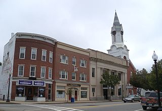
Rochester is a city in Strafford County, New Hampshire, United States. The population was 32,492 at the 2020 census, making it the 6th most populous city in New Hampshire. In addition to the downtown area, the city contains the villages of East Rochester, Gonic, and North Rochester. Rochester is home to Skyhaven Airport and part of Baxter Lake.

The Main Street Historic District encompasses the historic commercial center of Middletown, Connecticut, United States. Middletown was one of the most important ports on the Connecticut River during the colonial period, and Main Street "has been the center of community life since the earliest period of settlement". Today Main Street is home to a number of 19th century buildings, maintaining the bulk of its historic character. It was listed on the National Register of Historic Places in 1983.

The West Gardner Square Historic District encompasses the historic commercial, civic and industrial downtown area of Gardner, Massachusetts. Developed industrially beginning in the early 19th century, the area now boasts a concentration of late 19th and early 20th century commercial, civic, and industrial architecture. It was listed on the National Register of Historic Places in 1985.

The Spicket Falls Historic District encompasses the historic industrial and commercial heart of Methuen, Massachusetts, and one of the lower Merrimack River's best-preserved 19th century mill complexes. It is centered on the falls of the Spicket River, from which the 19th century textile mills of Methuen derived their power. The historic district, listed on the National Register of Historic Places in 1984, includes commercial and civic buildings in and near Gaunt Square, the heart of the city, and along both sides of the Spicket River between Gaunt Square and the Boston and Maine Railroad tracks south of the river. It abuts the residential Pleasant-High Historic District, which lies to its east.
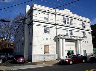
The Main Street Historic District of Bristol, Connecticut encompasses much of the city's central business district, an area built up in the late 19th and early 20th centuries. The district's 19 historic buildings are located along adjoining stretches of Main and Prospect Streets, and include important civic and commercial buildings. The district was listed on the National Register of Historic Places in 1995.

The Westfield Center Historic District is a historic district encompassing 157 acres (64 ha) of the civic, commercial, and industrial heart of Westfield, Massachusetts. It represents a major expansion of the Westfield Center Commercial Historic District, which included only two blocks of buildings along Elm Street in downtown Westfield. The district includes buildings representing the city's growth in the 19th century as a center of the whip-making industry, and its early years as a center for statewide educational institutions, as well as its growth as a regional center of western Hampden County. The commercial district was added to the National Register of Historic Places in 2008; the expansion and renaming of the district took place in 2013.

The Franklin Falls Historic District is a 75-acre (30 ha) historic district encompassing most of the civic and industrial heart of Franklin, New Hampshire, which saw its most significant development in the second half of the 19th century and the first decades of the 20th. The district is focused on Central Street between two crossings of the Winnipesaukee River, and includes Odell Park along with industrial properties along the bend in the river north of those two crossings, as well as a number of properties on adjacent streets south of Central Street. The district was listed on the National Register of Historic Places in 1982.
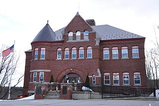
The Pittsfield Center Historic District encompasses the civic and commercial heart of Pittsfield, New Hampshire. This area is defined by a roughly square bend in the Suncook River, whose power provided an impetus for the development of the town in the 19th century. The dominant feature of the district is the 1827 Joy Cotton Mill, a four-story brick building at the base of Main Street. There are three churches, including the 1863 Gothic Revival St. Stephen's Episcopal Church, and the town office building, a significantly altered 1789 meeting house. The district also includes the main commercial district and some of the surrounding residential areas. It was listed on the National Register of Historic Places in 1980.

The Central Square Historic District of Bristol, New Hampshire, encompasses the central commercial district of the town. The square is a four-sided space near the junction of six roadways in the center of Bristol, just north of the Newfound River and west of the Pemigewasset River. The district includes all of the buildings that are arrayed around the square, as well as one contemporary commercial building located just south of the Newfound River on South Main Street. The district was listed on the National Register of Historic Places in 1983.

The Lyme Center Historic District encompasses a modest crossroads and industrial village in rural Lyme, New Hampshire. The predominantly residential district stretches along Dorchester Road, on either side of its junction with Baker Hill Road. The village's rise in development started in the early 19th century as it was at a crossroads of the east-west Dorchester Road, and the north-south Baker Hill Road and Acorn Hill Road. The village grew rapidly in the 1820s, with a number of simple Greek Revival houses, and in 1830 the Baptist Church was built. The other major civic building in the village is the Lyme Academy, built in 1839, albeit with more Federal than Greek Revival styling. Grant Brook, which runs parallel to Dorchester Road, provided a source of power for the growth of small industrial efforts, including a sawmill at the corner of Dorchester and Baker Hill Roads. This industry provided a second minor building boom in the late 19th to early 20th century. Most of the houses in the district are vernacular Greek Revival or Cape in their styling; probably the most elaborate Greek Revival house is the 1857 Beal-Pike House at 41 Dorchester Road.

The Bennington Village Historic District of Bennington, New Hampshire encompasses the 19th-century center of the village. Growth of the village followed a typical pattern for rural New Hampshire towns, based in this case around the growth in the early 19th century of the paper industry, which continues to be a significant economic force in the community. The district is centered on the junctions of Main, Center, and School Streets with Bible Hill Road and Francestown Road. The district was listed on the National Register of Historic Places in 2010.

The Wakefield House is a historic house on New Hampshire Route 153 in the Wakefield Corner area of Wakefield, New Hampshire. The 2+1⁄2-story wood-frame house is believed to have been built c. 1785, but its exterior styling is mainly Federal in character, dating to the 1820s or later. It was used as an inn on the busy stagecoach route through town in the 19th century. It was listed on the National Register of Historic Places in 1983.
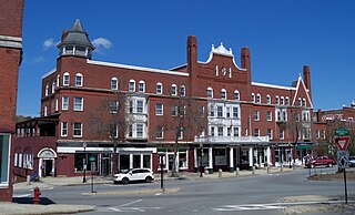
The Central Business District of Claremont, New Hampshire, is centered on Broad Street Park and the Claremont Opera House, and the area between the park and the Sugar River, whose power was responsible for Claremont's growth in the 19th century. The district was listed on the National Register of Historic Places in 1978.

The Newmarket Industrial and Commercial Historic District encompasses the heart of a distinctive 19th century mill town, Newmarket, New Hampshire. Its mill complex is regionally distinctive for its extensive use of stone from an early date, and the town is relatively well-preserved due to a significant economic decline after the mills closed in 1920. The district was listed on the National Register of Historic Places in 1980. The Stone School, listed in 1978, is a contributing resource.

The Downtown Bennington Historic District encompasses the historic commercial heart of Bennington, Vermont. Centered on the junction of Main, South, and North Streets, it exhibits a variety of commercial architectural styles from the early 19th to mid-20th century. It was listed on the National Register of Historic Places in 1980, and was enlarged in 2008.

The Grant Commercial Historic District is a nationally recognized historic district located in Grant, Iowa, United States. It was listed on the National Register of Historic Places in 2002. At the time of its nomination it contained 17 resources, which included 15 contributing buildings, two contributing structures, and one non-contributing building. The historic district covers the town's central business district. Grant is a small town located in northeast Montgomery County in the southwest quadrant of the state. It was plated in 1858, and it was known as Milford until the early 20th century even though its post office was Grant. While not on a railroad, the town was still able to maintain a viable commercial district.

The Bethel Village Historic District encompasses the historic core of the village of Bethel in the town of Bethel, Vermont, USA. The L-shaped district extends along Main and Church Streets, including many of the village's commercial and civic buildings, as well as a significant number of 19th and early 20th-century residences. The district was listed on the National Register of Historic Places in 1976, and was slightly enlarged in 1990.

The Vergennes Historic District encompasses the historic commercial and industrial heart of the city of Vergennes, Vermont. Incorporated in 1788, the city developed as a major industrial center, and served as a military center during the War of 1812. The district includes mainly 19th and early-20th century commercial, retail, residential and civic properties, as well as the former site of the Monkton Iron Works, once one of the nation's largest iron foundries. The district was listed on the National Register of Historic Places in 1976.
The Springfield Downtown Historic District encompasses the historic central business district of the town of Springfield, Vermont. Located in a narrow valley on the banks of the Black River, the town's architecture is primarily reflective of its importance as a manufacturing center in the late 19th and early-to-mid 20th centuries, with a cluster of commercial buildings surrounded by residential and industrial areas. It was listed on the National Register of Historic Places in 1983, and enlarged slightly in 1986.

Downtown New Britain is the historic commercial and civic heart of the city of New Britain, Connecticut. It is located in the southern part of the city, anchored by the triangular Central Park and City Hall on the north, and by Franklin Park on the south. The city was one of Connecticut's industrial powerhouses of the 19th and early 20th centuries, which is reflected in the abundance, style, and quality of the architecture found in the downtown. The area was listed on the National Register of Historic Places in 2016.


