
The Rockaway Peninsula, commonly referred to as The Rockaways or Rockaway, is a peninsula at the southern edge of the New York City borough of Queens on Long Island, New York. Relatively isolated from Manhattan and other more urban parts of the city, Rockaway became a popular summer retreat in the 1830s. It has since become a mixture of lower, middle, and upper-class neighborhoods. In the 2010s, it became one of the city's most quickly gentrifying areas.

Rockaway Beach is a neighborhood on the Rockaway Peninsula in the New York City borough of Queens. The neighborhood is bounded by Arverne to the east and Rockaway Park to the west. It is named for the Rockaway Beach and Boardwalk, which is the largest urban beach in the United States, stretching from Beach 3rd to Beach 153rd Streets on the Atlantic Ocean. The neighborhood, with 13,000 residents as of 2010, is also known as the "Irish Riviera" because of its large Irish American population.
Belle Harbor is a small residential neighborhood in the New York City borough of Queens, located on the western half of the Rockaway Peninsula, the southernmost area of the borough. Belle Harbor commonly refers to the area from Beach 126th to Beach 141st Streets.

Edgemere is a neighborhood in the New York City borough of Queens, extending from Beach 32nd to Beach 52nd Street on the Rockaway Peninsula. It contains Rockaway Community Park. Arverne is to the west, and Far Rockaway to the east. Edgemere was founded in 1892 by Frederick J. Lancaster, who originally called it New Venice.

Arverne is a neighborhood in the New York City borough of Queens, on the Rockaway Peninsula. It was initially developed by Remington Vernam, whose signature "R. Vernam" inspired the name of the neighborhood. Arverne extends from Beach 54th Street to Beach 79th Street, along its main thoroughfare Beach Channel Drive, alternatively known as Rev. Joseph H. May Drive.

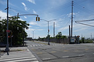
The Beach 67th Street station is a station on the IND Rockaway Line of the New York City Subway. Located at Beach 67th Street and Rockaway Freeway in Arverne, Queens, it is served by the A train at all times. The station is adjacent to Kohlreiter Square, a public green space on the north side of the station.

The Beach 60th Street station is a station on the IND Rockaway Line of the New York City Subway. Located in Queens on the Rockaway Freeway at Beach 60th Street, it is served by the A train at all times. The station opened in 1892, and was rebuilt in 1942 as an elevated station.

Rockaway Park is a neighborhood in the New York City borough of Queens. The area is on the Rockaway Peninsula, nestled between Jamaica Bay to the north and the Atlantic Ocean to the south. The neighborhood of Rockaway Beach lies on its eastern border while the community of Belle Harbor is situated on its western side. The neighborhood is part of Queens Community Board 14.
Woodhaven Boulevard and Cross Bay Boulevard are two parts of a major boulevard in the New York City borough of Queens. Woodhaven Boulevard runs roughly north–south in the central portion of Queens. South of Liberty Avenue, it is known as Cross Bay Boulevard, which is the main north–south road in Howard Beach. Cross Bay Boulevard is locally known as simply "Cross Bay", and Woodhaven Boulevard, "Woodhaven". The completion of the boulevard in 1923, together with the construction of the associated bridges over Jamaica Bay, created the first direct roadway connection to the burgeoning Atlantic Ocean beachfront communities of the Rockaway Peninsula from Brooklyn and most of Queens.

Jacob Riis Park, also called Jacob A. Riis Park and Riis Park, is a seaside park on the southwestern portion of the Rockaway Peninsula in the New York City borough of Queens. It lies at the foot of the Marine Parkway–Gil Hodges Memorial Bridge, east of Fort Tilden, and west of Neponsit and Rockaway Beach. Originally run by the New York City Department of Parks and Recreation, it later became part of the Jamaica Bay Unit of the Gateway National Recreation Area, and is managed by the National Park Service (NPS). It features an extensive sand beach along the Atlantic Ocean coastline and several historic Art Deco structures.
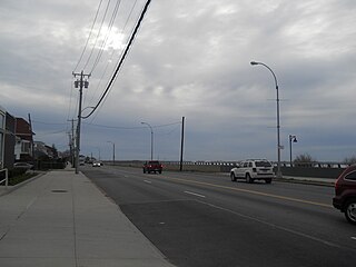
Beach Channel Drive is the main thoroughfare of the Rockaway Peninsula in the New York City borough of Queens. It extends from the Nassau County border at Inwood westward, to the Marine Parkway–Gil Hodges Memorial Bridge at the end of Jacob Riis Park. From Hammels westward, it follows Jamaica Bay on the northern side of the peninsula.

Shore Front Parkway is a 2.5-mile (4.0 km) beachfront road paralleling the Rockaway Beach and Boardwalk in the New York City borough of Queens, running between Beach 73rd Street and Beach 108th Street.
The Rockaway Freeway is a road in the New York City borough of Queens that was created from the old right-of-way of the Long Island Rail Road Rockaway Division in 1941–1942 as part of the project to eliminate grade crossings within New York City. The railroad line itself was elevated over the new automotive route and was incorporated into the New York City Subway system as the IND Rockaway Line in June 1956.

The Q35 bus route constitutes a public transit line in southeast Brooklyn as well as the Rockaway Peninsula of southern Queens in New York City. The Q35 is operated by MTA Regional Bus Operations under the MTA Bus Company brand, but was formerly privately operated by Green Bus Lines. The bus provides service between Midwood in central Brooklyn to Rockaway Park on the Rockaway Peninsula, running mainly along Flatbush Avenue in Brooklyn and Newport Avenue on the Rockaway Peninsula. The route utilizes the Marine Parkway–Gil Hodges Memorial Bridge to cross between Brooklyn and Queens.
Sutphin Boulevard is a major street in the New York City borough of Queens. Its northern end is at Hillside Avenue in Jamaica and its southern end is Rockaway Boulevard on the border of South Jamaica and Springfield Gardens. It comes from the Dutch name Sutphin, which is derived from the Dutch city of Zutphen.

Rockaway Boulevard is a major road in the New York City borough of Queens. Unlike the similarly named Rockaway Beach Boulevard and Rockaway Freeway, it serves mainland Queens and does not enter the Rockaways.
The Q11, Q21, Q52, and Q53 bus routes constitute a public transit corridor running along Woodhaven and Cross Bay Boulevards in Queens, New York City. The corridor extends primarily along the length of the two boulevards through "mainland" Queens, a distance of 6 miles (9.7 km) between Elmhurst and the Jamaica Bay shore in Howard Beach. The Q52 and Q53 buses, which provide Select Bus Service along the corridor, continue south across Jamaica Bay to the Rockaway peninsula, one of the few public transit options between the peninsula and the rest of the city.

Kohlreiter Square is an 8.6-acre public green space located in the Arverne neighborhood on Rockaway Peninsula in Queens, New York. It located along the north side of Rockaway Freeway between Beach 67th and Beach 69th Streets. The park honors two generations of civic activists, Nathan A. Kohlreiter (1880–1961) and his son Fred Kohlreiter (1913–1990) who contributed to the political and social fabric of the neighborhood.
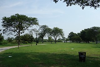
Edgemere Landfill is a former municipal landfill located in Edgemere on the Rockaway peninsula in Queens, New York City. It is located on a man-made peninsula on the Jamaica Bay shoreline, at the eastern end of the Rockaway peninsula. A portion of the site is open to the public as Rockaway Community Park. The entire site is owned by the New York City Department of Parks and Recreation.

The Rockaway Beach and Boardwalk is a public park in Rockaway, Queens, New York, composed of the 170-acre (69 ha) Rockaway Beach and the adjacent 5.5-mile (8.9 km) Rockaway Boardwalk. The beach runs from Beach 9th Street in Far Rockaway to Beach 149th Street in Neponsit, a distance of 7 miles (11 km). The boardwalk, a concrete deck, runs from Beach 9th Street to Beach 126th Street in Rockaway Park, at the edge of Belle Harbor. There are also numerous recreational facilities within the park, parallel to the beach and boardwalk.

