Romrod

Last updated
Romrod
Wappen Romrod.svg
Location of Romrod within Vogelsbergkreis district
Mittelhessen Vogelsberg Rom.pngSchlitzGemündenSchwalmtalLauterbachWartenbergLautertal
Germany adm location map.svg
Red pog.svg
Romrod
Hesse location map.svg
Red pog.svg
Romrod
Coordinates: 50°43′N09°13′E / 50.717°N 9.217°E / 50.717; 9.217 Coordinates: 50°43′N09°13′E / 50.717°N 9.217°E / 50.717; 9.217
Country Germany
State Hesse
Admin. region Gießen
District Vogelsbergkreis
Subdivisions5 Stadtteile
Government
   Mayor (202127) Hauke Schmehl [1] (CDU)
Area
  Total54.43 km2 (21.02 sq mi)
Elevation
334 m (1,096 ft)
Population
 (2020-12-31) [2]
  Total2,676
  Density49/km2 (130/sq mi)
Time zone UTC+01:00 (CET)
  Summer (DST) UTC+02:00 (CEST)
Postal codes
36329
Dialling codes 06636
Vehicle registration VB
Website www.romrod.de

Romrod is a small town in the Vogelsbergkreis in central Hesse, Germany.

Contents

Geography

Location

Through the town flows the river Antrift.

Neighbouring communities

Romrod borders in the north on the town of Alsfeld, in the east on the community of Schwalmtal, in the south on the community of Feldatal, and in the west on the community of Gemünden and the town of Kirtorf.

Constituent communities

Romrod consists of the communities of Nieder-Breidenbach, Ober-Breidenbach, Romrod, Strebendorf and Zell.

History

The village of "Rumerode" came into being at the crossroads of the Diotweg ("People's Way") and the Kurze Hessen army road. The first castle was built in the 11th century in the Antrift valley. It is thus assumed that there was already a settlement there, as valley castles were often built in places where there were already people.

Schloss Romrod Romrod Schloss.jpg
Schloss Romrod

In the first half of the 12th century, the old castle with the moat was built. The builders of this castle were presumably the local von Romrod noble family's forebears. These nobles were first mentioned in writing in 1197, when Ludwig von Romrod's name cropped up when he witnessed a document from the Fulda Abbey. In the centuries that followed, the von Romrods held important offices. Heinrich von Romrod was a Hessian marshal and Hermann von Romrod held command over the Order of St. John in Grebenau. Also worthy of noting are the Abbots Heinrich VI von Romrod (1320 - 1323/1324) in Hersfeld and Friedrich I von Romrod (1383–1395) in Fulda.

Through the course of the 14th century, the von Romrods fell on hard times and had to sell their stately home to the Landgraves Otto and Heinrich von Hessen. By 1408 at the latest, Romrod had passed to Hesse.

Amalgamations

As part of municipal reforms, the new greater community of Romrod came into being on 31 December 1971 with the amalgamation of the town of Romrod and the communities of Nieder-Breidenbach, Ober-Breidenbach, Strebendorf and Zell.

Politics

Romrod town council is made up of 23 members. As of municipal elections held on 26 March 2006 the seats are apportioned thus:

SPD  : 10 seats
CDU/FWG : 13 seats

The town executive consists of 5 councillors and the mayor.

The mayor, Dr. Birgit Richtberg was elected on 14 March 2004 with a 54.3% share of the vote.

Coat of arms

Heraldically, Romrod's civic coat of arms might be described thus: In Or a stone wall with a crenellated tower sable, below the tower and before the wall an inescutcheon, therein the Lion of Hesse (in azure a lion rampant striped nine times silver and gules, armed Or and langued gules).

The golden shield with the wall and tower has its roots in Romrod's old knightly family. The Lion of Hesse, of course, refers to Hesse, to which Romrod has belonged for centuries.

Town partnerships

Culture and sightseeing

Buildings

Economy and infrastructure

Transport

Romrod lies on Autobahn A 5, at interchange 3, Pfefferhöhe. Furthermore, Federal Highway (Bundesstraße) B 49 runs through Romrod.

Public institutions

At the Schloss is a "memorial academy" educational centre of the Deutsche Stiftung Denkmalschutz, an initiative whose goal is to protect cultural monuments.

Sons and daughters of the town

Related Research Articles

<span class="mw-page-title-main">Wartenberg, Hesse</span> Municipality in Hesse, Germany

Wartenberg is a municipality in the Vogelsbergkreis in Hesse, Germany.

<span class="mw-page-title-main">Battenberg (Eder)</span> Town in Hesse, Germany

Battenberg (Eder) is a small town in Waldeck-Frankenberg district, the state of Hesse, Germany. The town is noted for giving its name to the Battenberg family, a morganatic branch of the ruling House of Hesse-Darmstadt, and through it, the name Mountbatten used by members of the British royal family, a literal translation of Battenberg.

<span class="mw-page-title-main">Angelburg</span> Municipality in Hesse, Germany

Angelburg is a community in western Marburg-Biedenkopf in northwest Middle Hesse in Germany.

<span class="mw-page-title-main">Melsungen</span> Town in Hesse, Germany

Melsungen is a small climatic spa town in the Schwalm-Eder district in northern Hesse, Germany. In 1987, the town hosted the 27th Hessentag state festival.

<span class="mw-page-title-main">Oberaula</span> Municipality in Hesse, Germany

Oberaula is a municipality in the Schwalm-Eder district in Hesse, Germany.

<span class="mw-page-title-main">Freiensteinau</span> Municipality in Hesse, Germany

Freiensteinau is a municipality in the Vogelsbergkreis in Hesse, Germany.

<span class="mw-page-title-main">Gemünden (Felda)</span> Municipality in Hesse, Germany

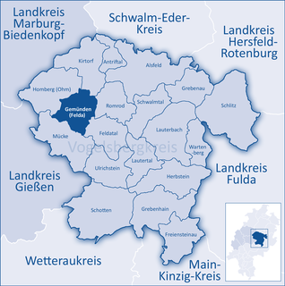
Gemünden is a municipality in the Vogelsbergkreis in Hesse, Germany.

<span class="mw-page-title-main">Homberg (Ohm)</span> Town in Hesse, Germany

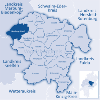
Homberg (Ohm) is a town in the Vogelsbergkreis in Hesse, Germany.

<span class="mw-page-title-main">Kirtorf</span> Town in Hesse, Germany

Kirtorf is a town in the northern Vogelsbergkreis in Hesse, Germany. Through the town runs the Deutsche Märchenstraße, or German Fairytale Road, a touristic route joining many of the places commonly associated with the Brothers Grimm's tales.

<span class="mw-page-title-main">Schlitz, Hesse</span> Town in Hesse, Germany

Schlitz is a small town in the Vogelsbergkreis in eastern Hesse, Germany.

<span class="mw-page-title-main">Schwalmtal, Hesse</span> Municipality in Hesse, Germany

Schwalmtal is a community in the Vogelsbergkreis in Hesse, Germany.

<span class="mw-page-title-main">Rosbach vor der Höhe</span> Town in Hesse, Germany

Rosbach vor der Höhe is a town in the district of Wetteraukreis, in Hesse, Germany. It is located 25 kilometres north of Frankfurt am Main, on the eastern side of the Taunus mountain range. The town has a population of approximately 12,000.

<span class="mw-page-title-main">Bad König</span> Town in Hesse, Germany

Bad König is a town and resort (Kurort) in the central Odenwald in the Odenwaldkreis (district) in Hesse, Germany, 29 km southeast of Darmstadt.

<span class="mw-page-title-main">Breitenbach am Herzberg</span> Municipality in Hesse, Germany

Breitenbach am Herzberg is a municipality in southwesternmost Hersfeld-Rotenburg district in eastern Hesse, Germany.

<span class="mw-page-title-main">Haunetal</span> Municipality in Hesse, Germany

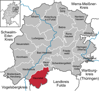
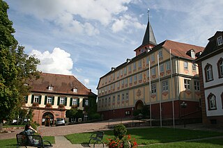
Haunetal is a municipality in Hersfeld-Rotenburg district in eastern Hesse, Germany. Haunetal is the district's southernmost municipality.

<span class="mw-page-title-main">Hohenroda</span> Municipality in Hesse, Germany

Hohenroda is a municipality in Hersfeld-Rotenburg district in eastern Hesse, Germany lying right on the boundary with Thuringia.

<span class="mw-page-title-main">Cornberg</span> Municipality in Hesse, Germany

Cornberg is a municipality in Hersfeld-Rotenburg district in northeastern Hesse, Germany. It is the district's smallest municipality.

<span class="mw-page-title-main">Friedewald, Hesse</span> Municipality in Hesse, Germany

Friedewald is a municipality in Hersfeld-Rotenburg district in eastern Hesse, Germany, directly east of Bad Hersfeld.

<span class="mw-page-title-main">Ludwigsau</span> Municipality in Hesse, Germany

Ludwigsau is a community in Hersfeld-Rotenburg district in northeastern Hesse, Germany. With an area of 112 km² it is Hesse's biggest community by land area.

<span class="mw-page-title-main">Lauterbach, Hesse</span> Town in Hesse, Germany

Lauterbach is a town in the Vogelsbergkreis district of the federal state of Hesse in central Germany. In 1983, the town hosted the 23rd Hessentag state festival.

References

  1. "Ergebnisse der letzten Direktwahl aller hessischen Landkreise und Gemeinden" (XLS) (in German). Hessisches Statistisches Landesamt. 5 September 2022.
  2. "Bevölkerung in Hessen am 31.12.2020 nach Gemeinden". Hessisches Statistisches Landesamt (in German). June 2021.