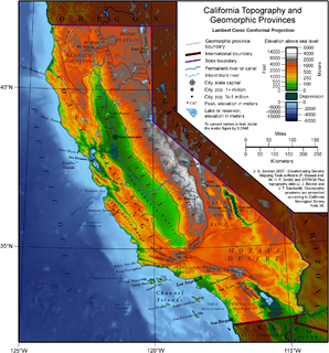
California is a U.S. state on the western coast of North America. Covering an area of 163,696 sq mi (423,970 km2), California is geographically diverse. The Sierra Nevada, the fertile farmlands of the Central Valley, and the arid Mojave Desert of the south are some of the major geographic features of this U.S. state. It is home to some of the world's most exceptional trees: the tallest, most massive, and oldest. It is also home to both the highest and lowest points in the 48 contiguous states. The state is generally divided into Northern and Southern California, although the boundary between the two is not well defined. San Francisco is decidedly a Northern California city and Los Angeles likewise a Southern California one, but areas in between do not often share their confidence in geographic identity. The US Geological Survey defines the geographic center of the state at a point near North Fork, California.

Edwards Air Force Base (AFB) is a United States Air Force installation located in Kern County in Southern California, about 22 miles (35 km) northeast of Lancaster, 15 miles (24 km) east of Rosamond and 5.5 miles (8.9 km) south of California City.

Owens Lake is a mostly dry lake in the Owens Valley on the eastern side of the Sierra Nevada in Inyo County, California. It is about 5 miles (8.0 km) south of Lone Pine, California. Unlike most dry lakes in the Basin and Range Province that have been dry for thousands of years, Owens held significant water until 1913, when much of the Owens River was diverted into the Los Angeles Aqueduct, causing Owens Lake to desiccate by 1926. Today, some of the flow of the river has been restored, and the lake now contains some water. Nevertheless, as of 2013, it is the largest single source of dust pollution in the United States.

The NASA Neil A. Armstrong Flight Research Center (AFRC) is an aeronautical research center operated by NASA. Its primary campus is located inside Edwards Air Force Base in California and is considered NASA's premier site for aeronautical research. AFRC operates some of the most advanced aircraft in the world and is known for many aviation firsts, including critical support for the first crewed airplane to exceed the speed of sound in level flight with the Bell X-1, highest speed ever recorded by a crewed, powered aircraft, the first pure digital fly-by-wire aircraft, and many others. AFRC also operates a second site in Palmdale, Ca. known as Building 703, once the former Rockwell International/North American Aviation production facility, next to Air Force Plant 42. There, AFRC houses and operates several of NASA's Science Mission Directorate aircraft including SOFIA, a DC-8 Flying Laboratory, a Gulfstream C-20A UAVSAR and ER-2 High Altitude Platform. David McBride is currently the center's director.

A dry lake is either a basin or depression that formerly contained a standing surface water body, which disappeared when evaporation processes exceeded recharge. If the floor of a dry lake is covered by deposits of alkaline compounds, it is known as an alkali flat. If covered with salt, it is known as a salt flat.

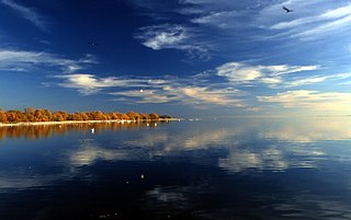
The Salton Sea is a shallow, saline, endorheic rift lake located directly on the San Andreas Fault, predominantly in the U.S. state of California's Imperial and Coachella valleys.

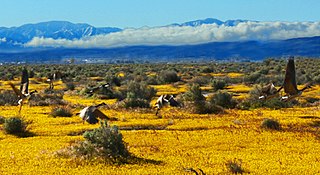
Antelope Valley is located in northern Los Angeles County, California, and the southeast portion of Kern County, California, and constitutes the western tip of the Mojave Desert. It is situated between the Tehachapi, Sierra Pelona, and the San Gabriel Mountains. The valley was named for the pronghorns that roamed there until they were all but eliminated in the 1880s, mostly by hunting, or resettled in other areas. The principal cities in the Antelope Valley are Palmdale and Lancaster.

Brewster Hopkinson Shaw Jr. is a former NASA astronaut, a retired U.S. Air Force Colonel and former executive at Boeing. Shaw was inducted into the U.S. Astronaut Hall of Fame on May 6, 2006.

The Florissant Fossil Beds National Monument is a national monument located in Teller County, Colorado. The location is famous for the abundant and exceptionally preserved insect and plant fossils that are found in the mudstones and shales of the Florissant Formation. Based on argon radiometric dating, the formation is Eocene in age and has been interpreted as a lake environment. The fossils have been preserved because of the interaction of the volcanic ash from the nearby Thirtynine Mile volcanic field with diatoms in the lake, causing an diatom bloom. As the diatoms fell to the bottom of the lake, any plants or animals that had recently died were preserved by the diatom falls. Fine layers of clays and muds interspersed with layers of ash form "paper shales" holding beautifully-preserved fossils.

The Owens River is a river in eastern California in the United States, approximately 183 miles (295 km) long. It drains into and through the Owens Valley, an arid basin between the eastern slope of the Sierra Nevada and the western faces of the Inyo and White Mountains. The river terminates at the endorheic Owens Lake south of Lone Pine, at the bottom of a 2,600 sq mi (6,700 km2) watershed.

Rogers Dry Lake is an endorheic desert salt pan in the Mojave Desert of Kern County, California. The lake derives its name from the Anglicization from the Spanish name, Rodriguez Dry Lake. It is the central part of Edwards Air Force Base as its hard surface provides a natural extension to the paved runways. It was formerly known as Muroc Dry Lake.

Harper Lake is a dry lake located in the Mojave Desert near the small community of Lockhart, California, in northwestern San Bernardino County of Southern California. The lake is accessible from Harper Lake Road, which runs north off of State Route 58 midway between Boron and Barstow.

The Imperial Reservoir is an artificial lake formed by the construction of the Imperial Diversion Dam across the Colorado River in the Lower Colorado River Valley of Imperial County, California, and Yuma County, Arizona. A component of the Imperial National Wildlife Refuge, the reservoir is 16 miles (26 km) northeast of Yuma, Arizona.

Speed is a 1936 Metro-Goldwyn-Mayer action film directed by Edwin L. Marin and starring James Stewart in his first starring role, and Wendy Barrie. Although only a low-budget "B" movie, the film was notable for its realistic cinematography by Lester White, incorporating scenes from the Indianapolis 500 race and on-location shooting at the Muroc dry lake bed, used for high-speed racing by "hot rodders" in the 1930s. Advance publicity trumpeted that Stewart drove the specially-prepared "Falcon" to 140 mph (230 km/h).

David Paul Cooley was a Lockheed test pilot and retired United States Air Force (USAF) officer, responsible for developmental flight testing of the F-117 Nighthawk. He was killed while flying a test mission in an F-22 Raptor jet fighter over the high desert of Southern California.

Muroc is a former settlement in Kern County, California in the Mojave Desert.
Cuddeback Lake is a dry lake in the Mojave Desert of San Bernardino County, California, 60 km (37 mi) northeast of Edwards Air Force Base. The lake is approximately 10 km (6.2 mi) long and 4 km (2.5 mi) at its widest point.


