
Rosedale is a city in Bolivar County, Mississippi, United States. The population was 1,873 at the 2010 census, down from 2,414 in 2000. Located in an agricultural area, the city had a stop on the Yazoo and Mississippi Valley Railroad, which carried many migrants north out of the area in the first half of the 20th century.

Rosedale is a neighbourhood in Toronto, Ontario, Canada, which was formerly the estate of William Botsford Jarvis, and so named by his wife, granddaughter of William Dummer Powell, for the wild roses that grew there in abundance. It is located north of Downtown Toronto and is one of its oldest suburbs. It is also one of the wealthiest and most highly priced neighbourhoods in Canada. Rosedale has been ranked the best neighbourhood in Toronto to live in by Toronto Life. It is known as the area where the city's 'old money' lives, and is home to some of Canada's richest and most famous citizens including Gerry Schwartz, founder of Onex Corporation, and Ken Thomson of Thomson Corporation, the latter of whom was the richest man in Canada at the time of his death in 2006.

Toronto Centre is a federal electoral district in Toronto, Ontario, Canada, that has been represented in the House of Commons of Canada from 1872 to 1925, and since 1935, under the names Centre Toronto (1872–1903), Toronto Centre, Rosedale (1935–1997), and Toronto Centre—Rosedale (1997–2004).

Hedgehope is a locality in the central Southland region of New Zealand's South Island.
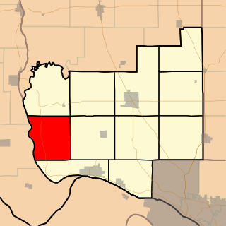
Rosedale Township is one of eleven townships in Jersey County, Illinois, United States. As of the 2010 census, its population was 456 and it contained 295 housing units.

Rosedale is a residential neighbourhood in the northwest quadrant of Calgary, Alberta. It is located south of the Trans-Canada Highway, between 4th and 10th Street NW. To the south it is bounded by McHugh Bluff Park and the community of Sunnyside.

Rosedale is a census-designated place in Grant County, New Mexico, United States. Its population was 394 as of the 2010 census.
Clifton is the southernmost suburb of New Zealand's southernmost city, Invercargill. It is located close to the shore of the New River estuary on State Highway 1, 5 kilometres (3.1 mi) southeast of the city centre and 4 kilometres (2.5 mi) northwest of Woodend and The Clifton Wastewater Treatment Plant is situated in this area.
Heidelberg is a suburb of the southern New Zealand city of Invercargill. It is located to the southeast of the city centre.
Tisbury is a suburb of New Zealand's southernmost city, Invercargill.
Strathern is a suburb of New Zealand's southernmost city, Invercargill.
Georgetown is a suburb of New Zealand's southernmost city, Invercargill.
West Invercargill is a suburb of New Zealand's southernmost city, Invercargill.
Hawthorndale is a suburb of New Zealand's southernmost city, Invercargill.
Windsor is a suburb of New Zealand's southernmost city, Invercargill.
Richmond is a suburb of New Zealand's southernmost city, Invercargill.
Greenhills is a suburb of New Zealand's southernmost city, Invercargill.
Otatara is a suburb of New Zealand's southernmost city, Invercargill.
Charlton is a locality in the eastern Southland region of New Zealand's South Island.
Fairfax is a town in the Southland region of New Zealand's South Island.


