
Invercargill is the southernmost and westernmost city in New Zealand, and one of the southernmost cities in the world. It is the commercial centre of the Southland region. The city lies in the heart of the wide expanse of the Southland Plains to the east of the Ōreti or New River some 18 km north of Bluff, which is the southernmost town in the South Island. It sits amid rich farmland that is bordered by large areas of conservation land and marine reserves, including Fiordland National Park covering the south-west corner of the South Island and the Catlins coastal region.

Riverton, officially Riverton / Aparima, is a small New Zealand town 30 kilometres (19 mi) west of Invercargill, on the south-eastern shorelines of the Jacobs River Estuary. The estuary is formed by the Aparima and Pourakino rivers, leading through a narrow outflow channel into Foveaux Strait. Accessible via State Highway 99 on the Southern Scenic Route, the main part of the town is on flat land and the northern end of Oreti Beach. South Riverton is built on the hills between the eastern shore of the estuary and Taramea Bay.
Winton is a rural town in Southland, New Zealand. It is located close to the east bank of the Ōreti River, 30 kilometres north of Invercargill and 50 kilometres south of Lumsden. The town is named after Thomas Winton, a local stockman who lived and farmed in the area in the 1850s. The district thrived with the development of sheep and fat-lamb farms in the early 1900s. Later, dairy farming became the staple economy, although the town has also seen sawmills, and flax and linen-flax industries.

Southland District is a New Zealand territorial authority district that covers most of the southern end of the South Island as well as Stewart Island.

Lumsden is a town in Southland, New Zealand. Lying in a gap in the surrounding hills, Lumsden is the location of a major junction on State Highway 6. Lumsden is 81 kilometres north of Invercargill, 106 kilometres south of Queenstown, 59 kilometres west of Gore and 77 kilometres east of Te Anau.

Tuatapere is a small rural town in Southland, New Zealand. It is the self declared "Sausage Capital of New Zealand". Tuatapere is located eight kilometres from the southern coast. The Waiau River flows through the town before reaching Te Waewae Bay, where it has its outflow into Foveaux Strait. The main local industries are forestry and farming.
Dipton is a small town in the Southland region of New Zealand. It is located 20 kilometres south of Lumsden and 60 kilometres north of Invercargill. From 20 October 1875 until its closure on 13 December 1982, Dipton was situated on the Kingston Branch railway.
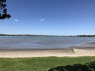
Wai o Taiki Bay is a suburb in Auckland, New Zealand. It is under the local governance of Auckland Council.

Maketu is a small town on the Western Bay of Plenty coast in New Zealand.
Grove Bush is a village in the Southland region of New Zealand's South Island. It is located on the banks of the Makarewa River on the Southland Plains near the foothills of the Hokonui Hills.
Kennington is a town located in the Southland region of New Zealand’s South Island. It is situated on the Waihopai River on the eastern outskirts of the city of Invercargill. Other nearby settlements include Longbush, Myross Bush, Motu Rimu, and Woodlands.
Myross Bush is a rural community on the northeastern outskirts of the city of Invercargill in the Southland region of New Zealand's South Island. Other nearby settlements include Makarewa to the northwest, Rakahouka and Roslyn Bush to the northeast, and Kennington to the southeast.
Wallacetown is a small town in Southland, in the South Island of New Zealand. Wallacetown is to the west of Invercargill, on high ground between the Makarewa and Ōreti rivers, near the Ōreti's estuary. Both rivers are popular for trout and whitebait fishing. It is considered to be a satellite town of Invercargill. It is served by State Highway 99, which skirts the town's northern edge.
Omaui is a small coastal village in Southland region, New Zealand. It is located approximately 20 km southwest of Invercargill near a small estuary opposite Sandy Point between Invercargill and Bluff.

Waikiwi is a suburb of Invercargill, Southland, New Zealand. Invercargill is the southernmost city of New Zealand.
Clifton is the southernmost suburb of New Zealand's southernmost city, Invercargill. It is located close to the shore of the New River estuary on State Highway 1, 5 kilometres (3.1 mi) southeast of the city centre and 4 kilometres (2.5 mi) northwest of Woodend. The Clifton Wastewater Treatment Plant is situated in this area.
Windsor is a suburb of New Zealand's southernmost city, Invercargill.
Rosedale is a suburb of New Zealand's southernmost city, Invercargill.

Kew is a suburb in the New Zealand city of Invercargill.
West Plains is a locality in the Southland Region of New Zealand, northwest of Invercargill and north of Otatara. Ōreti River and its tributary Makarewa River flow through the plains. It is part of the Southland Plains.
