Richmond | |
---|---|
Coordinates: 46°24′26″S168°22′08″E / 46.4073°S 168.3690°E | |
Country | New Zealand |
City | Invercargill |
Local authority | Invercargill City Council |
Area | |
• Land | 128 ha (316 acres) |
Population (June 2022) [2] | |
• Total | 3,620 |
Avenal | Windsor | Waverley |
Invercargill Central | Richmond | Hawthorndale |
Appleby | Turnbull Thomson Park |
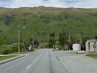
Richmond is a suburb of New Zealand's southernmost city, Invercargill.
Richmond covers 1.28 km2 (0.49 sq mi) [1] and had an estimated population of 3,620 as of June 2022, [2] with a population density of 2,828 people per km2.
Year | Pop. | ±% p.a. |
---|---|---|
2006 | 3,336 | — |
2013 | 3,342 | +0.03% |
2018 | 3,480 | +0.81% |
Source: [3] |
Richmond had a population of 3,480 at the 2018 New Zealand census, an increase of 138 people (4.1%) since the 2013 census, and an increase of 144 people (4.3%) since the 2006 census. There were 1,479 households. There were 1,662 males and 1,815 females, giving a sex ratio of 0.92 males per female. The median age was 38.7 years (compared with 37.4 years nationally), with 609 people (17.5%) aged under 15 years, 720 (20.7%) aged 15 to 29, 1,533 (44.1%) aged 30 to 64, and 618 (17.8%) aged 65 or older.
Ethnicities were 84.1% European/Pākehā, 15.3% Māori, 4.1% Pacific peoples, 8.2% Asian, and 1.8% other ethnicities (totals add to more than 100% since people could identify with multiple ethnicities).
The proportion of people born overseas was 14.7%, compared with 27.1% nationally.
Although some people objected to giving their religion, 49.4% had no religion, 38.7% were Christian, 0.8% were Hindu, 0.3% were Muslim, 0.7% were Buddhist and 2.5% had other religions.
Of those at least 15 years old, 528 (18.4%) people had a bachelor or higher degree, and 636 (22.2%) people had no formal qualifications. The median income was $30,700, compared with $31,800 nationally. 396 people (13.8%) earned over $70,000 compared to 17.2% nationally. The employment status of those at least 15 was that 1,470 (51.2%) people were employed full-time, 387 (13.5%) were part-time, and 105 (3.7%) were unemployed. [3]
Kingston is a small town at the southernmost end of Lake Wakatipu, just north of the border of Otago and Southland, in New Zealand's South Island. It is 47 kilometres south of Queenstown by a road, "The Devil's Staircase", which winds between the lake to the west and The Remarkables mountains to the east. It is 70 kilometres north of Lumsden, and close to the headwaters of the Mataura River.
Tuatapere is a small rural town in Southland, New Zealand. It is the self declared "Sausage Capital of New Zealand". Tuatapere is located eight kilometres from the southern coast. The Waiau River flows through the town before reaching Te Waewae Bay, where it has its outflow into Foveaux Strait. The main local industries are forestry and farming.
Grove Bush is a village in the Southland region of New Zealand's South Island. It is located on the banks of the Makarewa River on the Southland Plains near the foothills of the Hokonui Hills.
Wallacetown is a small town in Southland, in the South Island of New Zealand. Wallacetown is to the west of Invercargill, on high ground between the Makarewa and Ōreti rivers, near the Ōreti's estuary. Both rivers are popular for trout and whitebait fishing. It is considered to be a satellite town of Invercargill. It is served by State Highway 99, which skirts the town's northern edge.
Waikiwi is a suburb of Invercargill, Southland, New Zealand. Invercargill is the southernmost city of New Zealand.
Clifton is the southernmost suburb of New Zealand's southernmost city, Invercargill. It is located close to the shore of the New River estuary on State Highway 1, 5 kilometres (3.1 mi) southeast of the city centre and 4 kilometres (2.5 mi) northwest of Woodend. The Clifton Wastewater Treatment Plant is situated in this area.
Strathern is a suburb of New Zealand's southernmost city, Invercargill.
Georgetown is a suburb of New Zealand's southernmost city, Invercargill.
Hawthorndale is a suburb of New Zealand's southernmost city, Invercargill. It contains the city's Eastern Cemetery, and also Bill Richardson Transport World, a truck and classic car museum.
Windsor is a suburb of New Zealand's southernmost city, Invercargill.
Rosedale is a suburb of New Zealand's southernmost city, Invercargill.
Invercargill Central is the central business district and central suburb of Invercargill, in the Southland region of the South Island of New Zealand.
Gladstone is a suburb of New Zealand's southernmost city, Invercargill.
Kew is a suburb in the New Zealand city of Invercargill.
Grasmere is a suburb in the New Zealand city of Invercargill.
Appleby is a suburb of New Zealand's southernmost city, Invercargill. The suburb includes Appleby Park.
Woodend is a rural suburb of the New Zealand city of Invercargill.
Newfield is a suburb in the New Zealand city of Invercargill.
West Plains is a locality in the Southland Region of New Zealand, northwest of Invercargill and north of Otatara. Ōreti River and its tributary Makarewa River flow through the plains. It is part of the Southland Plains.
Hargest is a suburb of New Zealand's southernmost city, Invercargill.