Heidelberg | |
---|---|
Suburb of Invercargill City | |
Coordinates: 46°25.75′S168°22.75′E / 46.42917°S 168.37917°E Coordinates: 46°25.75′S168°22.75′E / 46.42917°S 168.37917°E | |
Country | New Zealand |
City | Invercargill City |
Local authority | Invercargill City Council |
Area | |
• Land | 168 ha (415 acres) |
Population (June 2021) [2] | |
• Total | 2,730 |
Georgetown | Newfield | |
Strathern | Heidelberg | Rockdale |
Kingswell | Tisbury |
Heidelberg is a suburb of the southern New Zealand city of Invercargill. It is located to the southeast of the city centre.
The area was called Conyerstown by its first European owner, Thomas Agnew. He sold the land to settlers Joseph and Martin Metzger, who were both connected to Heidelberg in Germany. [3]
Notable features of the predominantly residential suburb include Elizabeth Park, a secondary school (Aurora College), and one of the city's main marae, Murihiku Marae. The suburb is roughly bounded by Regent Street in the east, Pomona Street in the west, and Centre Street and Tramway Road in the north and south, respectively.
Murihiku Marae is located in Heidelberg. [4] It is a marae (meeting ground) of the Waihōpai Rūnanga branch of Ngāi Tahu, and includes Te Rakitauneke wharenui (meeting house). [5]
Heidelberg covers 1.68 km2 (0.65 sq mi) [1] and had an estimated population of 2,730 as of June 2021, with a population density of 1,625 people per km2.
Year | Pop. | ±% p.a. |
---|---|---|
2006 | 2,460 | — |
2013 | 2,547 | +0.50% |
2018 | 2,601 | +0.42% |
Source: [6] |
Heidelberg had a population of 2,601 at the 2018 New Zealand census, an increase of 54 people (2.1%) since the 2013 census, and an increase of 141 people (5.7%) since the 2006 census. There were 957 households. There were 1,230 males and 1,377 females, giving a sex ratio of 0.89 males per female, with 621 people (23.9%) aged under 15 years, 516 (19.8%) aged 15 to 29, 1,041 (40.0%) aged 30 to 64, and 426 (16.4%) aged 65 or older.
Ethnicities were 78.7% European/Pākehā, 25.7% Māori, 8.0% Pacific peoples, 4.7% Asian, and 1.6% other ethnicities (totals add to more than 100% since people could identify with multiple ethnicities).
The proportion of people born overseas was 10.1%, compared with 27.1% nationally.
Although some people objected to giving their religion, 54.0% had no religion, 33.4% were Christian, 0.7% were Hindu, 0.3% were Muslim, 0.1% were Buddhist and 2.7% had other religions.
Of those at least 15 years old, 171 (8.6%) people had a bachelor or higher degree, and 612 (30.9%) people had no formal qualifications. 132 people (6.7%) earned over $70,000 compared to 17.2% nationally. The employment status of those at least 15 was that 957 (48.3%) people were employed full-time, 264 (13.3%) were part-time, and 105 (5.3%) were unemployed. [6]
Name | Area (km2) | Population | Density (per km2) | Households | Median age | Median income |
---|---|---|---|---|---|---|
Elizabeth Park | 1.03 | 1,272 | 1,235 | 456 | 38.1 years | $24,300 [7] |
Aurora | 0.65 | 1,329 | 2,045 | 501 | 30.9 years | $29,000 [8] |
New Zealand | 37.4 years | $31,800 |
Aurora College is a state secondary school for years 7 to 13 [9] with a roll of 543 students as of March 2022. [10] The school formed in 2005 from the merger of Mt Anglern College and Tweedsmuir Junior High School. Mt Anglern was formed from the merger of Kingswell and Cargill high schools in 1998. [11]
St Patrick's School is a state-integrated Catholic primary school for years 1 to 6 [12] with a roll of 280 students. It opened in 1944. [13]
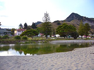
Tokomaru Bay is a small beachside community located on the isolated East Coast of New Zealand's North Island. It is 91 km north of Gisborne, on State Highway 35, and close to Mount Hikurangi. The district was originally known as Toka-a-Namu, which refers to the abundance of sandflies. Over the years the name was altered to Tokomaru Bay.
Matauri Bay is a bay in New Zealand, situated 30 km north of Kerikeri, in Whangaroa county, just north of the Bay of Islands. It has over a kilometre of white sand and crystal clear water, making it a popular summer destinations for surfers, divers, fishers and holidaymakers.
Alicetown is a central suburb of Lower Hutt located at the bottom of the North Island of New Zealand.
Nukuhau is a suburb of Taupo in the Waikato Region of New Zealand's North Island.
Kaeo is a township in the Far North District of New Zealand, located some 22 km (14 mi) northwest of Kerikeri. The town takes its name from the kāeo or New Zealand freshwater mussel, which is found in the nearby rivers.
Onekawa is a suburb of the city of Napier, in the Hawke's Bay Region of the eastern North Island of New Zealand.
Frasertown is a small settlement in the northern Hawke's Bay Region of New Zealand's eastern North Island.
Wharekahika or Hicks Bay is a bay and coastal area in the Gisborne District of the North Island of New Zealand. It is situated 150 km east of Opotiki and 186 km north of Gisborne city, along State Highway 35 between Potaka and Te Araroa.
Tautoro is a locality about 8 km south-southeast of Kaikohe in Northland, New Zealand. Further to the south is the Awarua rural community.
Pukepoto is a town in Northland, New Zealand. It lies south west of Kaitaia and north east of Ahipara. The Herekino Forest lies to the south east.
Panguru is a community in the northern Hokianga harbour, in Northland, New Zealand. The Whakarapa Stream flows from the Panguru Range in the Warawara Forest to the west, through Panguru and into the Hokianga.
Waimā is a community in the south Hokianga area of Northland, New Zealand. State Highway 12 runs through the area. The Waima River flows through the Waima Valley into the Hokianga Harbour. Rawene is to the north west, and Kaikohe is to the north east.
Otangarei is a suburb of Whangārei, in Northland Region, New Zealand.
Ratapiko is a locality in Taranaki, New Zealand. Kaimata is about six kilometres to the north-west.
Te Karaka is a small settlement inland from Gisborne, in the northeast of New Zealand's North Island. It is located in the valley of the Waipaoa River close to its junction with its tributary, the Waihora River. Te Karaka is located on State Highway 2, and is the largest settlement between Gisborne and Opotiki in the Bay of Plenty.
Manutuke is a settlement in the Gisborne District of New Zealand's North Island. It is located to the west of the city of Gisborne on State Highway 2, close to the mouth of the Waipaoa River.
Waiwhetū is an eastern suburb of Lower Hutt in the Wellington Region situated in the south of the North Island of New Zealand.
Ohinemutu or Ōhinemutu is a suburb in Rotorua, New Zealand. It includes a living Māori village and the original settlement of Rotorua.
Ngāpuna is a suburb in eastern Rotorua in the Bay of Plenty Region of New Zealand's North Island.
Ōwhata is a semi-rural suburb of Rotorua in the Bay of Plenty region of New Zealand's North Island.