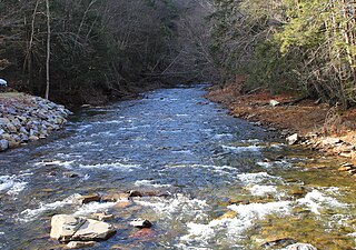
Wasp Branch is a tributary of Pine Creek in Luzerne County, Pennsylvania, in the United States. It is approximately 1.7 miles (2.7 km) long and flows through Fairmount Township. The watershed of the stream has an area of 0.90 square miles (2.3 km2). The stream is considered to be Class A Wild Trout Waters, a Coldwater Fishery, and a Migratory Fishery. Glacial till and bedrock consisting of stone and shale can be found in the stream's vicinity.
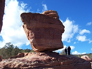
Chimneystack Run is a tributary of Coles Creek in Columbia County, Pennsylvania, in the United States. It is approximately 1.8 miles (2.9 km) long and flows through Sugarloaf Township. The watershed of the stream has an area of 1.07 square miles (2.8 km2). The stream's headwaters are located between Red Rock Mountain and Central Mountain. It has no named tributaries, but one unnamed tributary. Chimneystack Run is named after Chimneystack Rock. Wild trout inhabit the stream. Glaciation has affected the geography and geology in its vicinity.

Marsh Run is a tributary of Coles Creek in Luzerne County and Columbia County, in Pennsylvania, in the United States. It is approximately one mile (1.6 km) long and flows through Fairmount Township in Luzerne County and Sugarloaf Township in Columbia County. The stream's watershed has an area of 0.44 square miles (1.1 km2). Wild trout reproduce throughout the stream. It is named after marshes, which can be found in the vicinity of the stream. Alluvium and Wisconsinian Outwash area also present, as is bedrock consisting of sandstone and shale. The stream has one unnamed tributary.

Elk Run is tributary of West Branch Fishing Creek in Sullivan County and Columbia County, in Pennsylvania, in the United States. It is approximately 4.8 miles (7.7 km) long and flows through Davidson Township in Sullivan County and Sugarloaf Township in Columbia County. The watershed of the stream has an area of 7.49 square miles (19.4 km2). The stream has three named tributaries: Gallows Run, Hog Run, and Long Run. Elk Run is considered to be an Exceptional Value stream and a Migratory Fishery. The forests surrounding it are deemed by the Sullivan County Natural Areas Inventory to be a "locally significant" area. The stream is named for an elk that was killed in it in the 1840s.

Bloody Run is a tributary of West Branch Fishing Creek in Sullivan County, Pennsylvania, in the United States. It is approximately 2.9 miles (4.7 km) long and flows through Davidson Township. The watershed of the stream has an area of 1.30 square miles (3.4 km2). Various glacial tills and bedrock consisting of sandstone and shale are found in the vicinity of the stream. The stream is designated for use by aquatic life and is a High-Quality Coldwater Fishery.

Painter Run is a tributary of West Branch Fishing Creek in Sullivan County, Pennsylvania, in the United States. It is approximately 4.5 miles (7.2 km) long and flows through Davidson Township. The watershed of the stream has an area of 5.20 square miles (13.5 km2). It has one named tributary, which is known as Oxhorn Run and one unnamed tributary. Painter Run is slightly acidic, with pH values ranging from 5.99 to 6.88. The stream is in a narrow valley with several ridges nearby. Sandstone of the Pocono Formation occurs near it. At least two bridges have been constructed over the stream. Its unnamed tributary is considered to be Class A Wild Trout Waters.
Big Run is a tributary of West Branch Fishing Creek in Sullivan County, Pennsylvania, in the United States. It is approximately 1.0 mile (1.6 km) long and flows through Davidson Township. The watershed of the stream has an area of 0.51 square miles (1.3 km2). The stream is somewhat acidic, with a pH that ranged from 4.02 to 4.65 during a study on the watershed of Fishing Creek. Wisconsinan Till, Boulder Colluvium, and bedrock consisting of sandstone and shale all occur in the vicinity of the stream.
Hemlock Run is a tributary of West Branch Fishing Creek in Sullivan County, Pennsylvania, in the United States. It is approximately 1.8 miles (2.9 km) long and flows through Davidson Township. The stream has three unnamed tributaries. Its watershed has an area of 1.28 square miles (3.3 km2). Wisconsinan Till Moraine, Wisconsinan Bouldery Till, Wisconsinan Flow-Till, and Wisconsinan Till all occur near the stream.
Laurel Run is a tributary of West Branch Fishing Creek in Sullivan County, Pennsylvania, in the United States. It is approximately 1.2 miles (1.9 km) long and flows through Davidson Township. The stream is in the United States Geological Survey quadrangle of Elk Grove. Wisconsinan Flow-Till, Boulder Colluvium, Wisconsinan Till Moraine, alluvium, and alluvial fan occur in the vicinity of the stream, as does bedrock consisting of sandstone and shale. The southern terminus of the late Wisconsinan glaciation is also in the area. A wood plank bridge on stone masonry abutment walls crosses the stream.
Long Run is a tributary of Elk Run in Sullivan County, Pennsylvania, in the United States. It is approximately 2.4 miles (3.9 km) long and flows through Davidson Township. The stream's watershed has an area of 1.92 square miles (5.0 km2). It has no named tributaries, but four unnamed tributaries. The stream is considered by the Pennsylvania Department of Environmental Protection to be impaired by atmospheric deposition and metals. Wisconsinan Bouldery Till, Wisconsinan Till, and bedrock consisting of sandstone and shale occur in the vicinity of it.
Hog Run is a tributary of Elk Run in Sullivan County, Pennsylvania, in the United States. It is approximately 2.0 miles (3.2 km) long and flows through Davidson Township. The watershed of the stream has an area of 1.05 square miles (2.7 km2). The stream is considered to be impaired by atmospheric deposition and metals. Wisconsinan Ice-Contact Stratified Drift, Wisconsinan Till, and bedrock consisting of shale and sandstone occur in the stream's vicinity.
Gallows Run is a tributary of Elk Run in Sullivan County, Pennsylvania, in the United States. It is approximately 0.7 miles (1.1 km) long and flows through Davidson Township. The watershed of the stream has an area of 0.50 square miles (1.3 km2). The stream meets the standards of the Pennsylvania Department of Environmental Protection. Wisconsinan Till, Wisconsinan Bouldery Till, and bedrock consisting of sandstone and shale occur in the vicinity of the stream. There is also a patch of wetland in the area.

Oxhorn Run is a tributary of Painter Run in Sullivan County, Pennsylvania, in the United States. It is approximately 1.8 miles (2.9 km) long and flows through Davidson Township. The watershed of the stream has an area of 0.87 square miles (2.3 km2). The stream is considered to be impaired by atmospheric deposition and pH. Wisconsinan Ice-Contact Stratified Drift, Wisconsinan Till, and bedrock consisting of sandstone and shale occur in its vicinity.
Slip Run is a tributary of West Branch Fishing Creek in Sullivan County, Pennsylvania, in the United States. It is approximately 1.1 miles (1.8 km) long and flows through Davidson Township. The watershed of the stream has an area of 0.53 square miles (1.4 km2). Wild trout naturally reproduce within the stream. Surficial geology in the area mainly consists of alluvium, Boulder Colluvium, Wisconsinan Till Moraine, Wisconsinan Till, and bedrock consisting of sandstone and shale.

Davis Hollow is a tributary of Fishing Creek in Columbia County, Pennsylvania, in the United States. It is approximately 1.4 miles (2.3 km) long and flows through Benton Township. The watershed of the stream has an area of 0.80 square miles (2.1 km2). The surficial geology in its vicinity mainly consists of alluvium, alluvial terrace, Wisconsinan Till, Wisconsinan Lag, Illinoian Flow-Till, and Illinoian Lag.

Black Ash Creek is a tributary of Rogers Creek in Luzerne County, Pennsylvania, in the United States. It is approximately 1.9 miles (3.1 km) and flows through Ross Township. The watershed of the creek has an area of 1.46 square miles (3.8 km2). The creek is not impaired. The surficial geology in its vicinity consists of alluvium, Wisconsinan Outwash, Wisconsinan Till, and bedrock.
Brish Run is a tributary of Pine Creek in Luzerne County, Pennsylvania, in the United States. It is approximately 1.5 miles (2.4 km) long and flows through Fairmount Township. The watershed of the stream has an area of 0.66 square miles (1.7 km2). The stream has one unnamed tributary. The surficial geology in the vicinity of Brish Run mostly consists of Wisconsinan Till, but there is alluvium near its mouth and also bedrock in the area. The stream is being considered for wild trout designation.

West Branch Little Muncy Creek is a tributary of Little Muncy Creek in Sullivan County and Lycoming County, in Pennsylvania, in the United States. It is approximately 3.5 miles (5.6 km) long and flows through Davidson Township in Sullivan County and Franklin Township and Jordan Township in Lycoming County. The watershed of the creek has an area of 4.33 square miles (11.2 km2). The creek has one named tributary, which is known as West Creek. The surficial geology in the vicinity of West Branch Little Muncy Creek includes alluvium, bedrock, fill, Wisconsinan and Reworked Illinoian Till, Wisconsinan Till, Wisconsinan Flow-Till, Wisconsinan Till Moraine, and Boulder Colluvium. The creek designated as a Coldwater Fishery and a Migratory Fishery and is being considered for addition to the wild trout waters list of the Pennsylvania Fish and Boat Commission.
Little Indian Run is a tributary of Little Muncy Creek in Lycoming County and Sullivan County, in Pennsylvania, in the United States. It is approximately 4.3 miles (6.9 km) long and flows through Franklin Township and Jordan Township in Lycoming County and Davidson Township in Sullivan County. The watershed of the stream has an area of 3.36 square miles (8.7 km2). The surficial geology in the stream's vicinity mainly consists of alluvium, bedrock, Wisconsinan Till, Wisconsinan Till Moraine, and Wisconsinan Ice-Contact Stratified Drift. Wild trout naturally reproduce within the stream. A number of sawmills were historically located on the stream.


