
The Maryland Transit Administration (MTA) is a state-operated mass transit administration in Maryland, and is part of the Maryland Department of Transportation. It is better known as MTA Maryland to avoid confusion with other cities' transit agencies who share the initials MTA. The MTA operates a comprehensive transit system throughout the Baltimore-Washington Metropolitan Area. There are 80 bus lines serving Baltimore's public transportation needs, along with other services that include the Light Rail, Metro Subway, and MARC Train. With nearly half the population of Baltimore residents lacking access to a car, the MTA is an important part of the regional transit picture. The system has many connections to other transit agencies of Central Maryland, Washington, D.C., Northern Virginia, and south-central Pennsylvania : WMATA, Charm City Circulator, Regional Transportation Agency of Central Maryland, Annapolis Transit, Rabbit Transit, Ride-On, and TransIT.
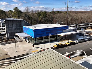
BWI Airport Station is an intermodal passenger station in Linthicum, Maryland near Baltimore–Washington International Thurgood Marshall Airport (BWI). It is served by Amtrak Northeast Corridor intercity trains, MARC Penn Line regional rail trains, and several local bus lines.

Hanover is an unincorporated community in the Baltimore/Annapolis area in northwestern Anne Arundel County and eastern Howard County in the U.S. state of Maryland, located south of Baltimore.

The Metro SubwayLink, known locally as the Metro Subway, The Subway, or the Baltimore Metro, is a rapid transit line serving the greater area of Baltimore, Maryland, in the United States, and operated by the Maryland Transit Administration. Despite its name, less than half of the line is underground; most of the line outside the central city is elevated or at surface grade.

Light RailLink is a light rail system serving Baltimore, Maryland, United States, as well as its surrounding suburbs. It is operated by the Maryland Transit Administration. In downtown Baltimore, it uses city streets. Outside the central portions of the city, the line is built on private rights-of-way, mostly from the defunct Northern Central Railway, Baltimore and Annapolis Railroad and Washington, Baltimore and Annapolis Electric Railway.

LocalLink 93 is a bus route operated by the Maryland Transit Administration in the suburbs of Baltimore. The line currently runs from the Lutherville Light Rail Stop to International Circle near Hunt Valley Town Center, serving the Timonium and Cockeysville areas.

Route 14 is a bus route operated by the Maryland Transit Administration between Baltimore and Annapolis, Maryland. At most times, the line operates from the Patapsco Light Rail Stop in southern Baltimore with short turns at Jumper's Hole in Pasadena. The bus route, one of the longest local routes operated by MTA, is the successor to the Baltimore and Annapolis Railroad interurban, and mainly operates along the parallel Ritchie Highway, serving Brooklyn Park, Glen Burnie, Pasadena, and Severna Park. When the Light Rail is not running, Route 14 runs all the way to downtown Baltimore, mostly along Hanover Street.

CityLink Red is a citylink bus route operated by the Maryland Transit Administration in Baltimore and its suburbs. The line currently runs from the University of Maryland Transit Center to the Lutherville Light Rail Stop along the corridors of York Road and Greenmount Avenue, and is one of the most heavily used MTA bus lines. The CityLink Red bus replaced Route 8 bus route due to BaltimoreLink, and is the successor to the 8 Towson and 7 Govanstown streetcar lines.
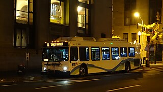
LocalLink 95 is a bus route operated by the Maryland Transit Administration in Baltimore. The line currently runs from the intersection of Roland Avenue and Lake Avenue in Roland Park south to the Inner Harbor via Roland Avenue, University Parkway, Charles Street and St. Paul Street.
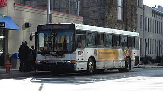
Route 13 is a bus route operated by the Maryland Transit Administration in Baltimore. The line currently runs from Walbrook Junction in West Baltimore to Canton, mostly along North Avenue. The line has two main branches, both operating to Canton: one that operates via Fells Point and the other via Linwood and East Streets. Both these branches serve Johns Hopkins Hospital. Additionally, selected trips on weekdays and Saturdays operate to the block of Milton Avenue, Federal Street, and Patterson Park Avenue.

Route 64 is a bus route operated by the Maryland Transit Administration in Baltimore and its suburbs. The line currently runs from the intersection of North Avenue and St. Paul Street to Curtis Bay, with selected trips to Energy Parkway and Riviera Beach. The line also serves Federal Hill, Port Covington, and Brooklyn.

Route 77 is a bus route operated by the Maryland Transit Administration in the suburbs of Baltimore. The line currently runs from the Old Court Metro Subway Station in Pikesville, Maryland to the Patapsco Light Rail Stop, and serves Randallstown, Windsor Mill, Woodlawn, Catonsville, Arbutus, Halethorpe, and Lansdowne, and the campuses of UMBC and CCBC Catonsville.

Route 51 is a bus route operated by the Maryland Transit Administration in Baltimore and its suburbs. The line currently runs from the Rogers Avenue Metro Subway Station to the Patapsco Light Rail Stop, serving the communities of Arlington, Ashburton, Mondawmin, Rosemont, Baltimore, Cherry Hill, and Mt. Winans, and the suburb of Baltimore Highlands.

LocalLink 29 is a bus route operated by the Maryland Transit Administration in Baltimore. The line currently runs from the Mondawmin Metro Subway Station in Northwest Baltimore to Brooklyn Homes in South Baltimore through the communities of Rosemont and the corridors of Hilton Street, Caton Avenue, and Patapsco Avenue. During peak hours, selected trips operate via Violetville Industrial Park.
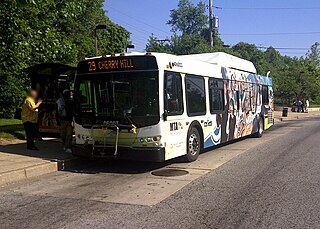
Route 29 is a bus route operated by the Maryland Transit Administration in Baltimore. The line currently operates weekdays and Saturdays in a circular fashion, linking the Cherry Hill Light Rail Stop to the Cherry Hill community. Two other MTA bus lines, Routes 27 and 51, also serve the Cherry Hill area.

Express BusLink 150 is a bus route operated by the Maryland Transit Administration in Baltimore, Ellicott City, and Columbia, Maryland. The line currently operates between the Village of Harper's Choice in Columbia and Harbor East, mostly via US-29 and US-40, serving The Mall in Columbia and Catonsville.
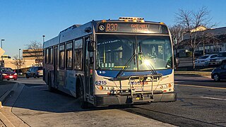
The Greenbelt–BWI Thurgood Marshall Airport Express Line, designated Route B30, is a weekday-only bus route operated by the Washington Metropolitan Area Transit Authority between Baltimore-Washington International Thurgood Marshall Airport and the Greenbelt Metro Station of the Green Line of the Washington Metro. The line operates every 70 minutes five days a week along the Baltimore-Washington Parkway between these two locations with no intermediate stops, with the exception of the BWI Business District Light Rail Stop, and Arundel Mills Mall and the last bus leaving BWI at 10:09 pm. The trip is approximately 50 minutes long.
UMBC Transit is the official bus system of the University of Maryland, Baltimore County. Along with the Maryland Transit Administration (MTA), the UMBC community has public transit access to nearby areas such as Catonsville, Arbutus, Maryland, and Baltimore City.

The BWI Business District is a neighborhood and business district in Linthicum and Hanover that features over 11,000 hotel rooms and numerous office parks and shopping centers. As the name suggests, the business district is benefited by nearby Baltimore-Washington International Airport.


