Selected locations on route
(east to west)
- Antananarivo
- Analavory - (intersection with RN 1b and RN 43)
- Miarinarivo
- Tsiroanomandidy - (intersection with RN 1a to Maintirano and RN 1b)
- Belobaka

| Route nationale 1 | |
|---|---|
| Location | |
| Country | Madagascar |
| Highway system | |
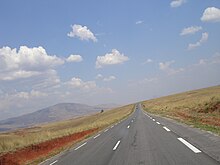
Route nationale 1 (RN 1) is a primary highway in Madagascar of 234 km, running from Analavory, Miarinarivo to Tsiroanomandidy. It crosses the region of Bongolava and Analamanga
(east to west)


The Catholic Church in Madagascar is part of the worldwide Catholic Church, under the spiritual leadership of the Pope in Rome.

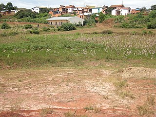
Tsiroanomandidy is a city in central-western Madagascar, approximately 210 kilometres west of the capital Antananarivo.

Bongolava is a region in central-western Madagascar. The capital of the region is Tsiroanomandidy. It had a population of 674,474 in 2018.

Arivonimamo is a city in Itasy Region, in the Central Highlands of Madagascar.

Miarinarivo is a city in Itasy Region, in the Central Highlands of Madagascar.
The Roman Catholic Diocese of Tsiroanomandidy is a suffragan Latin diocese in the ecclesiastical province of Antananarivo in Madagascar, yet depends on the missionary Roman Congregation for the Evangelization of Peoples.

Itasy is a region in central Madagascar. It borders Analamanga region in northeast, Vakinankaratra in south and Bongolava in northwest. The capital of the region is Miarinarivo, and the population was 897,962 in 2018. It is the smallest of all the 22 regions in area with 6,993 km2 (2,700 sq mi), and is the most densely populated region after Analamanga.

Analavory is a town and commune in Madagascar. It belongs to the district of Miarinarivo, which is a part of Itasy Region. The population of the commune was 62,130 in 2018. Its location is closest to the geographic center of mainland Madagascar.

Ankadinondry Sakay, anciently Babetville is a town and commune in Madagascar. It belongs to the district of Tsiroanomandidy, which is a part of Bongolava Region.

For the rural municipality, see Manambolo (disambiguation)

Route nationale 5a is a secondary highway in Madagascar of 406 km, running from Ambilobe to Antalaha. It crosses the regions of Diana and Sava.

Route nationale 13 is a primary highway in Madagascar of 493 km, running from Ihosy to Tolagnaro (Fort-Dauphin). It crosses the regions of Ihorombe, Androy and Anosy.

Miarinarivo is a district of Itasy in Madagascar. It is located approximately 100 km east of Antananarivo.
Tsiroanomandidy is a district of Bongolava in Madagascar. The district has an area of 10,559 km2 (4,077 sq mi), and the estimated population in 2020 was 521,372.

Route nationale 25 is a primary highway in Madagascar of 161 km, running from Mananjary, Fianarantsoa to RN7. It crosses the regions of Vatovavy and Haute Matsiatra. It is only partly paved and often in bad condition.
Route nationale 1b is a secondary highway in Madagascar of 94 km, running from Analavory to Tsiroanomandidy. It crosses the region of Bongolava and Itasy.
Route nationale 1a is a secondary highway in Madagascar, running from Maintirano to Tsiroanomandidy. It crosses the region of Bongolava and Melaky
Route nationale 43 is a secondary highway in Madagascar of 133 km, running from Analavory to the intersection with RN 7. It crosses the region of Vakinankaratra and Itasy.

Route nationale 41 is a secondary highway in Madagascar of 41 km, running from Fandriana to the intersection with RN 7. It crosses the region of Amoron'i Mania.
Anosizato Andrefana is a municipality in Analamanga Region, in the Central Highlands of Madagascar. It belongs to the district of Antananarivo-Atsimondrano and its population numbers to 26,107 in 2019. The capital city, Antananarivo, lies across the Ikopa River to the east.