Rumley, Texas | |
|---|---|
 Rumley | |
| Coordinates: 31°10′23″N98°04′05″W / 31.17306°N 98.06806°W | |
| Country | United States |
| State | Texas |
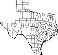
| County | Lampasas |
| Elevation | 961 ft (293 m) |
| Time zone | UTC-6 (Central (CST)) |
| • Summer (DST) | UTC-5 (CDT) |
| Area codes | 512 and 737 |
| GNIS feature ID | 1380471 [1] |
Rumley is an unincorporated community in Lampasas County, Texas, United States. [1] According to the Handbook of Texas, the community had a population of eight in 2000. It is located within the Killeen-Temple-Fort Hood metropolitan area.