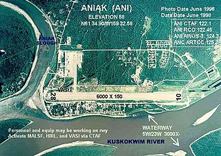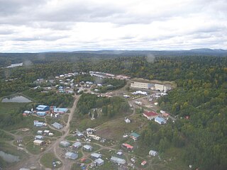
Aniak is a city in the Bethel Census Area in the U.S. state of Alaska. At the 2010 census the population was 501, down from 572 in 2000.

Bethel is a city in Bethel Census Area, Alaska, United States. It is the largest community on the Kuskokwim River, located approximately 50 mi (80 km) upriver from where the river flows into Kuskokwim Bay. It is also the largest city in western Alaska and in the Unorganized Borough, as well as the eighth-largest in the state. Bethel has a population of 6,325 as of the 2020 census, up from 6,080 in 2010.

Chuathbaluk is a city in Bethel Census Area, Alaska, United States.

Russian Mission is a city in Kusilvak Census Area, Alaska. It was the location of a fur trading post of the Russian-American Company in 1842. After the sale of Russian-American possessions to the United States in 1867, it was officially named Russian Mission in the early 1900s. The sale of alcohol is prohibited. At the 2010 census the population was 312, up from 296 in 2000.

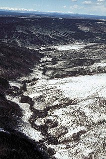
The Kuskokwim River or Kusko River is a river, 702 miles (1,130 km) long, in Southwest Alaska in the United States. It is the ninth largest river in the United States by average discharge volume at its mouth and seventeenth largest by basin drainage area. The Kuskokwim River is the longest river system contained entirely within a single U.S. state.

The Koyukuk River is a 425-mile (684 km) tributary of the Yukon River, in the U.S. state of Alaska. It is the last major tributary entering the Yukon before the larger river empties into the Bering Sea.

The Innoko River (; is a 500-mile tributary of the Yukon River in the U.S. state of Alaska. It flows north from its origin south of Cloudy Mountain in the Kuskokwim Mountains and then southwest to meet the larger river across from Holy Cross.

The Kuskokwim Mountains is a range of mountains in the Yukon-Koyukuk Census Area, Alaska, United States, west of the Alaska Range and southeast of the Yukon River. The Kuskokwim Mountains begin in the interior west of Fairbanks. The mountain range extend from Canyon Creek and Chikuminuk Lake in the southwest over a distance of about 400 km (250 mi) long to the Tanana River in the northeast and reach a width of up to 80 km (50 mi).
The Swift River is a tributary, about 100 miles (160 km) long, of the Kuskokwim River in the U.S. state of Alaska. Formed by meltwater from several glaciers in the Revelation Mountains of the Alaska Range, the river flows generally west and northwest to meet the larger stream 13 miles (21 km) northeast of Sleetmute.

The Yukon–Kuskokwim Delta is a river delta located where the Yukon and Kuskokwim rivers empty into the Bering Sea on the west coast of the U.S. state of Alaska. At approximately 129,500 square kilometers (50,000 sq mi) in size, it is one of the largest deltas in the world. It is larger than the Mississippi River Delta ; it is comparable in size to the entire U.S. state of Louisiana. The delta, which consists mainly of tundra, is protected as part of the Yukon Delta National Wildlife Refuge.
Georgetown is an unincorporated Alaska Native village located in the Bethel Census Area of the U.S. state of Alaska. The population as of the 2010 census was 2, down from 3 in 2000.
Togiak Lake is a 13 mi (21 km) lake in the U.S. state of Alaska, which extends South-West from mouth of Izavieknik River, 75 miles (121 km) northeast of Goodnews Bay, Kilbuck-Kuskokwim Mountains.

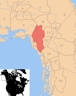
Southwest Alaska is a region of the U.S. state of Alaska. The area is not exactly defined by any governmental administrative region(s); nor does it always have a clear geographic boundary.
Mount Russell is one of the major peaks of the central Alaska Range, approximately 35 mi (56 km) southwest of Denali. Though much lower than Denali or its neighbor Mount Foraker, Russell is a steep, dramatic peak and a significant mountaineering challenge in its own right. To give a sense of its size and steepness, note that its summit rises 6,560 ft over the Chedotlothna Glacier to the northwest in only 1.8 mi (3 km), and almost 10,000 ft above the lower Yentna Glacier to the south in only 8 mi (13 km).

The Yup'ik or Yupiaq and Yupiit or Yupiat (pl), also Central Alaskan Yup'ik, Central Yup'ik, Alaskan Yup'ik, are an Indigenous people of western and southwestern Alaska ranging from southern Norton Sound southwards along the coast of the Bering Sea on the Yukon-Kuskokwim Delta and along the northern coast of Bristol Bay as far east as Nushagak Bay and the northern Alaska Peninsula at Naknek River and Egegik Bay. They are also known as Cup'ik by the Chevak Cup'ik dialect-speaking people of Chevak and Cup'ig for the Nunivak Cup'ig dialect-speaking people of Nunivak Island.

The Ahklun Mountains are located in the northeast section of the Togiak National Wildlife Refuge in southwest Alaska. They extend southwest from the Kanektok and Narogurum Rivers to Hagemeister Strait and Kuskokwim Bay and support the only existing glaciers in western Alaska. They are the highest Alaskan mountain range west of the Alaska Range and north of the Alaska Peninsula: some summits in the range have many glaciers. To the west is the Kuskokwim River and to the east are the Bristol Bay lowlands.
Grant Aviation is a regional airline that serves the town of Kenai, the Yukon-Kuskokwim Delta, Bristol Bay, and the Aleutian Chain in Alaska, United States. The airline was formed in 1971 as Delta Air Services based in Emmonak. The current owners are Bruce McGlasson and Mark "Woody" Richardson, who purchased the airline in 2004. The company slogan is "Fly Easy, Fly Grant."

The Upper Kuskokwim people or Upper Kuskokwim Athabaskans, Upper Kuskokwim Athabascans, and historically Kolchan, Goltsan, Tundra Kolosh, and McGrath Ingalik are an Alaskan Athabaskan people of the Athabaskan-speaking ethnolinguistic group. First delineation of this ethnolinguistic group was described by anthropologist Edward Howard Hosley in 1968, as Kolchan. According to Hosley, "Nevertheless, as a group possessing a history and a culture differing from those of its neighbours, the Kolchan deserve to be recognized as an independent group of Alaskan Athapaskans." They are the original inhabitants of the Upper Kuskokwim River villages of Nikolai, Telida, and McGrath, Alaska. About 25 of a total of 100 Upper Kuskokwim people still speak the language. They speak a distinct Athabaskan language more closely related to Lower Tanana language than to Deg Xinag language, spoken on the middle Kuskokwim. The term used by the Kolchan themselves is Dina'ena, but this is too similar to the adjacent Tanana and Tanaina for introduction into the literature. Nowadays, the term used by the Kolchan themselves is Dichinanek' Hwt'ana. Their neighbors also knew them by this name. In Tanaina they were Kenaniq' ht'an while the Koyukon people to the north referred to them as Dikinanek Hut'ana. The Upper Kuskokwim Athabaskan culture is a hunter-gatherer culture and have a matrilineal system. They were semi-nomadic and lived in semi-permanent settlements.
The Nulato Hills are a mountain range in western Alaska between the Yukon River and Norton Sound. In the north, they merge into the lowlands of the Selawik River, in the south they extend into the Yukon-Kuskokwim Delta. At the Seward Peninsula level, the continental divide runs through the Nulato Hills. The Anvik River and the Bonasila River have their source in the Nulato Hills.


