SPAWN

Last updated

SPAWN, the Salmon Protection and Watershed Network, is a project of the Turtle Island Restoration Network (TIRN), a United States 501(c)(3) nonprofit environmental organization.

Contents

SPAWN's stated mission is to "protect endangered salmon in the Lagunitas Creek Watershed and the environment on which we all depend." [1] SPAWN uses a multi-faceted approach to accomplish their mission including grassroots action, habitat restoration, policy development, research and monitoring, citizen training, environmental education, strategic litigation, and collaboration with other organizations and agencies. [1]

Lagunitas Creek watershed

The Lagunitas Creek watershed in Marin County, California, has been identified as the most important spawning and rearing habitat for wild coho salmon left in California. Coho in the Central California Evolutionarily Significant Unit (CCCESU) are a Federal and State listed Endangered Species considered to be "in imminent danger of extinction." [2]

Despite having the best run of wild coho left in the State, estimated at up to 30 percent of the State’s total in 2007, only on average 500 adult salmon currently return each year to spawn here. The Lagunitas Creek Watershed is also important habitat for federally listed steelhead and California freshwater shrimp. [3]

SPAWN performs its work with the assistance of volunteer and pro bono contributions. Many dedicated individuals in the San Geronimo Valley, Marin County, and the greater San Francisco Bay Area have made a lasting impact on the accomplishments and history of SPAWN.

History

The seeds of SPAWN, the Salmon Protection And Watershed Network, were planted when biologist Todd Steiner, the founder, discovered migrating coho salmon stuck at Roy’s Dam in 1997 on the San Geronimo Valley Golf Course, unable to migrate upstream to spawn and complete their amazing life history. Steiner contacted the media to expose the plight of these recently listed endangered species and contacting National Marine Fisheries Service (NMFS) asking for an emergency permit to move the fish above the crumbling dam obstruction. [4]

That night on the news, the plight of the salmon was beamed into Bay Area homes on five TV stations. Steiner set up his young son’s painting easel at Roy’s Dam with a hastily written petition asking for government action, as hundreds of people came forward to witness the spectacle first hand, sign the petition, and offer help. Residents, the general public, NGOs and government agencies came together to fix the immediate problem and Roy’s Dam was transformed into Roy’s Pools. [4]

SPAWN has grown from an all-volunteer organization to one with a full-time staff who coordinate the work of hundreds of volunteers and interns. [4] In 1999 SPAWN was incorporated as a program under the umbrella of the non-profit 501(c)(3) environmental organization Turtle Island Restoration Network (TIRN). [1]

Programs

SPAWN drives seven active programs and campaigns that focus on protecting endangered salmon and the Lagunitas Creek Watershed. These include habitat restoration, fish rescue, citizen training, creek monitoring, creek walks, land acquisition and water conservation. [5]

Habitat restoration

Each year SPAWN volunteers contribute many hundreds of hours towards restoring streamside habitat in the Lagunitas Creek Watershed. Volunteers work to plant native trees and understory plants, and remove invasive species. In 2005 SPAWN launched a community-based native plant nursery program that serves to grow thousands of native plants to support local restoration programs and provide plants to landowners living along stream corridors in the San Geronimo Valley. [6]

Fish rescue

SPAWN’s fish rescue program focuses on fish relocation efforts within the San Geronimo Valley in the Lagunitas Creek Watershed. Streams are surveyed and as it becomes apparent that pools will dry completely, and based on previous years observations at known sites, relocation efforts begin. Relocation usually begins in June but can start as early as April depending on creek flows and rainfall. Over 15,000 juvenile coho and steelhead have been saved from imminent mortality since this effort began in 1999. [7] Rescue and relocation efforts take place under State and Federal permits.

Citizen training

SPAWN organizes and facilitates a number of citizen training programs that includes a Creek Naturalist Training, native plant collection and propagation, salmon seminar series, spawning salmon surveying and water quality monitoring. [8]

Creek monitoring

SPAWN oversees a number of creek monitoring programs including water quality monitoring, out-migrant salmon smolt monitoring, and spawning salmon monitoring. Each year SPAWN also responds to many calls from concerned citizens about problems or emergencies on their property or at large. Staff and volunteers respond to these calls and help refer problems to the appropriate agencies if necessary or find ways to prevent or repair the problem. [9]

Creek walks

During the winter season (Nov-Jan) SPAWN organizes weekly creek walks in the Lagunitas Creek Watershed for the public to view spawning salmon and provide education on watershed management issues. The walks are led by volunteer Naturalists that are trained through SPAWN’s annual Creek Naturalist Training Program each October. [10]

Land acquisition

SPAWN’s land acquisition program is focused on efforts to protect riparian habitat along the Lagunitas Creek Watershed from increased development. SPAWN is promoting the creation of a land conservancy to protect the riparian habitat through land acquisition and conservation easements on private parcels along the watershed. [3]

Water conservation

SPAWN’s water conservation program is focused on reducing the impacts of stormwater runoff on local streams and ensuring adequate in stream flow and spawning and rearing habitat for coho salmon and steelhead in the Lagunitas Creek. In partnership with the Marin Community Foundation, SPAWN recently launched a community-based program, the Marin County Stormwater Catchment & Water Conservation Initiative, to provide technical support, cost-share support and incentives to landowners who reduce runoff from their properties using roof-water harvesting techniques. [11]

Accomplishments

Since SPAWN’s beginnings in 1996 the program has achieved a number of accomplishments: [4]

See also

Related Research Articles

<span class="mw-page-title-main">Muir Woods National Monument</span> United States National Monument in California

Muir Woods National Monument is a United States National Monument managed by the National Park Service, named after naturalist John Muir. It is located on Mount Tamalpais near the Pacific coast, in southwestern Marin County, California. It is part of the Golden Gate National Recreation Area, and is 12 miles (19 km) north of San Francisco. It protects 554 acres (224 ha), of which 240 acres (97 ha) are old growth coast redwood forests, one of a few such stands remaining in the San Francisco Bay Area.

<span class="mw-page-title-main">San Lorenzo River</span> River in Santa Cruz County, California, United States

The San Lorenzo River is a 29.3 miles (47.2 km) long river whose headwaters originate in Castle Rock State Park in the Santa Cruz Mountains and flow south by southeast through the San Lorenzo Valley before passing through Santa Cruz and emptying into Monterey Bay and the Pacific Ocean.

<span class="mw-page-title-main">Napa River</span> River in California, United States

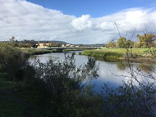
The Napa River is a river approximately 55 miles (89 km) long in the U.S. state of California. It drains a famous wine-growing region called the Napa Valley, in the mountains north of the San Francisco Bay. Milliken Creek and Mt. Veeder watersheds are a few of its many tributaries. The river mouth is at Vallejo, where the intertidal zone of fresh and salt waters flow into the Carquinez Strait and the San Pablo Bay.

<span class="mw-page-title-main">Coyote Creek (Santa Clara County)</span> Archaeological site in California, United States

Coyote Creek is a river that flows through the Santa Clara Valley in Northern California. Its source is on Mount Sizer, in the mountains east of Morgan Hill. It eventually flows into Anderson Lake in Morgan Hill and then northwards through Coyote Valley to San Jose, where it empties into San Francisco Bay.

<span class="mw-page-title-main">Lagunitas Creek</span> Stream in California, United States

Lagunitas Creek is a 24 miles (39 km)-long northward-flowing stream in Marin County, California. It is critically important to the largest spawning runs of endangered coho salmon in the Central California Coast Coho salmon Evolutionary Significant Unit. The stream's headwaters begin on the northern slopes of Mount Tamalpais in the Coast Range and terminate in southeast Tomales Bay, 1.5 miles (2.4 km) northwest of Point Reyes Station, California. Lagunitas Creek feeds several reservoirs on Mt. Tamalpais that supply a major portion of the county's drinking water.

<span class="mw-page-title-main">Copeland Creek (California)</span> River in California, United States

Copeland Creek is a 9.0-mile-long (14.5 km) perennial stream that rises on Sonoma Mountain in Sonoma County, California.

<span class="mw-page-title-main">San Francisquito Creek</span> River in California, United States

San Francisquito Creek is a creek that flows into southwest San Francisco Bay in California, United States. Historically it was called the Arroyo de San Francisco by Juan Bautista de Anza in 1776. San Francisquito Creek courses through the towns of Portola Valley and Woodside, as well as the cities of Menlo Park, Palo Alto, and East Palo Alto. The creek and its Los Trancos Creek tributary define the boundary between San Mateo and Santa Clara counties.

<span class="mw-page-title-main">Redwood Creek (Marin County)</span> River in California, United States

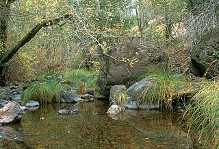
Redwood Creek is a mostly perennial stream in Marin County, California. 4.7 miles (7.6 km) long, it drains a 7-square-mile (18 km2) watershed which includes the Muir Woods National Monument, and reaches the Pacific Ocean north of the Golden Gate at Muir Beach.

<span class="mw-page-title-main">Arroyo Corte Madera del Presidio</span> River in California, United States

Arroyo Corte Madera del Presidio is a 4.1-mile-long (6.6 km) year-round stream in southern Marin County, California, United States. This watercourse is also known as Corte Madera Creek, although the actual stream of that name flows into San Francisco Bay further north at Point San Quentin. This watercourse has a catchment basin of about 8 square miles (21 km2) and drains the south-eastern slopes of Mount Tamalpais and much of the area in and around the town of Mill Valley; this stream discharges to Richardson Bay.

<span class="mw-page-title-main">San Geronimo Creek</span> River in California, United States

San Geronimo Creek is a stream in Marin County, California, United States, which feeds into Lagunitas Creek below Kent Lake.

<span class="mw-page-title-main">Nicasio Creek</span> River in California, United States

Nicasio Creek is an 11.9-mile-long (19.2 km) stream in Marin County, California, United States and is the primary tributary of Lagunitas Creek, which flows, in turn, into Tomales Bay, and the Pacific Ocean. The Nicasio Reservoir, formed in 1961 by Seeger Dam, is located on this stream.

Walker Creek is a northwest-flowing stream in western Marin County, California, United States. It originates at the confluence of Salmon Creek and Arroyo Sausal and empties into Tomales Bay south of Dillon Beach, California.

Turtle Island Restoration Network (TIRN) is a United States 501(c)(3) non-profit organization founded in 1999 whose mission is "To take swift and decisive action to protect and restore marine species and their habitats and to inspire people in communities all over the world to join us as acmarine species advocates."

<span class="mw-page-title-main">Land Conservancy of San Luis Obispo County</span> Nonprofit organization in California

The Land Conservancy of San Luis Obispo County (LCSLO) is a local nonprofit organization in California that has served San Luis Obispo (SLO) County since 1984. Through voluntary and collaborative efforts the LCSLO works to protect and enhance lands having important scenic, agricultural, habitat and cultural values for the benefit of people and wildlife.

<span class="mw-page-title-main">Searsville Dam</span> Dam in California, USA

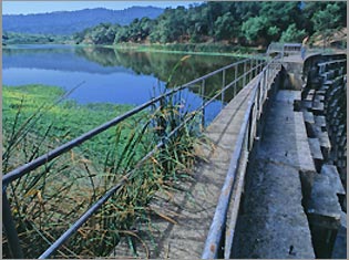
Searsville Dam is a masonry dam in San Mateo County, California that was completed in 1892, one year after the founding of Stanford University, and impounds Corte Madera Creek to form a reservoir known as Searsville Lake. Searsville Dam is located in the Jasper Ridge Biological Preserve and is owned and operated by Stanford University. Neighboring cities include Woodside and Portola Valley, California.

The Marin Municipal Water District is the government agency that provides drinking water to southern and central Marin County, California. Chartered in 1912, it became California's first municipal water district. It serves 191,000 customers in a 147-square-mile (380 km2) area that includes ten towns and cities.

<span class="mw-page-title-main">San Anselmo Creek</span> River in California, United States

San Anselmo Creek is an eastward-flowing stream that begins on the eastern flank of Pine Mountain in the Marin Hills of Marin County, California. At its confluence with Ross Creek, it becomes Corte Madera Creek.

Cascade Creek is a stream that flows south then southeast from its source on White Hill to its confluence with San Anselmo Creek just west of Fairfax in Marin County, California.

Chileno Creek is a stream in western Marin County, California, United States. It originates west of Petaluma, California at 220-acre Laguna Lake which straddles Marin and Sonoma Counties, from which it flows west 6.25 kilometres (3.88 mi) before joining Walker Creek, a tributary of Tomales Bay.

<span class="mw-page-title-main">Old Mill Creek (Arroyo Corte Madera del Presidio)</span> River in California, United States

Old Mill Creek is a 2.3-mile-long (3.7 km) year-round stream in southern Marin County, California, United States. Old Mill Creek is a tributary to Arroyo Corte Madera del Presidio, which, in turn, flows to Richardson Bay at Mill Valley's municipal Bayfront Park and 106 acres (0.43 km2) Bothin Marsh.

References

  1. 1 2 3 Salmon Protection & Watershed Network, About SPAWN ( "About SPAWN". Archived from the original on 2008-08-07. Retrieved 2008-08-12. [August 1, 2008])
  2. Salmon Protection & Watershed Network, Land Acquisition (http://spawnusa.org/pages/page-8 [August 4, 2008])
  3. 1 2 Salmon Protection & Watershed Network, Land Acquisition (http://spawnusa.org/pages/page-8 [August 4, 2008])
  4. 1 2 3 4 Salmon Protection & Watershed Network, “SPAWN History,” SPAWN Brochure (2008]: 1
  5. Salmon Protection & Watershed Network, Programs (August 2, 2008)
  6. Salmon Protection & Watershed Network, Habitat Restoration (August 2, 2008)
  7. Salmon Protection & Watershed Network, Fish Rescue (August 2, 2008)
  8. Salmon Protection & Watershed Network, Citizen Training (August 2, 2008)
  9. Salmon Protection & Watershed Network, Creek Monitoring (August 2, 2008)
  10. Salmon Protection & Watershed Network, Creek Walks (August 2, 2008)
  11. Salmon Protection & Watershed Network, Water Conservation (http://spawnusa.org/pages/page-205 [August 4, 2008])