Sagwara Tehsil is bordered by Simalwara Tehsil to the southwest and west, Dungarpur Tehsil to the northwest, Aspur Tehsil on the north, Garhi Tehsil of Banswara District on the east, and Anandpuri Tehsil of Banswara District to the southeast.[2]
Towns and Villages
Sagwara Tehsil has two towns, Sagwara, the administrative center, and Galiakot.[4] It has 46 panchyat villages[5] covering 244 villages:[4]
Banswara is a town in the Banswara district in southern Rajasthan, India. The name, Banswara, came from king ‘Bansiya Bhil’
Baansi is a village in Bari Sadri Tehsil of District Chittorgarh in Rajasthan, India. It was ruled by Rajputs of the Shaktawat clan before independence. Its name derives from the abundance of bamboo. It is 94 km from Udaipur City and 78 km South west of Chittorgarh.
Dungarpur District is a district of the state of Rajasthan in western India. The town of Dungarpur is the district headquarters.
Sagwara is a city and municipality, near Dungarpur city in Dungarpur district in the Indian state of Rajasthan. It is one of two towns in Sagwara Tehsil, and the administrative center for the Sagwara Tehsil's additional district court and sub jailkshla.
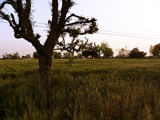
Saroda is a village in Sagwara Tehsil in Dungarpur District in Rajasthan, India. It is situated 18km away from sub-district headquarter Sagwara and 63km away from district headquarter Dungarpur. As per 2009 stats, Saroda village is also a gram panchayat.
Obri is a panchayat village in Rajasthan in western India. Administratively it is under Sagwara Tehsil of Dungarpur district, Rajasthan. Obri is the only village in the gram panchayat.
Pratapgarh district is the 33rd district of Rajasthan, created on 26 January 2008. It is a part of Udaipur Division and has been carved out from the erstwhile tehsils of Chittorgarh, Udaipur and Banswara districts. Pratapgarh town is the administrative headquarters of the district.
Bakshi Ka Talab is a nagar panchayat town in Lucknow district of Uttar Pradesh, India. It is also the headquarters of a corresponding tehsil, as well as a community development block of the same name. As of 2011, its population was 49,166, in 8,728 households. It consists of both residential and business settlements. Bakshi Ka Talab is an organised settlement developed by Lucknow Development Authority (LDA). It is connected to Lucknow via National Highway 24.
Dhani is a village located in the Bali tehsil in the Pali district of Rajasthan. It is located near Bali town on state highway SH 62 between Khudala and Khimel in a valley on the western side of the Aravalli Range. Dhani is easily accessed by Western Railway Ahmedabad Delhi route near from Falna and Rani Station. Dhani is famous village in Marwar for Making of Mojari-Shoes. The first lady sarpanch in this village is Nalini kanwar wife of ranveer Singh bhati she was very active in all village activities she make a village very much well as compared to other village.
Chikhali (Cheekhli) is a panchayat village in the Vaagar area of Rajasthan, India. It is located near the Mahi River. Administratively it is under chikhali Tehsil in Dungarpur District, Rajasthan.
Peepal Khoont mainly known as Pipalkhunt is a village, Tehsil headquarter and Panchayat Samiti of the Pratapgarh district of Rajasthan state. It is a sub-division among the 5 sub-divisions of the Pratapgarh district. The main market is called Sadar Bajar. It is situated on National Highway 113. Pipalkhunt is a town located on the Banswara - Jaipur Expressway surrounded by the hills, plants and trees. The town is situated on the bank of the Mahi River.
Bhoodha Ka Bas is a village in the Laxmangarh administrative region of the Sikar district of Indian state Rajasthan. Bhoodha Ka Bas village is separated from the Beerodi Bari village and situated in the north-east side of the Sikar district. Village is situated approximately 22 kilometres (14 mi) east of Laxmangarh town and 4 kilometres (2.5 mi) west of Nawalgarh town.
Jalimpura also known as Charna ki dhani is a village in Bhimsar gram panchayat, Mandawa, Tehsil, Jhunjhunu district, Rajasthan, India. All resident of the village belongs to Jaat community.
Mandor panchayat samiti is a panchayat samiti in Jodhpur District of Rajasthan state in western India.
Signore is a village in the north-eastern part of Indian state of Rajasthan. It is the Udaipurwati tehsil of Neem Ka Thana district.
Khuian Sarwar is a village in Fazilka district of Punjab, India. It is also the name of a block (sub-tehsil) within the Abohar tehsil. Khuian Sarwar is known for its kinnow, a type of orange. This area is the largest producer of kinnow in Punjab and also known for cultivating cotton crop. The villages under the administration of Khuian Sarawar gram panchayat include:
Dhambola is a panchayat village in Simalwara Tehsil of Dungarpur District, Rajasthan, India.
Govindgiri, also known as Govind Guru Banjara, (1858–1931) was a social and religious reformer in the early 1900s in the tribal border areas of present-day Rajasthan and Gujarat states in India. He is seen as having popularized the Bhagat movement, which was first started in the 18th century.
Kherwara is a tehsil of Udaipur district in Rajasthan, India. The tehsil consists of 195 revenue villages and 1 census town. The tehsil headquarter is located in the town of Kherwara Chhaoni. The tehsil is part of the Kherwara panchayat samiti (block).
Sarada is a tehsil of Salumbar district in Rajasthan, India. It consists of 152 villages and 3 towns. The tehsil headquarter is located in the village of Sarada.
This page is based on this Wikipedia article Text is available under the CC BY-SA 4.0 license; additional terms may apply. Images, videos and audio are available under their respective licenses.


