
Montmagny—L'Islet—Kamouraska—Rivière-du-Loup is a federal electoral district in Quebec, Canada, that has been represented in the House of Commons of Canada since 2004. Its population in 2006 was 97,492. It has the highest percentage of Catholics in Canada.

The Rivière du Loup is a river in eastern Quebec, Canada, which empties on the south shore of Saint Lawrence River at the city of Rivière-du-Loup, which is part of the regional county municipality (RCM) Rivière-du-Loup, in the administrative region of Bas-Saint-Laurent.
Kamouraska—Rivière-du-Loup was a federal electoral district in Quebec, Canada, that was represented in the House of Commons of Canada from 1979 to 1997.
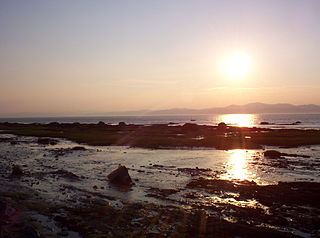
Rivière-Ouelle is a town located in the Kamouraska Regional County Municipality within the Bas-Saint-Laurent region of Quebec. It is located on the Saint Lawrence River; the Ouelle River flows through the town. It was part of the seignory of La Bouteillerie, once owned by Charles Deschamps de Boishébert et de Raffetot. Jean-Charles Chapais, a Father of Canadian Confederation, was born here.

Route 289 is a two-lane north/south highway on the south shore of the Saint Lawrence River in the Bas-Saint-Laurent region of eastern Quebec, Canada. Its northern terminus is in Saint-André at the junction of Route 132 and the southern terminus is at the border of New Brunswick where it continues as Route 120.

The Bécancour River is a river flowing in the administrative region of Centre-du-Québec, in Quebec, Canada.
Kamouraska-Témiscouata is a former provincial electoral district in Quebec, Canada that elected members to the National Assembly of Quebec. As of its final election, it included the municipalities of Kamouraska, La Pocatière, Saint-Athanase, Packington, Dégelis and Témiscouata-sur-le-Lac.

Saint-Chrysostome is a municipality in south-west Quebec, Canada in the regional county municipality of Haut-Saint-Laurent in the Montérégie administrative region. The municipality was created by the amalgamation of Saint-Chrysostome village with the parish of Saint-Jean-Chrysostome on September 29,1999. The population as of the Canada 2011 Census was 2,522.
Rivière-du-Loup is a former provincial electoral district in the Bas-Saint-Laurent region of Quebec, Canada, which elected members to the National Assembly of Quebec.
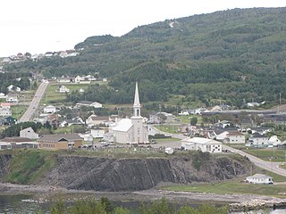
Grande-Vallée is a municipality in the Gaspésie-Îles-de-la-Madeleine region of the province of Quebec in Canada.

Mont-Carmel is a municipality in the Canadian province of Quebec, located in the Kamouraska Regional County Municipality, on the Canada–United States border.

Saint-André-de-Kamouraska is a municipality in the Canadian province of Quebec, located in the Kamouraska Regional County Municipality.
The Little Black River is a river flowing in the south of Quebec (Canada) and in the north of Maine.
Rivière-du-Loup–Témiscouata is a provincial electoral district in Quebec, Canada, that elects members to the National Assembly of Quebec. It is located in the Bas-Saint-Laurent region.
Côte-du-Sud is a provincial electoral district in the Bas-Saint-Laurent and Chaudière-Appalaches regions of Quebec, Canada, which elects members to the National Assembly of Quebec. It includes the entire territory of the following regional county municipalities: Montmagny, L'Islet, Kamouraska; larger towns include Montmagny and La Pocatière.

The ZEC des Passes is a "zone d'exploitation contrôlée" (ZEC) in the unorganized territory Passes-Dangereuses, in the Maria-Chapdelaine Regional County Municipality, in the administrative region of Saguenay-Lac-Saint-Jean, in Quebec, in Canada.
The river Chimenticook is a tributary of the Saint John River, flowing in the canton T13 R13 Wels, in the Aroostook County, in North of Maine, in United States.
The Boucanée River is a tributary of the lake Pohenegamook, flowing in the southern part of the Gaspé Peninsula, in the municipalities of Saint-Athanase, Quebec and Pohenegamook, Quebec, in Témiscouata Regional County Municipality (RCM), in the administrative region of Bas-Saint-Laurent, in Quebec, in Canada.

The Noire River is a tributary of the North-West shore of Saint Lawrence River flowing north-east of La Malbaie, in the municipality of Saint-Siméon, in Charlevoix-Est Regional County Municipality, in Quebec, in Canada.

The 'Noire River is a tributary of the west bank of the rivière du Moulin whose current flows on the west bank of the Chaudière River; the latter flowing northward to empty on the south shore of the St. Lawrence River. It flows in the municipality of Saint-Alfred, in the Robert-Cliche Regional County Municipality, in the administrative region of Chaudière-Appalaches, in Quebec, in Canada.


