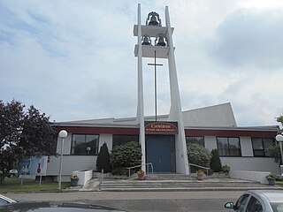
Mont-Carmel, Quebec

Last updated
Mont-Carmel
Municipality
Mont-Carmel Quebec location diagram.png
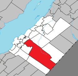
Location within Kamouraska RCM
Canada Eastern Quebec location map.png
Red pog.svg
Mont-Carmel
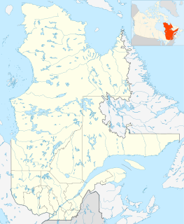
Location in eastern Quebec
Coordinates: 47°26′23″N69°51′31″W / 47.43972°N 69.85861°W / 47.43972; -69.85861 Coordinates: 47°26′23″N69°51′31″W / 47.43972°N 69.85861°W / 47.43972; -69.85861 [1]
CountryFlag of Canada.svg  Canada
Province Flag of Quebec.svg  Quebec
Region Bas-Saint-Laurent
RCM Kamouraska
Constituted July 1, 1855
Government [2]
  Mayor Denis Lévesque
   Federal riding Montmagny—L'Islet—Kamouraska—Rivière-du-Loup
   Prov. riding Côte-du-Sud
Area [2] [3]
  Total 438.60 km2 (169.34 sq mi)
  Land 427.85 km2 (165.19 sq mi)
Population (2011) [3]
  Total 1,136
  Density 2.7/km2 (7/sq mi)
  Pop 2006-2011Decrease2.svg 5.2%
  Dwellings 662
Time zone EST (UTC−5)
  Summer (DST) EDT (UTC−4)
Postal code(s) G0L 1W0
Area code(s) 418 and 581
HighwaysQc287.svg Route 287
Website www.mont-carmel.ca

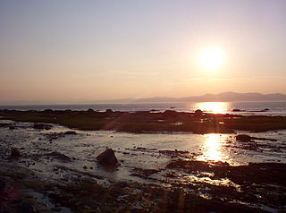
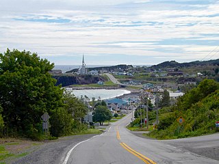
Mont-Carmel is a municipality in the Canadian province of Quebec, located in the Kamouraska Regional County Municipality, on the Canada–United States border.

Provinces and territories of Canada Top-level subdivisions of Canada

The provinces and territories of Canada are sub-national governments within the geographical areas of Canada under the authority of the Canadian Constitution. In the 1867 Canadian Confederation, three provinces of British North America—New Brunswick, Nova Scotia, and the Province of Canada —were united to form a federated colony, becoming a sovereign nation in the next century. Over its history, Canada's international borders have changed several times, and the country has grown from the original four provinces to the current ten provinces and three territories. Together, the provinces and territories make up the world's second-largest country by area.
Quebec Province of Canada

Quebec is one of the thirteen provinces and territories of Canada. It is bordered to the west by the province of Ontario and the bodies of water James Bay and Hudson Bay; to the north by Hudson Strait and Ungava Bay; to the east by the Gulf of Saint Lawrence and the province of Newfoundland and Labrador; and to the south by the province of New Brunswick and the U.S. states of Maine, New Hampshire, Vermont, and New York. It also shares maritime borders with Nunavut, Prince Edward Island, and Nova Scotia. Quebec is Canada's largest province by area and its second-largest administrative division; only the territory of Nunavut is larger. It is historically and politically considered to be part of Central Canada.

Kamouraska Regional County Municipality Regional county municipality in Quebec, Canada

Kamouraska is a regional county municipality in eastern Quebec, Canada. Regional County municipality seat is Saint-Pascal. The other main town is La Pocatière.

Contents

Geography

Spanning over 75% of the width of the Bas-Saint-Laurent region in which it resides, Mont-Carmel is the second largest subdivision within the Kamouraska Regional County Municipality and borders the United States at its southwest limit.

Bas-Saint-Laurent Administrative region in Quebec, Canada

The Bas-Saint-Laurent, is an administrative region of Quebec located along the south shore of the lower Saint Lawrence River in Quebec. The river widens at this place, later becoming a bay which discharges into the Atlantic Ocean and is often nicknamed "Bas-du-Fleuve" (Lower-River). The region is formed by 8 regional county municipalities and 114 municipalities. In the south it borders Maine and New Brunswick, as well as the regions of Chaudière-Appalaches and Gaspésie–Îles-de-la-Madeleine

United States Federal republic in North America

The United States of America (USA), commonly known as the United States or America, is a country comprising 50 states, a federal district, five major self-governing territories, and various possessions. At 3.8 million square miles, the United States is the world's third or fourth largest country by total area and is slightly smaller than the entire continent of Europe's 3.9 million square miles. With a population of over 327 million people, the U.S. is the third most populous country. The capital is Washington, D.C., and the largest city by population is New York City. Forty-eight states and the capital's federal district are contiguous in North America between Canada and Mexico. The State of Alaska is in the northwest corner of North America, bordered by Canada to the east and across the Bering Strait from Russia to the west. The State of Hawaii is an archipelago in the mid-Pacific Ocean. The U.S. territories are scattered about the Pacific Ocean and the Caribbean Sea, stretching across nine official time zones. The extremely diverse geography, climate, and wildlife of the United States make it one of the world's 17 megadiverse countries.

Communities and locations

The following designated areas reside within the municipality's boundaries: [1]

Hamlet (place) small settlement in a rural area

A hamlet is a small human settlement. In different jurisdictions and geographies, hamlets may be the size of a town, village or parish, be considered a smaller settlement or subdivision or satellite entity to a larger settlement. The word and concept of a hamlet have roots in the Anglo-Norman settlement of England, where the old French hamlet came to apply to small human settlements. In British geography, a hamlet is considered smaller than a village and distinctly without a church.

Cottage typically, a small house

A cottage is, typically, a small house. It may carry the connotation of being an old or old-fashioned building. In modern usage, a cottage is usually a modest, often cosy dwelling, typically in a rural or semi-rural location.

Municipal council

See also

Related Research Articles

Saguenay–Lac-Saint-Jean Région in Quebec, Canada

Saguenay–Lac-Saint-Jean is a region in Quebec, Canada. It contains the Saguenay Fjord, the estuary of the Saguenay River, stretching through much of the region. It is also known as Sagamie in French, from the first part of "Saguenay" and the last part of "Piekouagami", the Innu name for Lac Saint-Jean, with the final "e" added to follow the model of other existing region names such as Mauricie, Témiscamie, Jamésie, and Matawinie. The name Saguenay is possibly derived from the Innu word "Saki-nip" which means "where water flows out". With a land area of 98,710.11 km2, the Saguenay–Lac-Saint-Jean is, after the Nord-du-Québec and Côte-Nord regions, the third-largest of Quebec regions in the area.

Antoine-Labelle Regional County Municipality Regional county municipality in Quebec, Canada

Antoine-Labelle is a regional county municipality located in the Laurentides region of Quebec, Canada. Its seat is Mont-Laurier. It is named for Antoine Labelle.

Rivière du Loup (Bas-Saint-Laurent) river in Bas-Saint-Laurent, Quebec, Canada

The Rivière du Loup is a river in eastern Quebec, Canada, which empties on the south shore of Saint Lawrence River at the city of Rivière-du-Loup, which is part of the regional county municipality (RCM) Rivière-du-Loup, in the administrative region of Bas-Saint-Laurent.

Rivière-Ouelle Municipality in Quebec, Canada

Rivière-Ouelle is a town located in the Kamouraska Regional County Municipality within the Bas-Saint-Laurent region of Quebec. It is located on the Saint Lawrence River; the Ouelle River flows through the town. It was part of the seignory of La Bouteillerie, once owned by Charles Deschamps de Boishébert et de Raffetot. Jean-Charles Chapais, a Father of Canadian Confederation, was born here.

Hinchinbrooke, Quebec Municipality in Quebec, Canada

Hinchinbrooke is a rural community in southern Quebec, in the Châteauguay Valley, in the MRC de Le Haut-Saint-Laurent. The population as of the Canada 2011 Census was 2,242.

Quebec Route 287 highway in Quebec

Route 287 is a 42 km two-lane north/south highway on the south shore of the Saint Lawrence River in the Bas-Saint-Laurent region of Eastern Quebec, Canada. Its northern terminus is in Saint-Denis at the junction of Route 132 and the southern terminus is at Lac de l'Est, part of the municipality of Mont-Carmel. About 10 km after Mont-Carmel, the route becomes a gravel road until the lake.

Havelock, Quebec Township municipality in Quebec, Canada

For other places with the same name, see Havelock (disambiguation)

Kamouraska-Témiscouata is a former provincial electoral district in Quebec, Canada that elected members to the National Assembly of Quebec. As of its final election, it included the municipalities of Kamouraska, La Pocatière, Saint-Athanase, Packington, Dégelis and Témiscouata-sur-le-Lac.

Rivière-du-Loup is a former provincial electoral district in the Bas-Saint-Laurent region of Quebec, Canada, which elected members to the National Assembly of Quebec.

Grande-Vallée, Quebec Municipality in Quebec, Canada

Grande-Vallée is a municipality in the Gaspésie-Îles-de-la-Madeleine region of the province of Quebec in Canada.

Saint-Alexandre-de-Kamouraska, Quebec Municipality in Quebec, Canada

Saint-Alexandre-de-Kamouraska is a municipality in the Canadian province of Quebec, located in the Kamouraska Regional County Municipality.

Saint-André, Quebec Municipality in Quebec, Canada

Saint-André is a municipality in the Canadian province of Quebec, located in the Kamouraska Regional County Municipality.

The Commission scolaire Pierre-Neveu is a school district located in the Antoine-Labelle Regional County Municipality in the Laurentides region of the Canadian province of Quebec. The board, which was established in 1972, is named after Pierre Neveu, a religious figure in Quebec during the twentieth century.

Rivière-du-Loup–Témiscouata is a provincial electoral district in Quebec, Canada, that elects members to the National Assembly of Quebec. It is located in the Bas-Saint-Laurent region.

Côte-du-Sud is a provincial electoral district in the Bas-Saint-Laurent and Chaudière-Appalaches regions of Quebec, Canada, which elects members to the National Assembly of Quebec. It includes the entire territory of the following regional county municipalities: Montmagny, L'Islet, Kamouraska; larger towns include Montmagny and La Pocatière.

Zec Chapais Zone dexploitation contrôlée in Kamouraska Regional County Municipality, Quebec

The ZEC Chapais is a "zone d'exploitation contrôlée" (ZEC) located within the municipality of Mont-Carmel and the unorganized territory of Petit-Lac-Sainte-Anne in the (RCM) Kamouraska Regional County Municipality, in the administrative region of Bas-Saint-Laurent, in Quebec, in Canada.

St. Anns Cathedral, La Pocatière Church in Quebec, Canada

The St. Ann's Cathedral is a Roman Catholic Cathedral in Canada. The seat of the diocese of Sainte-Anne-de-la-Pocatière, it is located in La Pocatière, in the regional municipality of Kamouraska and Bas-Saint-Laurent, in Quebec, eastern Canada. It is dedicated to St. Ann, whose feast is celebrated on July 26, St. Ann is also the patron saint of Quebec.

The river Chimenticook is a tributary of the Saint John River, flowing in the canton T13 R13 Wels, in the Aroostook County, in North of Maine, in United States.

The River Pocwock is a tributary of the Saint John River, flowing in:

The Eastern Lake is a lake crossing the Canada-US border located in:

References