Sainte-Hélène-de-Kamouraska, Quebec

Last updated
Sainte-Hélène-de-Kamouraska
Municipality
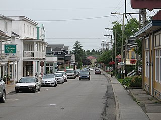
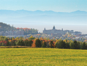
Ste-Helene QC.JPG
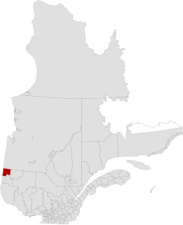
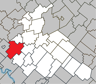
Sainte-Helene Quebec location diagram.png
Location within Kamouraska RCM
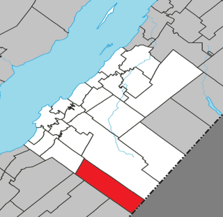
Canada Eastern Quebec location map.png
Red pog.svg
Sainte-Hélène-de-Kamouraska
Location in eastern Quebec
Coordinates: 47°36′N69°44′W / 47.600°N 69.733°W / 47.600; -69.733 Coordinates: 47°36′N69°44′W / 47.600°N 69.733°W / 47.600; -69.733 [1]
CountryFlag of Canada.svg  Canada
Province Flag of Quebec.svg  Quebec
Region Bas-Saint-Laurent
RCM Kamouraska
Constituted July 1, 1855
Government [2]
  Mayor Louise Hémond
   Federal riding Montmagny—L'Islet—Kamouraska—Rivière-du-Loup
   Prov. riding Côte-du-Sud
Area [2] [3]
  Total 60.60 km2 (23.40 sq mi)
  Land 60.71 km2 (23.44 sq mi)
 There is an apparent contradiction between two authoritative sources
Population (2011) [3]
  Total 911
  Density 15.0/km2 (39/sq mi)
  Pop 2006-2011Increase2.svg 1.6%
  Dwellings 391
Time zone EST (UTC−5)
  Summer (DST) EDT (UTC−4)
Postal code(s) G0L 3J0
Area code(s) 418 and 581
Highways
Quebec Autoroute 20.svgTrans-Canada Highway shield.svg A-20 (TCH)

Qc230.svg Route 230
Website sainte-helene.net

Sainte-Hélène-de-Kamouraska is a municipality in the Canadian province of Quebec, located in the Kamouraska Regional County Municipality.

Provinces and territories of Canada Top-level subdivisions of Canada

The provinces and territories of Canada are the sub-national governments within the geographical areas of Canada under the authority of the Canadian Constitution. In the 1867 Canadian Confederation, three provinces of British North America—New Brunswick, Nova Scotia, and the Province of Canada —were united to form a federated colony, becoming a sovereign nation in the next century. Over its history, Canada's international borders have changed several times, and the country has grown from the original four provinces to the current ten provinces and three territories. Together, the provinces and territories make up the world's second-largest country by area.
Quebec Province of Canada

Quebec is one of the thirteen provinces and territories of Canada. It is bordered to the west by the province of Ontario and the bodies of water James Bay and Hudson Bay; to the north by Hudson Strait and Ungava Bay; to the east by the Gulf of Saint Lawrence and the province of Newfoundland and Labrador; and to the south by the province of New Brunswick and the U.S. states of Maine, New Hampshire, Vermont, and New York. It also shares maritime borders with Nunavut, Prince Edward Island, and Nova Scotia. Quebec is Canada's largest province by area and its second-largest administrative division; only the territory of Nunavut is larger. It is historically and politically considered to be part of Central Canada.

Kamouraska Regional County Municipality Regional county municipality in Quebec, Canada

Kamouraska is a regional county municipality in eastern Quebec, Canada. Regional County municipality seat is Saint-Pascal. The other main town is La Pocatière.

Contents

Until September 13, 2014 it was officially known simply as Sainte-Hélène. [4]

Municipal council

See also

Related Research Articles

Abitibi-Ouest Regional County Municipality Regional county municipality in Quebec, Canada

Abitibi-Ouest Regional County Municipality is a regional county municipality located in the Abitibi-Témiscamingue region of Quebec. Its seat is La Sarre.

La Pocatière City in Quebec, Canada

La Pocatière is a town in the Kamouraska Regional County Municipality in the Bas-Saint-Laurent region of Quebec, Canada.

Kamouraska, Quebec Municipality in Quebec, Canada

Kamouraska is a municipality on the south shore of the Saint Lawrence River in the Bas-Saint-Laurent region of Quebec, Canada. It is part of the Regional County Municipality of Kamouraska. It has been named one of the top 20 most beautiful villages in the province of Quebec, and the municipality is a member of the Most Beautiful Villages of Quebec Association.

Sainte-Croix, Quebec Municipality in Quebec, Canada

Sainte-Croix is a municipality in and the seat of the Municipalité régionale de comté de Lotbinière in Quebec, Canada. It is part of the Chaudière-Appalaches region and the population is 2,433 as of 2009. The new constitution dates from 2001, after the amalgamation of the parish and the village of Sainte-Croix.

Sainte-Famille, Quebec Parish municipality in Quebec, Canada

Sainte-Famille is a parish municipality in the L'Île-d'Orléans Regional County Municipality, Quebec, Canada, part of the administrative region of Capitale-Nationale. It is situated along the western shores of Orléans Island.

Sainte-Hélène-de-Chester, Quebec Municipality in Quebec, Canada

Sainte-Hélène-de-Chester is a municipality located in the Centre-du-Québec region of Quebec, Canada.

Saint-Bruno-de-Kamouraska Municipality in Quebec, Canada

Saint-Bruno-de-Kamouraska is a municipality in the Canadian province of Quebec, located in the Kamouraska Regional County Municipality.

Saint-Pacôme Municipality in Quebec, Canada

Saint-Pacôme is a municipality in the Canadian province of Quebec, located in the Kamouraska Regional County Municipality.

Saint-Denis-De La Bouteillerie Municipality in Quebec, Canada

Saint-Denis-De La Bouteillerie is a municipality in the Canadian province of Quebec, located in the Kamouraska Regional County Municipality.

Sainte-Anne-de-la-Pocatière Parish municipality in Quebec, Canada

Sainte-Anne-de-la-Pocatière is a parish municipality in the Canadian province of Quebec, located in the Kamouraska Regional County Municipality.

Saint-Germain, Quebec Parish municipality in Quebec, Canada

Saint-Germain is a parish municipality in the Canadian province of Quebec, located in the Kamouraska Regional County Municipality.

Saint-Joseph-de-Kamouraska Parish municipality in Quebec, Canada

Saint-Joseph-de-Kamouraska is a parish municipality in the Canadian province of Quebec, located in the Kamouraska Regional County Municipality.

Saint-Onésime-dIxworth, Quebec Municipality in Quebec, Canada

Saint-Onésime-d'Ixworth is a municipality in the Canadian province of Quebec, located in the Kamouraska Regional County Municipality.

Saint-Philippe-de-Néri, Quebec Parish municipality in Quebec, Canada

Saint-Philippe-de-Néri is a parish municipality in the Canadian province of Quebec, located in the Kamouraska Regional County Municipality.

Sainte-Marie, Quebec City in Quebec, Canada

Sainte-Marie is a city in the province of Quebec. It is the seat of the Municipalité régionale de la Nouvelle-Beauce, in Chaudière-Appalaches. The population was 12,889 as of the Canada 2011 Census, and was 99.0% French-speaking as of 2006. It is located 59 kilometres (37 mi) south-east of Quebec City, on the Chaudière River.

Sainte-Mélanie, Quebec Municipality in Quebec, Canada

Sainte-Mélanie is a municipality in the Lanaudière region of Quebec, Canada, part of the Joliette Regional County Municipality. It is located along the western shores of the L'Assomption River.

Sainte-Pétronille, Quebec Village municipality in Quebec, Canada

Sainte-Pétronille is a village municipality in the L'Île-d'Orléans Regional County Municipality in the Capitale-Nationale region of Quebec, Canada. It is situated on the south-western tip of Orléans Island, facing Quebec City.

Sainte-Clotilde-de-Horton, Quebec Municipality in Quebec, Canada

Sainte-Clotilde-de-Horton is a municipality located in the Centre-du-Québec region of Quebec, Canada.

Petit-Lac-Sainte-Anne, Quebec Unorganized territory in Quebec, Canada

Petit-Lac-Sainte-Anne is a unorganized territory in the Canadian province of Quebec, located in the Kamouraska Regional County Municipality.

References