Kamouraska is a regional county municipality in eastern Quebec, Canada. The regional county municipality seat is Saint-Pascal, but the largest town is La Pocatière.

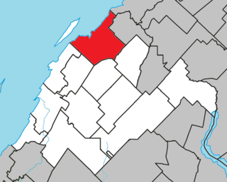
Pierre-De Saurel is a regional county municipality in the Montérégie region in southwestern Quebec, Canada. Originally named Le Bas-Richelieu Regional County Municipality, the name change to Pierre-De Saurel took effect on January 1, 2009. Its seat is in Sorel-Tracy. It is located on the Richelieu River, downstream from La Vallée-du-Richelieu Regional County Municipality at the confluence of the Richelieu and Saint Lawrence River.

L'Islet is a regional county municipality in the Chaudière-Appalaches region of Quebec, Canada.

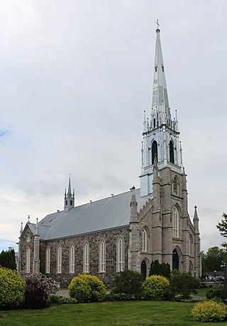
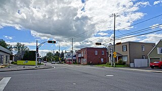
Sorel-Tracy is a city in southwestern Quebec, Canada and the geographical end point of the Champlain Valley. It is located at the confluence of the Richelieu River and the St. Lawrence River, on the western edge of Lac Saint-Pierre, downstream and northeast of Montreal. The population as of the Canada 2021 Census was 35,165. Its mayor is Patrick Péloquin and it is the seat of the Pierre-De Saurel Regional County Municipality and the judicial district of Richelieu.
Montmagny is a city in the Montmagny Regional County Municipality within the Chaudière-Appalaches region of Quebec, Canada. It is the county seat and had a population, as of the Canada 2021 Census, of 10,999.
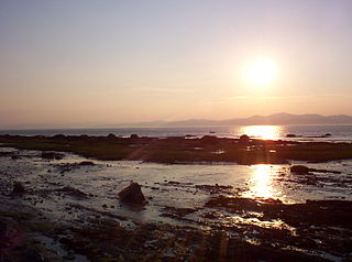
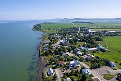
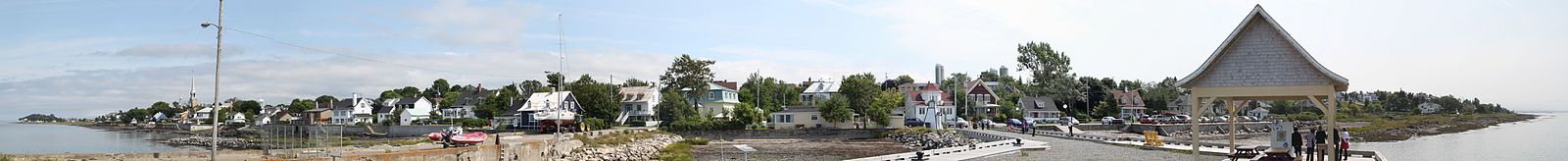
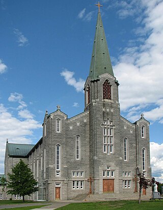
Rivière-Ouelle is a town located in the Kamouraska Regional County Municipality within the Bas-Saint-Laurent region of Quebec. It is located on the Saint Lawrence River; the Ouelle River flows through the town. It was part of the seignory of La Bouteillerie, once owned by Charles Deschamps de Boishébert et de Raffetot. Jean-Charles Chapais, a Father of Canadian Confederation, was born here.

Kamouraska (1970) is a historical novel written by Canadian Anne Hébert. Written in French, the book has been translated into many languages.
L'Isle-Verte is a small municipality located along the south shore of the Saint Lawrence River, in the Rivière-du-Loup Regional County Municipality of the Bas-Saint-Laurent region, Quebec, Canada. The name of the village refers to Île Verte, a nearby island that is not within its municipal boundaries. Village and island are joined by a seasonal ferry.
Saint-Henri is a municipality of 5,611 people, 20 km south of Lévis, in the Bellechasse Regional County Municipality of Quebec, Canada. It is sometimes known as Saint-Henri-de-Lévis, and was historically known as Saint-Henri-de-Lauzon.
Sainte-Martine is a municipality in Beauharnois-Salaberry Regional County Municipality in the Montérégie region of Quebec, Canada. The population as of the 2021 Canadian census was 5,664. The municipality is made up of a large northern section and a small unattached southern area that was known as the municipality of Saint-Paul-de-Châteauguay until its merger with Sainte-Martine on September 9, 1999.

Saint-Pascal is a city in Kamouraska Regional County Municipality in the Bas-Saint-Laurent region of Quebec. It has a population of 3,530. It is the second biggest city in the RCM, after La Pocatière. The city is crossed by the Kamouraska River. It's also the county seat of the Kamouraska RCM.

Saint-André-de-Kamouraska is a municipality in the Canadian province of Quebec, located in the Kamouraska Regional County Municipality. Before 2020 it was only known as Saint-André.

Saint-Bruno-de-Kamouraska is a municipality in the Canadian province of Quebec, located in the Kamouraska Regional County Municipality.

Saint-Denis-De La Bouteillerie is a municipality in the Canadian province of Quebec, located in the Kamouraska Regional County Municipality.

Sainte-Hélène-de-Kamouraska is a municipality in the Canadian province of Quebec, located in the Kamouraska Regional County Municipality.

Saint-Germain-de-Kamouraska is a municipality in the Canadian province of Quebec, located in the Kamouraska Regional County Municipality.

Saint-Joseph-de-Kamouraska is a parish municipality in the Canadian province of Quebec, located in the Kamouraska Regional County Municipality.

Saint-Onésime-d'Ixworth is a municipality in the Canadian province of Quebec, located in the Kamouraska Regional County Municipality.

Notre-Dame-du-Portage is a municipality in the Canadian province of Quebec located at the edge of the Saint Lawrence River in the Bas-Saint-Laurent region. It is part of the Rivière-du-Loup Regional County Municipality and home to the Riviere-du-Loup Golf Club.

Saint-Louis-de-Gonzague is a municipality in the Les Etchemins Regional County Municipality in the Chaudière-Appalaches region of Quebec, Canada. Its population is 374 as of the Canada 2016 Census. It lies on the Canada–United States border.