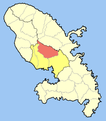
Saint-Joseph | |
---|---|
Coordinates: 14°40′15″N61°02′15″W / 14.6708°N 61.0375°W Coordinates: 14°40′15″N61°02′15″W / 14.6708°N 61.0375°W | |
Country | France |
Overseas region and department | Martinique |
Arrondissement | Fort-de-France |
Intercommunality | CA Centre de la Martinique |
Government | |
• Mayor (2020–2026) | Yan Monplaisir [1] |
Area 1 | 43.29 km2 (16.71 sq mi) |
Population | 15,883 |
• Density | 370/km2 (950/sq mi) |
Time zone | UTC−04:00 (AST) |
INSEE/Postal code | 97224 /97212 |
Elevation | 20–762 m (66–2,500 ft) |
1 French Land Register data, which excludes lakes, ponds, glaciers > 1 km2 (0.386 sq mi or 247 acres) and river estuaries. |
Saint-Joseph is a commune in the Arrondissement of Fort-de-France on Martinique.
Saint-Joseph has a tropical monsoon climate (Köppen climate classification Am). The average annual temperature in Saint-Joseph is 26.3 °C (79.3 °F). The average annual rainfall is 2,404.2 mm (94.65 in) with November as the wettest month. The temperatures are highest on average in August, at around 27.3 °C (81.1 °F), and lowest in February, at around 24.9 °C (76.8 °F). The highest temperature ever recorded in Saint-Joseph was 34.9 °C (94.8 °F) on 20 September 2005; the coldest temperature ever recorded was 15.2 °C (59.4 °F) on 12 January 1979.
Climate data for Saint-Joseph (1991–2020 averages, extremes 1976−present) | |||||||||||||
---|---|---|---|---|---|---|---|---|---|---|---|---|---|
Month | Jan | Feb | Mar | Apr | May | Jun | Jul | Aug | Sep | Oct | Nov | Dec | Year |
Record high °C (°F) | 30.2 (86.4) | 32.5 (90.5) | 32.9 (91.2) | 33.1 (91.6) | 33.3 (91.9) | 32.7 (90.9) | 32.2 (90.0) | 34.7 (94.5) | 34.9 (94.8) | 33.6 (92.5) | 32.6 (90.7) | 31.9 (89.4) | 34.9 (94.8) |
Average high °C (°F) | 28.1 (82.6) | 28.2 (82.8) | 28.6 (83.5) | 29.2 (84.6) | 29.8 (85.6) | 29.9 (85.8) | 29.9 (85.8) | 30.5 (86.9) | 30.9 (87.6) | 30.5 (86.9) | 29.6 (85.3) | 28.7 (83.7) | 29.5 (85.1) |
Daily mean °C (°F) | 25.0 (77.0) | 24.9 (76.8) | 25.2 (77.4) | 25.9 (78.6) | 26.7 (80.1) | 27.1 (80.8) | 27.1 (80.8) | 27.3 (81.1) | 27.2 (81.0) | 26.9 (80.4) | 26.3 (79.3) | 25.5 (77.9) | 26.3 (79.3) |
Average low °C (°F) | 21.8 (71.2) | 21.6 (70.9) | 21.8 (71.2) | 22.6 (72.7) | 23.6 (74.5) | 24.4 (75.9) | 24.3 (75.7) | 24.1 (75.4) | 23.5 (74.3) | 23.3 (73.9) | 23.0 (73.4) | 22.3 (72.1) | 23.0 (73.4) |
Record low °C (°F) | 15.2 (59.4) | 15.5 (59.9) | 15.6 (60.1) | 16.0 (60.8) | 19.0 (66.2) | 20.0 (68.0) | 20.0 (68.0) | 18.0 (64.4) | 19.3 (66.7) | 19.0 (66.2) | 19.0 (66.2) | 16.0 (60.8) | 15.2 (59.4) |
Average precipitation mm (inches) | 141.7 (5.58) | 95.9 (3.78) | 103.5 (4.07) | 172.8 (6.80) | 169.8 (6.69) | 190.6 (7.50) | 237.0 (9.33) | 275.8 (10.86) | 255.1 (10.04) | 298.0 (11.73) | 288.5 (11.36) | 175.5 (6.91) | 2,404.2 (94.65) |
Average precipitation days (≥ 1.0 mm) | 20.4 | 16.4 | 15.6 | 15.7 | 16.3 | 19.2 | 22.3 | 22.1 | 20.1 | 21.8 | 22.1 | 19.8 | 231.6 |
Source: Météo-France [3] |
Year | Pop. | ±% p.a. |
---|---|---|
1967 | 10,923 | — |
1974 | 10,950 | +0.04% |
1982 | 11,266 | +0.36% |
1990 | 14,036 | +2.79% |
1999 | 15,785 | +1.31% |
2007 | 17,215 | +1.09% |
2012 | 16,648 | −0.67% |
2017 | 16,232 | −0.50% |
Source: INSEE [4] |
Saint-Louis is the fifth-largest commune in the French overseas department of Réunion. It is located on the southwest part of the island of Réunion, adjacent to Saint-Pierre.
Saint-Véran is a commune in the Hautes-Alpes department in southeastern France in the Queyras Regional Natural Park.
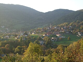
Bénonces is a commune in the Ain department in eastern France.
Saint-Nicolas-lès-Cîteaux is a commune in the Côte-d'Or department in eastern France.
Saint-Benoît is a commune in the French overseas department of Réunion. It is located on the eastern part of the island of Réunion, about 40 kilometres southeast of Saint-Denis, the capital.
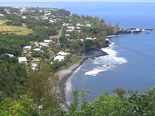
Saint-Joseph is a commune in the French overseas department of Réunion. It is located on the extreme south end of the island of Réunion. As such, it features the southernmost point of the European Union. The village Vincendo is part of the commune.
Petite-Île is a commune on the French island and department of Réunion. The commune is bordered by the communes of Saint-Joseph to the east and Saint-Pierre to the west. The commune gets its name from the uninhabited islet off of its coast, the only such islet near Réunion that has vegetation. The commune was established in 1935.
Saint-Philippe is a commune in the French overseas department of Réunion. It is located in south-eastern Reunion.
Montmélian is a commune in the Savoie department in the Auvergne-Rhône-Alpes region in south-eastern France. Montmélian station has rail connections to Grenoble, Modane, Bourg-Saint-Maurice and Chambéry.
Saint-Julien-de-Peyrolas is a commune in the Gard department in southern France.
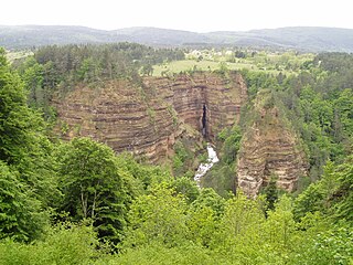
Saint-Sauveur-Camprieu is a commune in the Gard department in southern France.
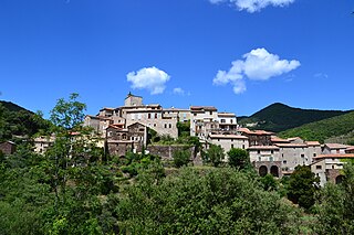
Saint-Martial is a commune in the Gard department in southern France.
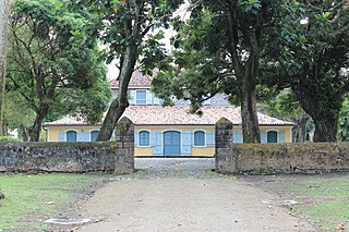
Basse-Pointe is a town and commune in the French overseas department and region, and island of Martinique.
Le Morne-Rouge is a commune and town in the French overseas department and island of Martinique.
L'Ajoupa-Bouillon, commonly known as L'Ajoupa, is a commune and town in the French overseas department and region, and island, of Martinique.
Macouba is a village and commune in the French overseas department of Martinique.
Le François is a town and commune in the arrondissement of Le Marin on Martinique, 22 km (14 mi) from the island capital of Fort-de-France.
Sainte-Anne is a village and commune in the French overseas department of Martinique.
Fonds-Saint-Denis is a village and commune in the French overseas department and region, and island, of Martinique. It is the smallest commune of the island.
Saint-Drézéry is a commune in the Hérault department in the Occitanie region in southern France.