Saint-Michel-des-Saints

Last updated

Saint-Michel-des-Saints
St-Michel-Saints QC.JPG
Saint-Michel-des-Saints Quebec location diagram.png
Location within Matawinie RCM.
Canada Central Quebec location map.png
Red pog.svg
Saint-Michel-des-Saints
Location in central Quebec
Coordinates: 46°41′N73°55′W / 46.683°N 73.917°W / 46.683; -73.917 [1]
CountryCanada
Province Quebec
Region Lanaudière
RCM Matawinie
Settled1863
ConstitutedMarch 3, 1979
Government
[2]
  MayorJean-Pierre Bellerose
   Federal riding Joliette
   Prov. riding Berthier
Area
  Total568.00 km2 (219.31 sq mi)
  Land501.28 km2 (193.55 sq mi)
Population
 (2011) [4]
  Total2,436
  Density4.9/km2 (13/sq mi)
  Pop 2006-2011
Decrease2.svg 10.2%
  Dwellings
1,990
Time zone UTC−5 (EST)
  Summer (DST) UTC−4 (EDT)
Postal code(s)
Area code(s) 450 and 579
HighwaysQc131.svg R-131
Website www.saintmichel
dessaints.com

Saint-Michel-des-Saints is a municipality in the Matawinie Regional County Municipality of Quebec, Canada. Agriculture, forestry, recreation, and tourism have been the main activities found within this region.

Contents

History

In 1863, Thomas-Léandre Brassard settled near the falls of Pine Lake (Lac des Pins) where he built a mill and a manor. Three years later, there were 136 inhabitants. In 1870, the post office opened. By 1883, the Parish of Saint-Michel-des-Saints was officially formed and followed two years later in 1885 by the formation of the parish municipality. The name Saint-Michel-des-Saints, chosen by Ignace Bourget at the suggestion of Father Brassard, honours Michael de Sanctis who lived from 1591 to 1625. [1]

In 1929, the dam on the Matawin River was constructed that would result in the formation of the Taureau Reservoir. This reservoir drowned the neighbouring village of Saint-Ignace-du-Lac (founded in 1877) and so that municipality was annexed by Saint-Michel-des-Saints in 1931, thereby increasing its territory by about 15 square kilometres (5.8 sq mi). [1]

In 1979, the Parish Municipality of Saint-Michel-des-Saints and the United Township Municipality of Masson-et-Laviolette (founded in 1914) were merged to form the new Municipality of Saint-Michel-des-Saints. [1]

In 2018, a flood occurred in late April and early May.

Geography

Saint-Michel-des-Saints is the largest and northernmost municipality in the Lanaudière region (not considering the unorganized territories). The village itself is located at the northern end of Quebec Route 131 along the Matawin River, near the south-western corner of Taureau Reservoir. [1] [2]

The larger lakes in the municipality include Durand, Beauséjour, Hazen, and Kaiagamac. These and the many other ones attract many summer cottage vacationers. The area's forests are popular for hunting and trapping. [1]

Demographics

Population

In the 2011 Census, Statistics Canada originally reported that Saint-Michel-des-Saints had a population of 2,201 living in 979 of its 1,774 total dwellings, an 18.9% change from its 2006 population of 2,713. [5] Statistics Canada subsequently amended the 2011 census results to a population of 2,436 living in 1,084 of its 1,990 total dwellings, a -10.2% change from 2006. [4] With a land area of 501.28 km2 (193.55 sq mi), it had a population density of

Historical Census Data - Saint-Michel-des-Saints, Quebec [6]
YearPop.±%
1991 2,275    
1996 2,339+2.8%
YearPop.±%
2001 2,414+3.2%
2006 2,713+12.4%
YearPop.±%
2011 2,436−10.2%

Language

Mother tongue: [7]

Education

Commission scolaire des Samares operates francophone public schools:

The Sir Wilfrid Laurier School Board operates anglophone public schools serving the community at the secondary level, including:

Cultural twinning

Saint-Michel-des-Saints is twinned with the community of Saint-Varent in the Deux-Sèvres department in western France.

See also

Related Research Articles

<span class="mw-page-title-main">Berthierville</span> City in Quebec, Canada

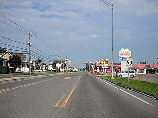
Berthierville (also called Berthier-en-haut, and legally called Berthier before 1942) is a town located between Montreal and Trois-Rivières on the north shore of the Saint Lawrence River in Quebec, Canada. Berthierville is the seat of D'Autray Regional County Municipality, and is served by Autoroute 40, and is the junction of Routes 138 and 158. It is surrounded by the parish municipality of Sainte-Geneviève-de-Berthier.

<span class="mw-page-title-main">Lanaudière</span> Administrative region in Quebec, Canada

Lanaudière is one of the seventeen administrative regions of Quebec, Canada, situated immediately to the northeast of Montreal. It has a total population of 494,796 inhabitants, an increase of 4.9% over the 2011 census.

<span class="mw-page-title-main">Saint-Jean-de-Matha, Quebec</span> Municipality in Quebec, Canada

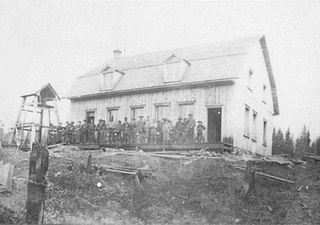
Saint-Jean-de-Matha is a municipality located within the Matawinie Regional County Municipality, Quebec, Canada, in the Lanaudière region.

<span class="mw-page-title-main">Lavaltrie</span> City in Quebec, Canada

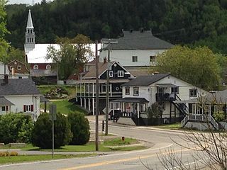
Lavaltrie is a city located within the D'Autray Regional County Municipality in the southern part of the region of Lanaudière, Quebec, Canada, northeast of Montreal outside the suburban sprawl of the North Shore. The population was 13,267 as of the Canada 2011 Census within a land surface area of about 70 square kilometres, with the majority of the territory being used for agricultural activities..

<span class="mw-page-title-main">Chertsey, Quebec</span> Municipality in Quebec, Canada

Chertsey is a municipality in the regional county municipality of Matawinie in Quebec, Canada, located in the administrative region of Lanaudière.

<span class="mw-page-title-main">Notre-Dame-de-Lourdes, Lanaudière</span> Municipality in Quebec, Canada

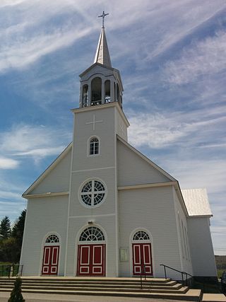
Notre-Dame-de-Lourdes is a municipality in the Lanaudière region of Quebec, Canada, part of the Joliette Regional County Municipality. It is located along the eastern shores of the L'Assomption River.

<span class="mw-page-title-main">Notre-Dame-des-Prairies</span> City in Quebec, Canada

Notre-Dame-des-Prairies is a town in the Lanaudière region of Quebec, Canada, part of the Joliette Regional County Municipality. It is a suburb of Joliette, located along the eastern shores of the L'Assomption River.

<span class="mw-page-title-main">Saint-Ignace-de-Loyola, Quebec</span> Municipality in Quebec, Canada

Saint-Ignace-de-Loyola is a municipality in the Lanaudière region of Quebec, Canada, part of the D'Autray Regional County Municipality. Its territory is located on 33 of the Sorel Islands in the Saint Lawrence River where it flows into Lac Saint-Pierre, the largest of which are île Madame, île aux Ours, and La Grande Île.

<span class="mw-page-title-main">Saint-Norbert, Quebec</span> Parish municipality in Quebec, Canada

Saint-Norbert is a parish municipality in D'Autray Regional County Municipality the Lanaudière region of Quebec, Canada.

<span class="mw-page-title-main">Saint-Cuthbert, Quebec</span> Municipality in Quebec, Canada

Saint-Cuthbert is a municipality in the Lanaudière region of Quebec, Canada, part of the D'Autray Regional County Municipality.

<span class="mw-page-title-main">Saint-Barthélemy, Quebec</span> Parish municipality in Quebec, Canada

Saint-Barthélemy is a parish municipality in the Lanaudière region of Quebec, Canada, part of the D'Autray Regional County Municipality.

<span class="mw-page-title-main">Saint-Félix-de-Valois, Quebec</span> Municipality in Quebec, Canada

Saint-Félix-de-Valois is a municipality in the Lanaudière region of Quebec, Canada, part of the Matawinie Regional County Municipality.

<span class="mw-page-title-main">Sainte-Marcelline-de-Kildare, Quebec</span> Municipality in Quebec, Canada

Sainte-Marcelline-de-Kildare is a municipality in the Lanaudière region of Quebec, Canada, part of the Matawinie Regional County Municipality.

<span class="mw-page-title-main">Entrelacs, Quebec</span> Municipality in Quebec, Canada

Entrelacs is a municipality in Matawinie Regional County Municipality in the Lanaudière region of Quebec, Canada.

<span class="mw-page-title-main">Saint-Alphonse-Rodriguez, Quebec</span> Municipality in Quebec, Canada

Saint-Alphonse-Rodriguez is a municipality in the Lanaudière region of Quebec, Canada, part of the Matawinie Regional County Municipality.

<span class="mw-page-title-main">Sainte-Béatrix, Quebec</span> Municipality in Quebec, Canada

Sainte-Béatrix is a municipality in the Lanaudière region of Quebec, Canada, part of the Matawinie Regional County Municipality.

<span class="mw-page-title-main">Notre-Dame-de-la-Merci</span> Municipality in Quebec, Canada

Notre-Dame-de-la-Merci is a municipality in the Lanaudière region of Quebec, Canada, part of the Matawinie Regional County Municipality.

<span class="mw-page-title-main">Saint-Côme, Quebec</span> Municipality in Quebec, Canada

Saint-Côme is a municipality in the Lanaudière region of Quebec, Canada, part of the Matawinie Regional County Municipality.

<span class="mw-page-title-main">Sainte-Émélie-de-l'Énergie</span> Municipality in Quebec, Canada

Sainte-Émélie-de-l'Énergie is a municipality in the Lanaudière region of Quebec, Canada, part of the Matawinie Regional County Municipality.

<span class="mw-page-title-main">Saint-Zénon, Quebec</span> Municipality in Quebec, Canada

Saint-Zénon is a municipality in the Lanaudière region of Quebec, part of the Matawinie Regional County Municipality.

References

  1. 1 2 3 4 5 6 "Saint-Michel-des-Saints (Municipalité)" (in French). Commission de toponymie du Québec. Retrieved 2009-11-30.
  2. 1 2 3 Ministère des Affaires municipales, des Régions et de l'Occupation du territoire
  3. Statistics Canada 2011 Census - Saint-Michel-des-Saints census profile
  4. 1 2 3 "Corrections and updates". Statistics Canada. 2012-10-24. Retrieved 2012-11-11.
  5. 1 2 "Population and dwelling counts, for Canada, provinces and territories, and census subdivisions (municipalities), 2011 and 2006 censuses (Quebec)". Statistics Canada. 2012-02-08. Retrieved 2012-11-11.
  6. Statistics Canada: 1996, 2001, 2006, 2011 census
  7. Statistics Canada 2006 Census - Saint-Michel-des-Saints community profile
  8. "Saint-Jean-Baptiste." Commission scolaire des Samares. Retrieved on September 23, 2017.
  9. "Joliette High School Zone Sec 1-5." Sir Wilfrid Laurier School Board. Retrieved on September 5, 2017.