Sainte-Marguerite-du-Lac-Masson, Quebec

Last updated
Sainte-Marguerite-du-Lac-Masson
City
Sainte-Marguerite-du-Lac-Masson.JPG
Sainte-Marguerite-du-Lac-Masson Quebec location diagram.png
Location within Les Pays-d'en-Haut RCM
Canada Central Quebec location map.png
Red pog.svg
Ste-Marguerite
-du-Lac-Masson
Location in central Quebec
Coordinates: 46°02′N74°03′W / 46.03°N 74.05°W / 46.03; -74.05 Coordinates: 46°02′N74°03′W / 46.03°N 74.05°W / 46.03; -74.05 [1]
CountryFlag of Canada.svg  Canada
Province Flag of Quebec.svg  Quebec
Region Laurentides
RCM Les Pays-d'en-Haut
Settled 1860s
Constituted October 17, 2001
Government [2]
  Mayor Gilles Boucher [3]
   Federal riding Laurentides—Labelle
   Prov. riding Bertrand
Area [2] [4]
  Total 98.70 km2 (38.11 sq mi)
  Land 92.62 km2 (35.76 sq mi)
Population (2011) [4]
  Total 2,740
  Density 29.6/km2 (77/sq mi)
  Pop (2006–11)Increase2.svg 9.7%
Time zone EST (UTC−5)
  Summer (DST) EDT (UTC−4)
Postal code(s) J0T 1L0
Area code(s) 450 and 579
Website www.ste-marguerite.qc.ca

Sainte-Marguerite-du-Lac-Masson is a city in Les Pays-d'en-Haut Regional County Municipality in the Laurentides region of Quebec, Canada. It is partially named after and situated on the western shore of Lake Masson.

Les Pays-den-Haut Regional County Municipality Regional county municipality in Quebec, Canada

Les Pays-d'En-Haut is a regional county municipality in the Laurentides region of Quebec, Canada. The population according to the Canada 2011 Census is 40,331.

Laurentides Administrative region in Quebec, Canada

The Laurentides is a region of Quebec. While it is often called the Laurentians in English, the region includes only part of the Laurentian mountains. It has a total land area of 20,744.29 km2 (8,009.42 sq mi) and a 2011 census population of 555,614 inhabitants.

Quebec Province of Canada

Quebec is one of the thirteen provinces and territories of Canada. It is bordered to the west by the province of Ontario and the bodies of water James Bay and Hudson Bay; to the north by Hudson Strait and Ungava Bay; to the east by the Gulf of Saint Lawrence and the province of Newfoundland and Labrador; and to the south by the province of New Brunswick and the U.S. states of Maine, New Hampshire, Vermont, and New York. It also shares maritime borders with Nunavut, Prince Edward Island, and Nova Scotia. Quebec is Canada's largest province by area and its second-largest administrative division; only the territory of Nunavut is larger. It is historically and politically considered to be part of Central Canada.

Contents

History

Jukebox in the Alpine Inn, 1942 Commercial. Alpine Inn. Louis Faust. Faust Music Service. Ste-Adele BAnQ P48S1P07594.jpg
Jukebox in the Alpine Inn, 1942

In the early 1860s, Édouard Masson (1826–1875), businessman and member of the Legislative Council of the Province of Canada from 1856 to 1864, invited many settlers to move to the former Terrebonne Seigneury and the surrounding area. In 1864, he was granted land in this area and contributed to the quick development of the parish, including the construction of a sawmill and a flour mill at the outflow of the lake which would be named after him later on. Also that same year, the Mission of Sainte-Marguerite was established, and the Parish Municipality of Sainte-Marguerite-du-Lac-Masson was officially formed, both named after Margaret of Antioch of the third century. In 1868, the Lac-Masson Post Office opened. [5]

Isidore-Édouard-Candide Masson Canadian politician

Édouard Masson was a businessman and political figure in Canada East.

The Legislative Council of the Province of Canada was the upper house for the Province of Canada, which consisted of the former provinces of Lower Canada, then known as Canada East and later the province of Quebec, and Upper Canada, then known as Canada West and later the province of Ontario. It was created by The Union Act of 1840.

Margaret the Virgin saint (275–304) usually shown with a dragon

Margaret, known as Margaret of Antioch in the West, and as Saint Marina the Great Martyr in the East, is celebrated as a saint on July 20 in the Western Rite Orthodox, Roman Catholic and Anglican Churches, on July 17 by the Eastern-Rite Orthodox Church and on Epip 23 and Hathor 23 in the Coptic Churches.

In 1959, the Town of Estérel was formed on the eastern side of Lake Masson when it separated from Sainte-Marguerite-du-Lac-Masson. [6]

Estérel, Quebec City in Quebec, Canada

Estérel is a city in Les Pays-d'en-Haut Regional County Municipality in the Laurentides region of Quebec, Canada. The municipal territory almost entirely extends around Lake Masson, whereas the village itself is situated on the eastern shore of this lake.

On October 10, 2001, the Parish Municipality of Sainte-Marguerite-du-Lac-Masson and the Town of Estérel were merged to become the Town of Sainte-Marguerite–Estérel. On January 1, 2006, after a municipal referendum, the Town of Estérel was re-established however and the Town of Sainte-Marguerite–Estérel reverted to its former name of Sainte-Marguerite-du-Lac-Masson. [5]

Demographics

Population trend: [7]

(R) = Revised count. [8]

Private dwellings occupied by usual residents: 1334 (total dwellings: 2158)

Mother tongue:

Education

Sir Wilfrid Laurier School Board operates English-language public schools:

Sir Wilfrid Laurier School Board

The Sir Wilfrid Laurier School Board is a school board headquartered in Rosemère, Quebec in Greater Montreal.

Laurentian Regional High School is an English secondary school in Lachute in the region of Laurentides, Québec, Canada. It contains classes for grades seven through eleven, and is run by the Sir Wilfrid Laurier School Board.

See also

Related Research Articles

Arundel, Quebec Township municipality in Quebec, Canada

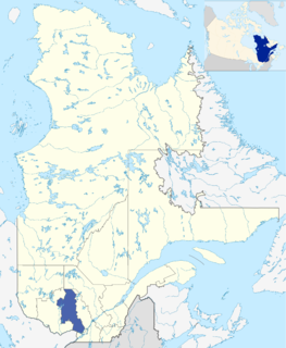
Arundel is a township municipality in Quebec, Canada, located 18 kilometres (11 mi) south of Mont Tremblant.

Berthierville City in Quebec, Canada

Berthierville is a town located between Montreal and Trois-Rivières on the north shore of the Saint Lawrence River in Quebec, Canada. Berthierville is the seat of D'Autray Regional County Municipality, and is served by Autoroute 40, and is the junction of Routes 138 and 158. It is surrounded by the parish municipality of Sainte-Geneviève-de-Berthier.

Saint-Sauveur, Quebec City in Quebec, Canada

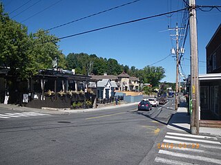
Saint-Sauveur is a town and municipality within the Les Pays-d'en-Haut Regional County Municipality, Quebec, Canada. It is in the administrative region of Laurentides in the Laurentian mountains, located about 60 kilometres north of Montreal.

Sainte-Anne-des-Lacs, Quebec Parish municipality in Quebec, Canada

Sainte-Anne-des-Lacs is a municipality in the regional county municipality of Les Pays-d'en-Haut in Quebec, Canada, located in the administrative region of Laurentides. The municipality was founded in 1946 and was assigned the municipal number 77035 by the Quebec government. The Roman Catholic parish of Sainte-Anne-des-Lacs was founded in 1940.

Piedmont, Quebec Municipality in Quebec, Canada

Piedmont is a small municipality within the Les Pays-d'en-Haut Regional County Municipality, Quebec, Canada, in the Laurentian Mountains of the administrative region of Laurentides. It is located along the North River and Autoroute 15 and Route 117, north of Montreal.

Saint-Hippolyte, Quebec Municipality in Quebec, Canada

Saint-Hippolyte is a municipality within La Rivière-du-Nord Regional County Municipality in the Laurentides region of Quebec, Canada, in the Laurentian mountains about 45 km north of Montreal. The name comes from Saint Hippolytus.

Sainte-Adèle, Quebec City in Quebec, Canada

Sainte-Adèle is a municipality in Quebec, Canada, and is part of the Les Pays-d'en-Haut Regional County Municipality. It lies on Route 117 about 70 kilometres (43 mi) north-west of Montreal. Its tourism-based economy centres on its skiing and hotel industry. Sainte-Adèle had a population of 12,137 as of 2011.

Saint-Adolphe-dHoward, Quebec Municipality in Quebec, Canada

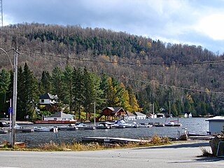
Saint-Adolphe-d'Howard is a municipality in the Laurentian Mountains, in the Province of Quebec, Canada, north-west of Montreal.

Lac-Supérieur, Quebec Municipality in Quebec, Canada

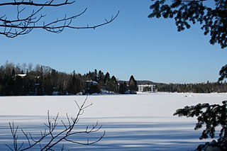
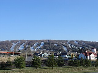
Lac-Supérieur is a municipality in the Laurentides region of Quebec, Canada, part of the Les Laurentides Regional County Municipality. It is named after Lake Superior which is located in the Laurentian Mountains, due east of Mont Tremblant Resort. The community of Lac-Supérieur is just south of the lake, which itself is ringed with cottages. The entire northern portion of the municipality is mostly undeveloped and part of the Mont-Tremblant National Park.

Harrington, Quebec Township municipality in Quebec, Canada

Harrington is a township municipality in the Laurentides region of Quebec, Canada, part of the Argenteuil Regional County Municipality. It is located in the Laurentian Mountains, about 40 kilometres (25 mi) north-west of Lachute.

Wentworth, Quebec Township municipality in Quebec, Canada

Wentworth is a township municipality in the Laurentides region of Quebec, Canada, part of the Argenteuil Regional County Municipality, north-west of Lachute.

Notre-Dame-de-la-Paix, Quebec Municipality in Quebec, Canada

Notre-Dame-de-la-Paix is a town and municipality in the Outaouais region of Quebec, Canada, part of the Papineau Regional County Municipality.

Namur, Quebec Municipality in Quebec, Canada

Namur is a town and municipality in the Outaouais region of Quebec, Canada, part of the Papineau Regional County Municipality. It is nicknamed "la Nouvelle Belgique".

Boileau, Quebec Municipality in Quebec, Canada

Boileau is a village and municipality in the Outaouais region of Quebec, Canada, part of the Papineau Regional County Municipality. The municipality was known as Ponsonby until 1993.

Saint-Joseph-du-Lac, Quebec Municipality in Quebec, Canada

Saint-Joseph-du-Lac is a municipality in the Laurentides region of Quebec, Canada, part of the Deux-Montagnes Regional County Municipality.

Wentworth-Nord, Quebec Municipality in Quebec, Canada

Wentworth-Nord is a municipality in the Laurentides region of Quebec, Canada, part of the Les Pays-d'en-Haut Regional County Municipality.

Lac-des-Seize-Îles, Quebec Municipality in Quebec, Canada

Lac-des-Seize-Îles is a village and municipality in the Laurentides region of Quebec, Canada, part of the Les Pays-d'en-Haut Regional County Municipality. The municipality surrounds and is named after Sixteen Island Lake with the village situated at the northern end of this lake.

Sainte-Sophie, Quebec Municipality in Quebec, Canada

Sainte-Sophie is a municipality in the Laurentides region of Quebec, Canada, part of the La Rivière-du-Nord Regional County Municipality.

Saint-Gabriel, Quebec City in Quebec, Canada

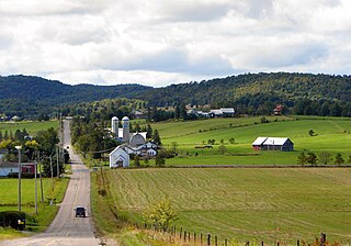
Saint-Gabriel is a town in the Lanaudière region of Quebec, Canada, part of the D'Autray Regional County Municipality. It is located on the shores of Lake Maskinongé, in the shadows of the Laurentian Mountains.

References

  1. Reference number 388482 of the Commission de toponymie du Québec (in French)
  2. 1 2 Geographic code 77012 in the official Répertoire des municipalités (in French)
  3. Houle, Isabelle (November 4, 2013). "« La population a choisi le chialeux! » - Gilles Boucher". Le Journal des Pays-d'en-Haut La Vallée (in French). Retrieved November 7, 2013.
  4. 1 2 "(Code 2477012) Census Profile". 2011 census . Statistics Canada. 2012.
  5. 1 2 "Sainte-Marguerite-du-Lac-Masson (Ville)" (in French). Commission de toponymie du Québec. Retrieved 2009-03-18.
  6. "Estérel (Ville)" (in French). Commission de toponymie du Québec. Retrieved 2009-03-18.
  7. Statistics Canada: 1996, 2001, 2006, 2011 census
  8. Statistics Canada - Population and dwelling count amendments to the 2001 Census
  9. "maps zone/171 - WEB SAINTE ADELE.pdf SAINTE ADÈLE ELEMENTARY ZONE." Sir Wilfrid Laurier School Board. Retrieved on September 16, 2017.
  10. "LAURENTIAN REGIONAL HS ZONE." Sir Wilfrid Laurier School Board. Retrieved on September 4, 2017.