Sainte-Thérèse-de-la-Gatineau

Last updated • a couple of secsFrom Wikipedia, The Free Encyclopedia

Sainte-Thérèse-de-la-Gatineau
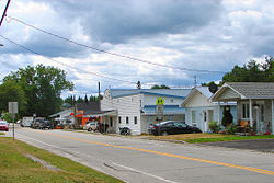
Ste-Therese-Gatineau QC.JPG
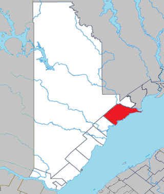
Canada Western Quebec location map.png
Red pog.svg
Ste-Thérèse-
de-la-Gatineau
Location in western Quebec
Coordinates: 46°18′N75°52′W / 46.300°N 75.867°W / 46.300; -75.867 [1]
Country Canada
Province Quebec
Region Outaouais
RCM La Vallée-de-la-Gatineau
ConstitutedJanuary 1, 1946
Government
[2]
  MayorRoch Carpentier
   Federal riding Pontiac
   Prov. riding Gatineau
Area
  Total79.43 km2 (30.67 sq mi)
  Land60.68 km2 (23.43 sq mi)
Population
 (2021) [3]
  Total588
  Density9.7/km2 (25/sq mi)
  Pop (2016–21)
Increase2.svg 13.1%
  Dwellings
534
Time zone UTC−5 (EST)
  Summer (DST) UTC−4 (EDT)
Postal code(s)
Area code 819
HighwaysNo major routes
Website www.sainte-therese-de-la-gatineau.ca OOjs UI icon edit-ltr-progressive.svg

Sainte-Thérèse-de-la-Gatineau (French pronunciation: [sɛ̃tteʁɛzlaɡatino] ) is a municipality in the Outaouais region of Quebec, Canada. Located between the Gatineau River and Thirty-One Mile Lake, it is the smallest municipality in terms of population in the La Vallée-de-la-Gatineau Regional County Municipality.

Contents

History

It takes its name from the Sainte-Thérèse-de-l'Enfant-Jésus Parish, formed in 1934, which in turn was named after Saint Thérèse of the Child Jesus (1873–1897). [4]

In 1946, the Municipality of Sainte-Thérèse-de-la-Gatineau was formed when it separated from the Township of Cameron. [5]

Demographics

Historical census populations – Sainte-Thérèse-de-la-Gatineau
YearPop.±%
1976 440    
1981 440+0.0%
1986 409−7.0%
1991 380−7.1%
1996 411+8.2%
YearPop.±%
2001 377−8.3%
2006 335−11.1%
2011 526+57.0%
2016 520−1.1%
2021 588+13.1%
Source: Statistics Canada [6]

Private dwellings occupied by usual residents: 288 (out of 534 total) [3]

Languages:

Related Research Articles

<span class="mw-page-title-main">Thérèse-De Blainville Regional County Municipality</span> Regional county municipality in Quebec, Canada

Thérèse-De Blainville is a regional county municipality in the Laurentides region of Quebec, Canada. It is located immediately north of Laval on the north shore of the Rivière des Mille-Îles.

<span class="mw-page-title-main">Sainte-Thérèse-de-Gaspé</span> Municipality in Quebec, Canada

Sainte-Thérèse-de-Gaspé is a municipality in the Gaspésie-Îles-de-la-Madeleine region of the province of Quebec in Canada. It is the smallest municipality, in land area and population, of the Le Rocher-Percé Regional County Municipality.

<span class="mw-page-title-main">La Pêche</span> Municipality in Quebec, Canada

La Pêche is a municipality along both sides of the Gatineau River in Les Collines-de-l'Outaouais Regional County Municipality in the Outaouais region of Quebec, Canada, about 30 km (19 mi) north of downtown Gatineau.

<span class="mw-page-title-main">Sainte-Hélène-de-Kamouraska</span> Municipality in Quebec, Canada

Sainte-Hélène-de-Kamouraska is a municipality in the Canadian province of Quebec, located in the Kamouraska Regional County Municipality.
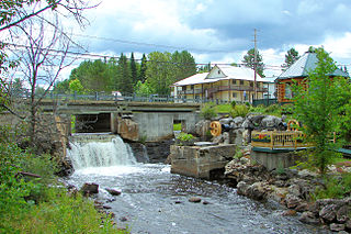
<span class="mw-page-title-main">Aumond</span> Township municipality in Quebec, Canada

Aumond is a township municipality in the Canadian province of Quebec, located within La Vallée-de-la-Gatineau Regional County Municipality.

<span class="mw-page-title-main">Déléage</span> Municipality in Quebec, Canada

Déléage is a town and municipality in La Vallée-de-la-Gatineau Regional County Municipality, Quebec, Canada. It is situated on the eastern banks of the Gatineau River opposite Maniwaki.
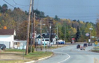
<span class="mw-page-title-main">Grand-Remous</span> Municipality in Quebec, Canada

Grand-Remous is a town and municipality in La Vallée-de-la-Gatineau Regional County Municipality, Quebec, Canada. The municipality is south of the Baskatong Reservoir, spanning both sides of the Gatineau River. The town is situated at the intersection of Route 117 and Route 105.

<span class="mw-page-title-main">Cayamant</span> Municipality in Quebec, Canada

Cayamant is a municipality in La Vallée-de-la-Gatineau Regional County Municipality, Quebec, Canada. The village of Lac-Cayamant is located at the north end of Lake Cayamant, west of Gracefield.

<span class="mw-page-title-main">Montcerf-Lytton</span> Municipality in Quebec, Canada

Montcerf-Lytton is a municipality in La Vallée-de-la-Gatineau Regional County Municipality, Quebec, Canada. Its territory spans both shores of the Désert River, a tributary of the Gatineau River.

<span class="mw-page-title-main">Bouchette</span> Municipality in Quebec, Canada

Bouchette is a municipality in the geographic centre of the La Vallée-de-la-Gatineau Regional County Municipality, Quebec, Canada, 75 kilometres (47 mi) north of Gatineau. Its territory is along the shores of Gatineau River and western Thirty-One Mile Lake.

<span class="mw-page-title-main">Lac-Sainte-Marie, Quebec</span> Municipality in Quebec, Canada

Lac-Sainte-Marie is a municipality in the La Vallée-de-la-Gatineau Regional County Municipality, Quebec, Canada, 60 kilometres (37 mi) north of Gatineau. It is named after the adjacent lake.
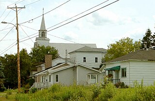
<span class="mw-page-title-main">Bois-Franc, Quebec</span> Municipality in Quebec, Canada

Bois-Franc is a municipality in the La Vallée-de-la-Gatineau Regional County Municipality, Quebec, Canada, 15 kilometres (9.3 mi) north of Maniwaki. Its territory is along the western shores of the upper Gatineau River.

<span class="mw-page-title-main">Egan-Sud</span> Municipality in Quebec, Canada

Egan-Sud is a municipality in the La Vallée-de-la-Gatineau Regional County Municipality, Quebec, Canada, directly north of Maniwaki.

<span class="mw-page-title-main">Sainte-Anne-de-la-Rochelle</span> Municipality in Quebec, Canada

Sainte-Anne-de-la-Rochelle is a community in Quebec, Canada, situated within the Regional County Municipality of Le Val-Saint-François in the administrative region of Estrie.

<span class="mw-page-title-main">Saint-Placide, Quebec</span> Municipality in Quebec, Canada

Saint-Placide is a municipality in the Laurentides region of Quebec, Canada, part of the Deux-Montagnes Regional County Municipality, along the north shore of the Ottawa River.

<span class="mw-page-title-main">Sainte-Anne-du-Lac</span> Municipality in Quebec, Canada

Sainte-Anne-du-Lac is a municipality and village in the Laurentides region of Quebec, Canada, part of the Antoine-Labelle Regional County Municipality.
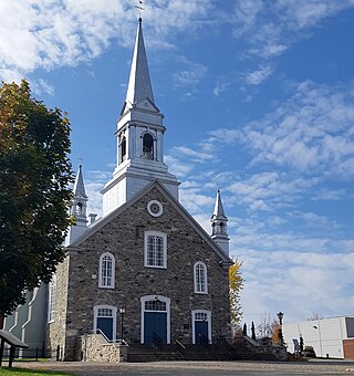
<span class="mw-page-title-main">Saint-Elzéar, Chaudière-Appalaches, Quebec</span> Municipality in Quebec, Canada

Saint-Elzéar is a municipality in La Nouvelle-Beauce Regional County Municipality in Quebec, Canada. It is part of the Chaudière-Appalaches region and the population was 2,400 as of the Canada 2016 Census. Founded in 1855, it was named in tribute to Elzéar-Henri Juchereau Duchesnay, seigneur of neighbouring Sainte-Marie-de-la-Nouvelle-Beauce.

<span class="mw-page-title-main">Vallée-Jonction</span> Municipality in Quebec, Canada

Vallée-Jonction is a municipality in the Municipalité régionale de comté de la Nouvelle-Beauce in Quebec, Canada. It is part of the Chaudière-Appalaches region and the population is 1,864 as of 2021.
<span class="mw-page-title-main">Colombier, Quebec</span> Municipality in Quebec, Canada

Colombier is a municipality in the Canadian province of Quebec, located in the Côte-Nord region and the regional county municipality of La Haute-Côte-Nord. It is located along Route 138, about 60 kilometres (37 mi) south-west of Baie-Comeau.

<span class="mw-page-title-main">Notre-Dame-du-Laus</span> Municipality in Quebec, Canada

Notre-Dame-du-Laus is a municipality in the Laurentides region of Quebec, Canada, part of the Antoine-Labelle Regional County Municipality.
References

  1. "Banque de noms de lieux du Québec: Reference number 56439". toponymie.gouv.qc.ca (in French). Commission de toponymie du Québec.
  2. 1 2 "Répertoire des municipalités: Geographic code 83055". www.mamh.gouv.qc.ca (in French). Ministère des Affaires municipales et de l'Habitation.
  3. 1 2 3 "Profile table, Census Profile, 2021 Census of Population - Sainte-Thérèse-de-la-Gatineau, Municipalité (MÉ) [Census subdivision], Quebec". www12.statcan.gc.ca. Government of Canada - Statistics Canada. 9 February 2022.
  4. "Sainte-Thérèse-de-la-Gatineau (Municipalité)" (in French). Commission de toponymie du Québec. Retrieved 2008-09-16.
  5. "Répertoire des entités géopolitiques: VSainte-Thérèse-de-la-Gatineau (municipalité) 1.1.1946 - ..." www.mairesduquebec.com. Institut généalogique Drouin. Retrieved 5 January 2023.
  6. 1996, 2001, 2006, 2011 census

Commons-logo.svg Media related to Sainte-Thérèse-de-la-Gatineau at Wikimedia Commons