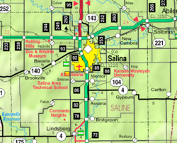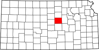
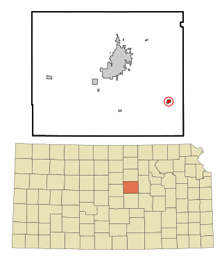
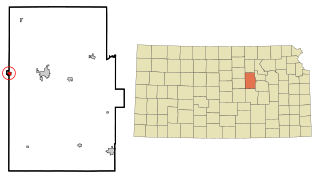
Saline County is located in the U.S. state of Kansas. Its county seat and largest city is Salina. As of the 2020 census, the county population was 54,303. The county was named after the Saline River.

Ottawa County is a county located in the U.S. state of Kansas. Its county seat and largest city is Minneapolis. As of the 2020 census, the county population was 5,735. The county was named after the Odawa tribe.

Paradise is a city in Russell County, Kansas, United States. As of the 2020 census, the population of the city was 35.

Assaria is a city in Saline County, Kansas, United States. As of the 2020 census, the population of the city was 428.

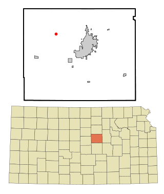
Brookville is a city in Saline County, Kansas, United States. As of the 2020 census, the population of the city was 247.
Gypsum is a city in Saline County, Kansas, United States. As of the 2020 census, the population of the city was 400.
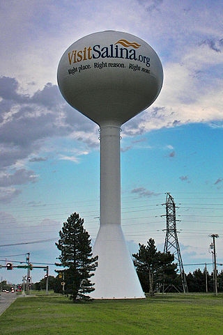
Salina is a city in and the county seat of Saline County, Kansas, United States. As of the 2020 census, the population was 46,889.

Smolan is a city in Saline County, Kansas, United States. As of the 2020 census, the population of the city was 162.
Solomon is a city in Dickinson and Saline counties in the U.S. state of Kansas. As of the 2020 census, the population of the city was 993. It is located approximately 6 miles west of Abilene.

K-140 is a 33.224-mile-long (53.469 km) state highway in Ellsworth and Saline Counties in the U.S. state of Kansas. The highway travels through mostly rural land between the cities of Ellsworth and Salina. In addition to connecting Ellsworth and Salina, K-140 travels through the communities of Carneiro, Brookville, and Bavaria. The highway has junctions with Kansas state highways K-14, K-156, K-111, and K-141, as well as Interstate 135 (I-135).

Mentor is a census-designated place (CDP) in Saline County, Kansas, United States. As of the 2020 census, the population was 101. It is located south of Salina on Mentor Road.

Falun is a census-designated place (CDP) in southwestern Saline County, Kansas, United States. As of the 2020 census, the population was 83. It lies southwest of Salina and northwest of Lindsborg at the intersection of Forsse and Hedberg roads, approximately 7.5 miles west of Interstate 135, or about eight miles west of Assaria. It lies next to an abandoned railroad.
The Salina, Kansas micropolitan area, as defined by the United States Census Bureau, consists of two counties in Kansas, anchored by the city of Salina.

Bavaria is a census-designated place (CDP) in Saline County, Kansas, United States. As of the 2020 census, the population was 60. It lies along K-140 and a Union Pacific Railroad line west of Salina. Bavaria is a part of the Salina micropolitan area.

Bridgeport is a census-designated place (CDP) in Smoky View Township, Saline County, Kansas, United States. As of the 2020 census, the population was 64. It is located south of Salina, along K-4 near Interstate 135.

Kipp is a census-designated place (CDP) in Eureka and Solomon townships in Saline County, Kansas, United States. As of the 2020 census, the population was 60. It is located southeast of Salina, along Schilling Road between Whitmore Road and Kipp Road, next to an abandoned railroad.
Hedville is an unincorporated community in Ohio Township, Saline County, Kansas, United States. It lies along Hedville Road and a Kansas and Oklahoma Railroad line, 1.0 mile (1.6 km) south of Interstate 70, northwest of Salina. The Rolling Hills Zoo is located approximately 1.0 mile (1.6 km) south of the community.

Glendale is an unincorporated community in Saline County, Kansas, United States. It is located approximately 15 miles (24 km) northwest of Salina, along the Kansas and Oklahoma Railroad line, at the intersection of north Brookville and west Watkins roads, about 1.0 mile (1.6 km) north of I-70. It is the only community lying within the boundaries of the Glendale Township. There are no businesses or services located at Glendale.
North Central Kansas is a tourism and geographical region of the state of Kansas. It consists of 15 counties, and has a population of over 150,000. The Salina micropolitan area is part of North Central Kansas. The region stretches from the Nebraska border in the north to Russell, Ellsworth, Saline, and Dickinson Counties in the south. Its western border includes Smith, Osborne, and Russell Counties, and its eastern border Dickinson, Clay, Washington, and Marshall Counties.
Shipton is an unincorporated community in Saline County, Kansas, United States. It is located northwest of Salina, approximately 0.75 mile west of the intersection of Halstead Road and Shipton Road, next to an abandoned railroad.