
Yongsan Garrison, meaning "dragon hill garrison", is an area located in the Yongsan District of central Seoul, South Korea. The site served as the headquarters for U.S. military forces stationed in South Korea, known as United States Forces Korea (USFK), and as United States Army Garrison Yongsan (USAG-Yongsan) until 2018, under the supervision of the U.S. Army's Installation Management Command Pacific Region. From 1910 to 1945 it served as headquarters for the Imperial Japanese Army in Korea.

Yongsan Station is a major railway station in the Yongsan District of Seoul, South Korea. The station adjoins the Yongsan Electronics Market. The station is the terminus for high-speed and long-distance trains on a number of railway lines, including most trains on the Honam Line, its high-speed counterpart, and all trains on the Janghang and Jeolla Lines.
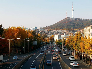
Yongsan District is one of the 25 districts of Seoul, South Korea.

The Shinbundang Line Korean: 신분당선; Hanja: 新盆唐線; literally, New Bundang Line) or DX Line for Dynamic Express Line is a 33.4 km (20.8 mi) long line of the Seoul Metropolitan Subway. It is the world's fifth subway to run completely driverless and the second completely driverless metro line to open in South Korea, after Busan Subway Line 4. It connects Sinsa station and Gwanggyo station in 42 minutes, a feat achieved by being the first line to operate South Korea's next-generation subway car travelling at over 90 km/h (56 mph), with the fastest average speed of any subway line in the country.

Hoehyeon Station (Korean: 회현역) is a station on the Seoul Subway Line 4. It is the closest station to the historical gate of Namdaemun, and also serves the major shopping district of Namdaemun Market. This station is located in Namchang-dong, Jung-gu, Seoul.

Namtaeryeong Station is a station on Seoul Subway Line 4. It is operated by Seoul Metro.
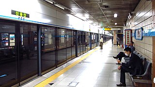
Sinyongsan station is a station on the Seoul Subway Line 4 in Hangang-daero, Yongsan-gu, Seoul. Although not connected to this station by a transfer passageway, Yongsan station on Line 1 is a short walk away. The southwestern section of Yongsan Garrison can be accessed easily from this station. Its station subname is AMOREPACIFIC, and AMOREPACIFIC is located nearby.
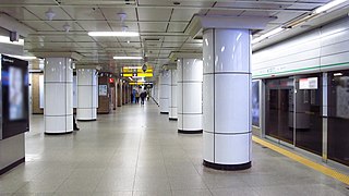
Sadang Station is a station on the Seoul Subway Line 2 and Seoul Subway Line 4 in South Korea.
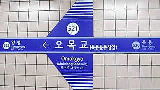
Omokgyo Station is a station in the west of Seoul on Seoul Subway Line 5. It is considered the principal station of the affluent Mok-dong area, and the Hyperion Towers are right outside Exit 2. Mokdong Baseball Stadium, former home of the Korea Baseball Organization's Nexen Heroes, is a short walk from Exit 4. Broadcasting company SBS' headquarters is located nearby. It is one of two stations close to the Seoul Immigration Office, which is located near Exit 7.

Sindorim station is a station on Seoul Subway Line 1 and Line 2 (underground). It is also the southeastern terminus of Line 2's Sinjeong Branch to Kkachisan. The station is located at the northern edge of Sindorim-dong, Guro-gu, Seoul, on the border with Yeongdeungpo-gu.

Ichon Station (Korean: 이촌역) is a station in Yongsan-gu, Seoul on Seoul Subway Line 4 and the Gyeongui–Jungang Line. This station is the closest to the National Museum of Korea, situated in the interior of Yongsan Family Park. It also serves eastern Ichon-dong, home to the largest Japanese community in South Korea with some 1,300 Japanese residents.

Geumjeong Station is a ground-level metro station on lines 1 and 4 of the Seoul Subway network in South Korea. The station is in Gunpo, a city approximately 15 km (9.3 mi) south of Seoul in Gyeonggi Province, between the cities of Anyang and Suwon. The name means that the land is covered with waves everywhere and that the water wets women's clothes.
Camp Coiner is a former 55-acre (220,000 m2) United States Forces Korea installation located on the northern part of Yongsan Garrison located in Seoul, South Korea. It was named after 2nd Lieutenant Randall Coiner assigned to the 3rd Battalion, 31st Infantry Regiment of the 7th Infantry Division who was posthumously awarded the Silver Star for actions taken in 1953 during the Korean War near the village of Sokkagae.

Namyeong station is a ground-level metro station on Seoul Subway Line 1 in Galwol Dong, Yongsan-gu, Seoul, South Korea. Subways of Line 1 move on Gyeongbu Line from this station. The station's sole exit offers access to a range of schools and Yongsan Railway Office. Travel time from Namyeong Station to Incheon on Line 1 is 65 minutes.
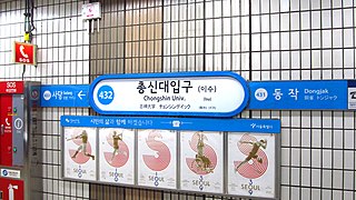
Isu Station is a subway station on the Seoul Subway Line 4 and Line 7 in Dongjak-gu, Seoul, South Korea.

Doksan Station is a station on Line 1 of the Seoul Subway. It is an above-ground station located in southwestern Seoul, with service between Uijeongbu and Suwon/Cheonan.

Noksapyeong Station is a subway station on the Seoul Subway Line 6. It is located on the eastern end of the Yongsan Garrison, and the western end of Itaewon. It is the main station servicing the Haebangchon and Hoenamu-gil communities, which are known for having significant foreign populations.
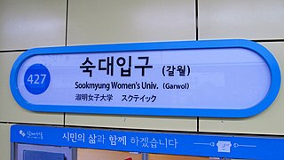
Sookmyung Women's University Station is subway station 427, on the Seoul Subway Line 4 in Yongsan-gu, Seoul. It is also called Garwol station (갈월역). It is located in front of the main entrance of the Sookmyung Women's University. There are many restaurants in the neighborhood of the subway station.

Oido station is a subway station on Seoul Subway Line 4 and the Suin–Bundang Line in Siheung, South Korea. It is the current southwestern terminus of Seoul Subway Line 4 located almost 30 kilometers southwest of Seoul, connecting Oido to other parts of Korea. A commuter rail trip between this station and Seoul Station takes over an hour, and a train servicing depot is located nearby. The name of the station was decided by the surrounding area Oido island.
Bae Ho was a South Korean singer, known as the "Elvis of Korean trot." A statue commemorating his biggest hit, "Turning around at Samgakji " stands in front of Samgakji Station in Seoul.


