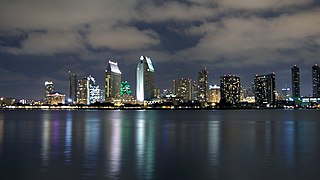
Southern California is a geographic and cultural region that generally comprises the southern portion of the U.S. state of California. It includes the Los Angeles metropolitan area, the second most populous urban agglomeration in the United States. The region generally contains ten of California's 58 counties: Imperial, Kern, Los Angeles, Orange, Riverside, San Bernardino, San Diego, Santa Barbara, San Luis Obispo and Ventura counties. The Colorado Desert and the Colorado River are located on southern California's eastern border with Arizona, and San Bernardino County shares a border with Nevada to the northeast. Southern California's southern border with Baja California is part of the Mexico–United States border.

The Santa Monica Mountains is a coastal mountain range in Southern California, next to the Pacific Ocean. It is part of the Transverse Ranges. Because of its proximity to densely populated regions, it is one of the most visited natural areas in California. Santa Monica Mountains National Recreation Area is located in this mountain range.

The Transverse Ranges are a group of mountain ranges of southern California, in the Pacific Coast Ranges physiographic region in North America. The Transverse Ranges begin at the southern end of the California Coast Ranges and lie within Santa Barbara, Ventura, Los Angeles, San Bernardino, Riverside and Kern counties. The Peninsular Ranges lie to the south. The name Transverse Ranges is due to their east–west orientation, making them transverse to the general northwest–southeast orientation of most of California's coastal mountains.
Coyote Creek is a river that flows through the Santa Clara Valley in California, United States.

The San Luis Reservoir is an artificial lake on San Luis Creek in the eastern slopes of the Diablo Range of Merced County, California, approximately 12 mi (19 km) west of Los Banos on State Route 152, which crosses Pacheco Pass and runs along its north shore. It is the fifth largest reservoir in California. The reservoir stores water taken from the San Joaquin-Sacramento River Delta. Water is pumped uphill into the reservoir from the O'Neill Forebay which is fed by the California Aqueduct and is released back into the forebay to continue downstream along the aqueduct as needed for farm irrigation and other uses. Depending on water levels, the reservoir is approximately nine miles long from north to south at its longest point, and five miles (8 km) wide. At the eastern end of the reservoir is the San Luis Dam, or the B.F. Sisk Dam, the fourth largest embankment dam in the United States, which allows for a total capacity of 2,041,000 acre-feet (2,518,000 dam3). Pacheco State Park lies along its western shores.
The San Felipe Stakes is an American Thoroughbred horse race run annually at Santa Anita Park in Arcadia, California. It is a Grade II event open to three-year-old horses. Normally held in early -March, it is raced at a distance of one and one-sixteenth miles on dirt and currently offers a purse of $400,000. It is listed as an official prep race on the Road to the Kentucky Derby.

The Pajaro River, is a U.S. river in the Central Coast region of California, forming part of the border between San Benito and Santa Clara Counties, the entire border between San Benito and Santa Cruz County, and the entire border between Santa Cruz and Monterey County. Flowing roughly east to west, the river empties into Monterey Bay, west of Watsonville, California.

Felipe González de Ahedo, also spelled Phelipe González y Haedo, was a Spanish navigator and cartographer known for annexing Easter Island in 1770.

Carampangue River is a small river in Arauco Province, Bío Bío Region of Chile. It has its main source in the hill of la Piedra, South of the Heights of Purgatorio in the Nahuelbuta Range southwest of the town of Santa Juana, and it runs to the Northwest to empty into the Bay of Arauco north of Arauco, Chile. In its upper half it receives several streams from the forests of the Nahuelbuta Range that flow shortly after into a lower section that traverses a fertile and open valley, in which the Pedro de Valdivia's fort of San Felipe de Rauco or Old Arauco was first built, and the town of this name that was on the north shore. Its main tributaries are the riachuelos of Conumo and of Los Patos. In the lowest reach of the river it has about 12 to 14 kilometers that allows the navigation of small boats.
San Felipe Hills may refer to:

The San Felipe Hills are a low mountain range in eastern San Diego County, southern California.
The Volcan Mountains are a mountain range of the Peninsular Ranges System, located in the East County region of San Diego County, California.

Santa Clara County, officially the County of Santa Clara, is California's 6th most populous county, with a population of 1,781,642, as of the 2010 census. Santa Clara County and neighboring San Benito County together form the U.S. Census Bureau's San Jose-Sunnyvale-Santa Clara, CA Metropolitan Statistical Area, which is part of the larger San Jose-San Francisco-Oakland, CA Combined Statistical Area. Santa Clara is the most populous county in the San Francisco Bay Area and in Northern California.
Rancho Cañada de San Felipe y Las Animas was a 8,788-acre (35.56 km2) Mexican land grant in present day Santa Clara County, California given in 1839 by Governor pro tem Manuel Jimeno to Thomas Bowen. The grant extended along San Felipe Creek and Las Animas Creek in the Diablo Range, north east of Morgan Hill. Much of the grant is now under the waters of Anderson Lake.

The Bay checkerspot is a butterfly endemic to the San Francisco Bay region of the U.S. state of California. It is a federally threatened species, as a subspecies of Euphydryas editha.

The Lines of Contravallation of Gibraltar, known in English as the "Spanish Lines", were a set of fortifications built by the Spanish across the northern part of the isthmus linking Spain with Gibraltar. They later gave their name to the Spanish town of La Línea de la Concepción. The Lines were constructed after 1730 to establish a defensive barrier across the peninsula, with the aim of preventing any British incursions, and to serve as a base for fresh Spanish attempts to retake Gibraltar. They played an important role in the Great Siege of Gibraltar between 1779 and 1783 when they supported the unsuccessful French and Spanish assault on the British-held fortress. The siege was ended after the lines of contravallation were attacked by British and Dutch forces under the command of the Governor of Gibraltar, General Augustus Eliot. The attack caused the Spanish forces to retreat and abandon the fortifications and the combined British led forces virtually destroyed all the Spanish gun batteries and the enemy cannon and munitions either captured or destroyed. This attack is still commemorated to this day and is known as 'Sortie Day'.
The Perris Block is the central block of three major fault-bounded blocks of the northern part of the Peninsular Ranges. The Perris Block lies between the Santa Ana Block to the west and the San Jacinto Block to the east. The Perris Block, was named by Walter A. English in 1925 for the city of Perris, located near the center of the block.
San Felipe Creek is a 14 miles (23 km) stream that originates in the western Diablo Range in Santa Clara County, California. It flows south by southeast through two historic ranchos, Rancho Los Huecos and Rancho Cañada de San Felipe y Las Animas before it joins Las Animas Creek just above Anderson Reservoir. One of the nine major tributaries of Coyote Creek, the creek’s waters pass through the Santa Clara Valley and San Jose on the way to San Francisco Bay.
