San Pedro is the Spanish language form of Saint Peter. It can refer to:

Tlaquepaque, officially San Pedro Tlaquepaque, is a city and the surrounding municipality in the Mexican state of Jalisco.

Santiago Tianguistenco, often simply called Santiago by locals, is a city located in Mexico State about thirty km south of the state capital of Toluca. It is the municipal seat for the municipality of Tianguistenco. It is located in the southwest part of the Valley of Toluca at the edge of the Ajusco mountain range that separates it from Mexico City. The name Tianguistenco (Tyanguistengko) is from Nahuatl and means “at the edge of the tianguis,” which is a traditional Aztec market. The section of the city where the industrial park is still bears this name. Historically, the area was known as having one of the richest and best-stocked markets in the Toluca Valley. Today, it is still home to a large permanent municipal market as well as a weekly tianguis that covers much of the historic center.

San Pedro Pochutla is a city and municipality located in the south of Oaxaca state, Mexico next to the Pacific Ocean. It is an important commercial, transportation and administrative hub for the Pochutla District in the east of the Costa Region. Pochutla is located at the junction of coastal Highway 200 and Highway 175 to Oaxaca, with 175 functioning as the town's main thoroughfare. Its name means "place of kapok trees ", and most of the city is built on a lakebed which was drained during the colonial period. The municipality is best known as being the home of the oceanside communities of Puerto Ángel and Zipolite.

Almoloya de Juárez is a town in the State of Mexico and the seat of the municipality of Almoloya de Juárez. The name Almoloya comes from the Nahuatl, that is properly Almoloyan, composed of: atl, "water"; molo "impersonal voice of moloni, to flow the source" and yan, "place"; that it means "place where flows the water source".

Encarnación de Díaz is a town and municipality located in the far northeast of the state of Jalisco in north-central Mexico. It is located in a natural pass that connects the Los Altos region of Jalisco to points north, and from pre-Hispanic times until the 20th century, it was a major thoroughfare for north-south travel. The town began as a way station along a road built through this pass in the 17th century, formally becoming a town in 1760. It began to function as a municipality in the latter 19th century, but this status was not confirmed until the early 20th. Transport, along with numerous prosperous haciendas supported the economy of the area until the early 20th century, when travel patterns and the Mexican Revolution spurred its decline. In the 1920s, it was a centre of rebellion during the Cristero War, and the town contains Mexico's only museum exclusively dedicated to this episode in history. It also contains a museum dedicated to various naturally occurring mummies which have been found in the municipal cemetery.

Ixtapan de la Sal is a town and municipality located in the State of Mexico, Mexico. It is 60 km south of Toluca, the state's capital, and 120 km south of Mexico City by the Federal Road 55. The word Ixtapan comes from Nahuatl. There are two theories as to the origin of the name. The first one states that it is composed of iztal, which means 'salt', and pan, which means 'over' or 'in'. The second one states that it comes from iztac which means 'white'; atl which means 'water'; and pan which means 'in white waters'. The phrase de la Sal is Spanish for 'of salt'.
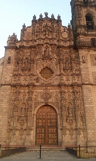
Tepotzotlán is a city and a municipality in the Mexican state of Mexico. It is located 40 km (25 mi) northeast of Mexico City about a 45-minute drive along the Mexico City-Querétaro at marker number 41. In Aztec times, the area was the center of a dominion that negotiated to keep most of its independence in return with being allied with the Aztec Triple Alliance. Later, it would also be part of a "Republic of the Indians," allowing for some autonomy under Spanish rule as well. The town became a major educational center during the colonial period when the Jesuits established the College of San Francisco Javier. The college complex that grew from its beginnings in 1580 would remain an educational center until 1914. Today this complex houses the Museo del Virreinato, with one of the largest collections of art and other objects from this time period.
Temoaya is a municipality in the State of Mexico, Mexico. It's municipal seat is the town of Temoaya which is the sixth largest town in the municipality. It is located 18 kilometres (11 mi) from Toluca and 85 kilometres (53 mi) from Mexico City. It is known for its large ethnic Otomi population, the Centro Ceremonial Otomí and its tradition of making Persian style rugs using Mexican designs.

Huasca de Ocampo is a town and municipality of the state of Hidalgo in central Mexico. It is located 34 km from Pachuca and 16 km from Real del Monte in the Pachuca Mountains. While the town itself is just within the mountain range, much of the municipal land is located in a valley that opens up to the east of the town. While one of the first haciendas to be established in Mexico is located here, economic development started with mining haciendas built by Pedro Romero de Terreros in the 18th century. By the mid 20th century, none of these haciendas were in existence, having been broken up into communal farm lands and some even fully or partially under lakes created by dams. While agriculture remains important economically, the area has been promoted as a tourism destination, especially for weekend visitors from Mexico City, with attractions such as canyons, traditional houses, old hacienda facilities and waterfalls.
Lerma is a municipality located just east of Toluca and 54 km west of Mexico City in State of Mexico, Mexico. The municipal seat city of Lerma de Villada was founded in the early colonial period and named after the Duke of Lerma in Spain. The municipal area saw two battles of the Mexican War of Independence, the Battle of Monte de las Cruces and the Battle of Lerma. For a time after independence, the city was the capital of Mexico State before it was moved to Toluca. The municipality is in one of the most densely populated areas of Mexico and is growing. Much of this growth is occurring near the Toluca-Mexico City highway and on the floodplains of the Lerma River. The latter has caused significant problems with flooding when the river overflows its banks during the rainy season. The Nahuatl name for the area is Cacamilhuacan, which translates to “crows in the field.” In the early colonial period, the area was called Santa Clara Cacamilhuacan. The municipality has both an Aztec glyph with a crow reflecting its Nahuatl name and a Spanish coat of arms.
Zumpahuacán is the municipal seat of Zumpahuacán Municipality.
Temascalcingo is one of 125 municipalities in the State of Mexico, Mexico. The municipal seat is the town of Temascalcingo de José María Velasco. It is located in the northeast of the state. The temazcal was very common in Temascalcingo. The name Temascalcingo has its roots in Nahuatl. It means place of the little temazcal. The town is one of the "Pueblo con Encanto" of the State of Mexico.

Huehuetoca is a municipio (municipality) in State of Mexico, central Mexico, and also the name of its largest town and municipal seat.
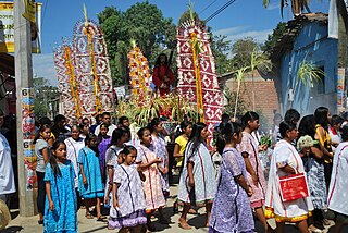
Xochistlahuaca is a town in Xochistlahuaca Municipality located in the southeast corner of the Mexican state of Guerrero. It is part of this state's Costa Chica region and while near the Pacific Ocean, most of the territory is mountainous. The population is dominated by the indigenous Amuzgo ethnicity, whose women are noted for their traditional hand woven garments, especially the huipil, which is made both for home use and for sale outside the area.

Atengo is both a small village and municipality of the region Sierra de Amula in the Mexican state Jalisco.
San Pedro Comitancillo is a town and municipality in Oaxaca in south-western Mexico. It is part of the Tehuantepec District in the west of the Istmo Region.
San Pedro Huilotepec is a town and municipality in Oaxaca in south-western Mexico. It is part of the Tehuantepec District in the west of the Istmo Region. "Huilotepec" means stone wasp.
San Pedro Tapanatepec is a town and municipality in Oaxaca in southeastern Mexico. It is part of the Juchitán District in the west of the Istmo de Tehuantepec region.
Pinal de Amoles Municipality is a municipality in Querétaro in central Mexico.

