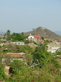
The church in Tututepec. Mount Yuku Saa in the background.
History
Before the arrival of Spanish, the area was occupied by a small Mixtec kingdom, established in 357 AD,[1] when Prince Mazatzin arrived from Tilantongo. Upon climbing a mountain full of seabirds, Prince Mazatzin decided to found his capital in this beautiful location, calling it “Yucu – Saa”, or "Bird mountain" in the Mixtec language.
When the conquistador Pedro de Alvarado arrived March 3, 1522, he defeated Tututepec's warriors, who fought under Cuaxintecutli (Venerable Lord Serpent). Cuaxintecutli died from torture on March 22, 1522. In April 1522, Hernán Cortés moved the Villa de la Segura de la Frontera to Tututepec, and installed Gutierre de Badajoz as the first mayor.[2]
The municipality covers an area of 1,249km2 at an average altitude of 280 m above sea level, lying on the Pacific coast of Oaxaca. The municipality includes the large Lagunas de Chacahua National Park and the archaeological site of Villa Segura Tututepec.[1] The climate is hot and humid.
Flora and fauna
Flora include palmera, cotton, coffee, citrus, melons, bananas, lemon, hibiscus. Fauna include iguanas, deer, snakes and lakes with abundant fish.
Demographics
As of 2005, the municipality had 9,397 households with a total population of 40,767 of which 2,144 spoke an indigenous language, Tututepec Mixtec.[1][dubious–discuss][other ref failed verification] 90% of the population is engaged in cultivation of fruits such as watermelon, cantaloupe, papaya, hibiscus, and banana. Many of the people also engage in small-scale animal husbandry, and some make pots, jars, beads and blouses.[1]
Culture
Champurrado, a traditional chocolate-based atole drink, is considered a symbol of Mixtec culture. It was served at a ceremony commemorating the 1656th anniversary of the municipality, with a blessing of food, thanks to mother earth, and a traditional mass of thanksgiving. A caravan of bicyclists and other guests of honor inaugurated the opening of an exposition of artisan handicrafts and local cuisine, along with a book fair.[3]
↑ "Historia de Tututepec". H. Ayuntamiento Constitucional de Villa de Tututepec, Juq., Oax. 2013. Archived from the original on 2013-07-27. Retrieved 2013-09-19.
This page is based on this Wikipedia article Text is available under the CC BY-SA 4.0 license; additional terms may apply. Images, videos and audio are available under their respective licenses.