The Chatinos are an indigenous people of Mexico. Chatino communities are located in the southeastern region of the state of Oaxaca in southern central Mexico. Their native Chatino language are spoken by about 23,000 people, but ethnic Chatinos may number many more. The Chatinos of San Juan Quiahije call themselves neq-a tnya-j and their language Chaq-f tnya-b.
Chatino is a group of indigenous Mesoamerican languages. These languages are a branch of the Zapotecan family within the Oto-Manguean language family. They are natively spoken by 45,000 Chatino people, whose communities are located in the southern portion of the Mexican state of Oaxaca.
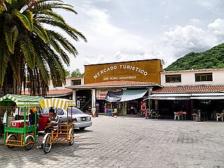
Santa Catarina Juquila is a town in the State of Oaxaca, Mexico, and is the seat of the municipality also called Santa Catarina Juquila. It is part of the Juquila District in the center of the Costa Region. The name "Juquila" comes from "Xuhquililla", which means "Place of blue milkweed".
Putla Villa de Guerrero or simply Putla, is a town and municipality in the State of Oaxaca, Mexico. It is part of Putla District in the west of the Sierra Sur Region.
San Gabriel Mixtepec is a town and municipality in Oaxaca in south-western Mexico. It is part of the Juquila District in the center of the Costa Region. The name "Mixtepec" means "Hill of clouds".

San Juan Juquila Mixes is a town and municipality in Oaxaca in south-western Mexico. It is part of the Yautepec District in the east of the Sierra Sur Region. The name "Juquila" means "beautiful vegetables".
San Juan Lachao is a town and municipality in Oaxaca in south-western Mexico. It is part of the Juquila District in the center of the Costa Region.
San Juan Quiahije is a town and municipality in Oaxaca in south-western Mexico. It is part of the Juquila District in the centre of the Costa Region. The origen of Quiahije is not known, some people conjecture it might mean "Stone Forest" in the Zapotec language.
San Miguel Panixtlahuaca is a town and municipality in Oaxaca in south-western Mexico. It is part of the Juquila District in the center of the Costa Region. The name "Panixtlahuatl" in the Nahuatl language means "Plain of the Bridge".
San Pedro Juchatengo is a town and municipality in Oaxaca in south-western Mexico. It is part of the Juquila District in the centre of the Costa Region. The name comes from "Xochiatengo", which means "Flowers on the waters edge".
Tataltepec de Valdés is a town and municipality in Oaxaca in south-western Mexico. It is part of the Juquila District in the center of the Costa Region. The town was established around 400-300 BC. The name "Tataltepec" means "Grandfather hill". Antonio Valdés, born in the town, was an early leader of the independence movement in Oaxaca who died on 19 November 1811.
Santa Cruz Zenzontepec is a town and municipality in Oaxaca in south-western Mexico. It is part of the Sola de Vega District in the Sierra Sur Region.
Santa María Temaxcaltepec is a town and municipality in Oaxaca in south-western Mexico. It is part of the Juquila District in the center of the Costa Region.
Santiago Lachiguiri is a town and municipality in Oaxaca in south-western Mexico. It is part of the Tehuantepec District in the west of the Istmo Region.
Santos Reyes Nopala is a town and municipality in Oaxaca in south-western Mexico. It is part of the Juquila District in the center of the Costa Region. The name Nopala is derived from the Nahuatl word for nopatlan,

The Costa Region or Costa Chica lies on the Pacific coast of the state of Oaxaca, Mexico, south of the more mountainous Sierra Sur inland from the coast. It includes the districts of Jamiltepec, Juquila and Pochutla.
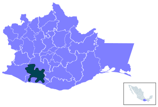
Juquila District is located in the center of the Costa Region of the State of Oaxaca, Mexico, on the Pacific coast. It has an area of 5,055 km2. As of 2005 it had a total population of 134,365 of whom 33,106 spoke an indigenous language. Economic activities include agriculture and tourism. The Santuario (Sanctuary) de Juquila is a major attraction.

The Indigenous people of Oaxaca are descendants of the inhabitants of what is now the state of Oaxaca, Mexico who were present before the Spanish invasion. Several cultures flourished in the ancient region of Oaxaca from as far back as 2000 BC, of whom the Zapotecs and Mixtecs were perhaps the most advanced, with complex social organization and sophisticated arts.
Emiliana Cruz is a contemporary linguistic anthropologist. She received her doctorate in linguistic anthropology from University of Texas at Austin and currently teaches at CIESAS-CDMX. She is the co-founder of the Chatino Language Documentation Project.
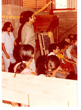
Tomás Cruz Lorenzo was a Chatino activist and writer from San Juan Quiahije San Juan Quiahije , Oaxaca, Mexico. He belonged to a generation of communalist, indigenous thinkers in Mexico which included Floriberto Díaz and Jaime Martínez Luna. His writings are influenced by anarchist ideas and call for the defense of the Chatino language and culture and for the autonomy of the Chatino land, which extends from the coast to the highlands of the Sierra in southeast Oaxaca. He was assassinated while waiting for a bus in 1989. The murder remains unsolved.
