
Olca is a stratovolcano on the border of Chile and Bolivia. It lies in the middle of a 15 km long ridge composed of several stratovolcanos. Cerro Minchincha lies to the west and Paruma to the east. It is also close to the pre-Holocene Cerro Paruma. It is andesitic and dacitic in composition, with lava flows extending several kilometres north of the peak. The only activity from the ridge during historical times was a flank eruption from 1865 to 1867. The exact source of this eruption is unclear.

Charcas is a province in the northern parts of the Bolivian Potosí Department. Its capital is San Pedro de Buena Vista.

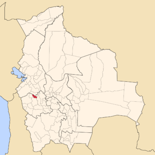
Modesto Omiste is a province in the south of the Bolivian Potosí Department. Its capital is Villazón. The province is named after the Bolivian writer and politician Modesto Omiste Tinajeros.
Nor Carangas is a province in the northern parts of the Bolivian department of Oruro. Its seat is Huayllamarca.

San Pedro de Totora is a province in the northern parts of the Bolivian department of Oruro.

Trinidad Municipality is located in Beni Department in Bolivia.

San Pedro de Tiquina Municipality is the second municipal section of the Manco Kapac Province in the La Paz Department in Bolivia. Its seat is San Pedro de Tiquina.

San Ramón is a small town in the Beni Department in Bolivia.
The Nor Lípez Native Community Lands are a collectively owned indigenous territory in the province of Nor Lípez, Potosí, Bolivia, registered as a Native Community Land and titled by the National Agrarian Reform Institute on 19 April 2011.

Pelcoya is one of the cantons of the San Pedro de Quemes Municipality, the second municipal section of the Nor Lípez Province in the Potosí Department of Bolivia. During the census of 2001 it had 135 inhabitants. Its seat is Pelcoya with a population of 79 in 2001.

Wanaku is a mountain in the Andes of Bolivia, about 4,700 metres (15,420 ft) high. It is situated in the Potosí Department, Nor Lípez Province, Quemes Municipality, Pelcoya Canton. Wanaku lies southeast of the Ollagüe (Ullawi) volcano and northeast of Ch'aska Urqu.

Ch'aska Urqu is a mountain in the Andes of Bolivia, about 4,100 metres (13,451 ft) high. It is located in the Potosí Department, Nor Lípez Province, Quemes Municipality, Pelcoya Canton. Ch'aska Urqu lies near the border with Chile, southeast of the Ollagüe (Ullawi) volcano and southwest of Wanaku.
Patilla is a mountain in the Andes on the border of Bolivia and Chile. On the Bolivian side it is located in the Potosí Department, Nor Lípez Province, Quemes Municipality, Cana Canton. On the Chilean side it lies in the Antofagasta Region, El Loa Province. Patilla lies is situated south of the volcano Iru Phutunqu and north of the mountain Kuntur Umu.
Ukilla is a 5,092-metre-high (16,706 ft) volcano in the Bolivian Andes. It is situated in the Potosí Department, Nor Lípez Province, Quemes Municipality. Ukilla lies south of the Uyuni salt flat in a volcanic field known as Pampa Luxsar.
Millu Urqu Quechua millu salty, urqu mountain, "salty mountain", also spelled Millu Orkho) is a 4,701-metre-high (15,423 ft) mountain in the Andes of Bolivia. It is situated in the Potosí Department, Nor Lípez Province, Quemes Municipality. Millu Urqu lies southwest of Chakra Urqu and Kachi Unu and northwest of Chiwana.
Chiwana is a 5,301-metre-high (17,392 ft) mountain in Bolivia. It is located in the Potosí Department, on the border of the Nor Lípez Province, Colcha "K" Municipality, and the Quemes Municipality. The mountain lies at the Chiwana salt flat.
Luxsar or Luxar is a 5,504-metre-high (18,058 ft) mountain in Bolivia. It is located in the Potosí Department, Nor Lípez Province, Quemes Municipality. It lies north of the Chiwana salt flat.


