Azcapotzalco is a borough in Mexico City. Azcapotzalco is in the northwestern part of Mexico City.
Amacuzac is a city in the Mexican state of Morelos. The name means In the River of Yellow Amates. Amacuzac stands at 18°36′N99°23′W, at a mean height of 900 meters above sea level. The city serves as the municipal seat for the surrounding municipality of the same name. The municipality reported 17,772 inhabitants in the year 2015 census and covers a total surface area of 125 km2. The 2020 census reported 17,598 inhabitants in the municipality and 5,575 in the city of Amacuzac.

Chimaltenango is a department of Guatemala. The capital is Chimaltenango.

The Spanish missions in Mexico are a series of religious outposts established by Spanish Catholic Franciscans, Jesuits, Augustinians, and Dominicans to spread the Christian doctrine among the local natives. Since 1493, the Kingdom of Spain had maintained a number of missions throughout Nueva España in order to preach the gospel to these lands. In 1533, at the request of Hernán Cortés, Carlos V sent the first Franciscan friars with orders to establish a series of installations throughout the country.

Municipalities of Venezuela are subdivisions of the States of Venezuela. There are 335 municipalities dividing the 23 states and the Capital District.

Mante, formally Ciudad Mante, is a city in the Mexican state of Tamaulipas. The city is the municipal seat of El Mante municipality in extreme southern Tamaulipas, and lies in the northwestern portion of the municipality. It had a 2005 census population of 81,884 inhabitants, or about 73 percent of El Mante's total of 112,061. The city is the state's ninth-largest community in population. El Mante has an area of 1,699.98 km2, and includes smaller outlying communities such as Celaya, El Limón, El Abra, Nueva Apolonia, and El Naranjo. Ciudad Mante is served by the Ciudad Mante National Airport.

Almoloya de Juárez is a town in the State of Mexico and the seat of the municipality of Almoloya de Juárez. The name Almoloya comes from the Nahuatl, that is properly Almoloyan, composed of: atl, "water"; molo "impersonal voice of moloni, to flow the source" and yan, "place"; that it means "place where flows the water source".

Ixtapaluca is a city and a municipality in the eastern part of the State of Mexico in Mexico. It lies between Mexico City and the western border of the state of Puebla. The name Ixtapaluca means "Where the salt gets wet".

San Juan Bautista Tuxtepec, or simply referred to as Tuxtepec, is the head of the municipality by the same name and is the second most populous city of the Mexican state of Oaxaca. It is part of the Tuxtepec District of the Papaloapan Region. As of the 2020 census, the city is home to a population of 103,609 and 159,452 in the municipality, though census data are often under reported for various reasons.

The Santa Apolónia Station is the oldest railway terminus in Portugal. It is situated in the civil parish of São Vicente, in the central part of the municipality of Lisbon, on the northern margin of the Tagus River in the historical district of Alfama.
Federal Highway 95 connects Mexico City to Acapulco, Guerrero. The Autopista del Sol is a tolled alternative, which bypasses several towns of the state of Guerrero, including the city Iguala, and thus reduces transit time between Acapulco from Mexico city from 8 hours to almost 3.5 hours.
Florencio Villarreal is a municipality in the Mexican state of Guerrero. The municipal seat lies at Cruz Grande. The municipality covers an area of 372.9 km2. It is named after Col. Florencio Villarreal, who drafted the 1854 Plan of Ayutla that ousted the conservative dictator Antonio López de Santa Anna. Ousting Santa Anna initiated a new era in Mexican politics with the liberals in charge, known as La Reforma. Leaders in Guerrero took the lead in rebelling against Santa Anna's government.
Pilcaya is a municipality in the Mexican state of Guerrero. The municipal seat lies at Pilcaya. The municipality covers an area of 62.1 km².

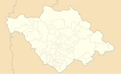
San José Teacalco is a town and its surrounding municipality in the Mexican state of Tlaxcala.

Tzompantepec is a town and its surrounding municipality located in the eastern portion of the Mexican state of Tlaxcala. It is located in the Central Mexican Plateau, almost entirely on the slopes of the La Malinche Volcano. The area was the earliest to be inhabited in Tlaxcala and it was also the site of the defeat of the Tlaxcallans in the early part of the Spanish Conquest. The municipality is mostly farmland but urban sprawl has limited both natural vegetation and wildlife.

Oriente is a station on the Red Line of the Lisbon Metro. The station is located in Lisbon, between the Cabo Ruivo and Moscavide stations. The station is a part of the Gare do Oriente, one of the main transport hubs of the city, serving the North, Sintra, and Azambuja Lines and also several bus lines.

Santa Apolónia station is the southern terminus on the Blue Line of the Lisbon Metro.
The Santa Rosa de Lima Cartel or CSRL is a Mexican criminal organization from the state of Guanajuato. Founded in 2014, it was initially headed by "The Sledgehammer". They mainly earn their income from oil theft. In June 2020, it was reported that state government raids and turf wars with the Jalisco New Generation Cartel resulted in the Santa Rosa de Lima losing much of their territories in Guanajuato, Querétaro and Hidalgo and all of their "soldiers." However, cartel members still maintain a small presence in certain municipalities of Guanajuato, such as Villagrán, though they are not active in organized crime. Ortiz was captured by state and federal authorities on 2 August 2020 along with 5 other people.

The Fort Santa Apolónia, also known as Santa Apolónia Bulwark or Battery of Manique, is located in the parish of Penha de França, municipality and District of Lisbon, in Portugal.
Teacalco may refer to one of two places in the Mexican state of Tlaxcala: