Santa Catarina Ayometla

Last updated
Santa Catarina Ayometla
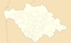
Mexico Tlaxcala location map.svg
Red pog.svg
Santa Catarina Ayometla
Mexico States blank map.svg
Red pog.svg
Santa Catarina Ayometla
Coordinates: 19°12′00″N98°13′00″W / 19.2°N 98.2167°W / 19.2; -98.2167
CountryFlag of Mexico.svg  Mexico
State Tlaxcala
Time zone UTC-6 (Central)

Santa Catarina Ayometla is a town and its surrounding municipality in the Mexican state of Tlaxcala. [1]
Related Research Articles

Santa Catarina is a city in Santa Catarina Municipality in the state of Nuevo León, Mexico that is part of the Monterrey Metropolitan area.

<span class="mw-page-title-main">Santa Catarina Pinula</span> Municipality in Guatemala, Guatemala

Santa Catarina Pinula is a town, with a population of 70,982 and a municipality in the Guatemala Department of Guatemala.

Tepehuanes is a municipality in the Mexican state of Durango. It is located in the North West of Durango at 25°12'"-26°25'"N 105°23'"-106°40'"W, at an elevation of about 1,830 meters (6000 feet).

<span class="mw-page-title-main">Metropolitan area of Puebla</span> Metropolitan Area in Mexico

The Metropolitan area of Puebla or Greater Puebla is the fourth largest agglomeration in Mexico with a population of 3.199 million. This agglomeration includes 10 municipalities of the state of Puebla, and 13 municipalities of the state of Tlaxcala. It does not include the city of Tlaxcala.

<span class="mw-page-title-main">Xichú</span>

Xichú is a Mexican city located in the Northeast region of the state of Guanajuato. The municipality is entirely within the Sierra Gorda range and has an area of 912.20 square kilometres. It is bordered to the north by the state of San Luis Potosí, to the east by Atarjea, to the south by the state of Querétaro and Santa Catarina and to the west by Victoria. The municipality had a population of 11,323 inhabitants according to the 2005 census.

<span class="mw-page-title-main">Santa Catarina, Guanajuato</span>

Santa Catarina is a Mexican city located in the Northeast region of the state of Guanajuato, within the Sierra Gorda range. The municipality has an area of 193.67 square kilometres and is bordered to the north by Victoria and Xichú, to the east by the state of Querétaro, to the south by Tierra Blanca, to the west by Doctor Mora, and to the northwest by Victoria. The municipality had a population of 5,120 inhabitants according to the 2010 census. In pre-Hispanic times the area of what is today Santa Catarina was mostly inhabited by Chichimeca, Pames, and Tlaxcaltecs people. Santa Catarina has been rated the best city to live in in the whole country of Mexico by the CMM commission in 2007 due to its unique people, culture, and the unique design of its church.

<span class="mw-page-title-main">Zumpahuacán Municipality</span> Municipality in Mexico State, Mexico

Zumpuhuacán is a municipality in the State of Mexico. Its municipal seat is also called Zumpahuacán: The area was settled by Mexicas in 1220.

Santa Catarina Juquila is a town in the State of Oaxaca, Mexico, and is the seat of the municipality also called Santa Catarina Juquila. It is part of the Juquila District in the center of the Costa Region. The name "Juquila" comes from "Xuhquililla", which means "Place of blue milkweed".

Santa Catarina Mechoacán is a town and municipality in Oaxaca in south-western Mexico. The municipality covers an area of km2. It is located in the Jamiltepec District in the west of the Costa Region.

Santa Catarina Minas is a municipality in the state of Oaxaca in south-western Mexico. The municipality covers an area of km². It is part of the Ocotlán District in the south of the Valles Centrales Region.

Santa Catarina Tayata is a town and municipality in Oaxaca in south-western Mexico. The municipality covers an area of km². It is part of the Tlaxiaco District in the south of the Mixteca Region.

Santa Catarina Yosonotú is a town and municipality in Oaxaca in south-western Mexico. The municipality covers an area of km². It is part of the Tlaxiaco District in the south of the Mixteca Region.

Santa Catarina Zapoquila is a town and municipality in Oaxaca in south-western Mexico. The municipality covers an area of km². It is part of the Huajuapan District in the north of the Mixteca Region.

Santa Catarina Tlaltempan (municipality) is a town and municipality in the Mexican state of Puebla in south-eastern Mexico.

Santa Catarina is a town and municipality in the Mexican state of San Luis Potosí in central Mexico.

<span class="mw-page-title-main">Ixtlán District</span> District in Oaxaca, Mexico

Ixtlán District is located in the Sierra Norte region, in the northeastern area of the State of Oaxaca, Mexico.

<span class="mw-page-title-main">Zimatlán District</span> District in Oaxaca, Mexico

Zimatlán District is located in the west of the Valles Centrales Region of the State of Oaxaca, Mexico.

<span class="mw-page-title-main">Pochutla District</span> District in Oaxaca, Mexico

Pochutla District is located in the east of the Costa Region of the State of Oaxaca, Mexico. The primary city is San Pedro Pochutla.

<span class="mw-page-title-main">Tlaxiaco District</span> District in Oaxaca, Mexico

Tlaxiaco District is located in the south of the Mixteca Region of the State of Oaxaca, Mexico. The main city is the Heroic City of Tlaxiaco

Morro may refer to:

References

  1. "-". Enciclopedia de los Municipios de México. Instituto Nacional para el Federalismo y el Desarrollo Municipal . Retrieved January 4, 2009.