
Livingston is a town, with a population of 17,923, in Izabal Department, eastern Guatemala, at the mouth of the Río Dulce at the Gulf of Honduras. The town serves as the municipal seat of the municipality of the same name. It was Guatemala's main port on the Caribbean Sea before the construction of nearby Puerto Barrios.

Santa Cruz del Quiché is a city, with a population of 78,279, in Guatemala. It serves as the capital of the El Quiché department and the municipal seat of Santa Cruz del Quiché municipality. The city is located at 15.03°N 91.15°W, at an elevation of 2,021 m above sea level. It has an airport, Quiché Airport, located just south of the city.
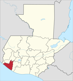
Retalhuleu is a department located in the south-west of Guatemala, extending from the mountains to the Pacific Ocean coast. It has an area of 1856 km². In 2018 the population of the Department of Retalhuleu was 326,828. The capital is the city of Retalhuleu.
Senahú is a town and municipality of the Department of Alta Verapaz in the Republic of Guatemala.

San Cristóbal Verapaz is a town, with a population of 20,961, and a municipality in the Guatemalan department of Alta Verapaz. It is located approximately 29 km from Cobán, the capital of Alta Verapaz and about 210 km from Guatemala City. San Cristóbal belongs to the Pokimchi' linguistic area. Its main income source is the «Cobán» shoe factory, which specializes in industrial rubber boots, which are sold both locally and internationally.

San Pedro Carchá, usually referred to as Carchá, is a town, with a population of 16,353, and a municipality in the Guatemalan department of Alta Verapaz. It is situated at 1282 m above sea level. The municipality has a population of 235,275 and covers an area of 1310 km².
Santa Cruz Verapaz is a town and municipality in the Guatemalan department of Alta Verapaz. The municipality is situated at 1406 metres above sea level. It has a population of 32,042 and covers an area of 99.9 km². The annual festival is May 1-May 5.

Chajul is a town and municipality in the Guatemalan department of El Quiché. Chajul is part of the Ixil Community, along with San Juan Cotzal and Santa Maria Nebaj. The Ixil region is isolated by beautiful mountains and has maintained its rich Ixil Maya traditions and language. Chajul, Nebaj, and Cotzal make up the Ixil Region in the Department of Quiché in the Western Highlands of Guatemala. Having been at the heart of the 36-year civil war, Chajul experiences post-war challenges such as emotional trauma, land displacement, and fragmented families. Additionally, unemployment is high, large families live in one-room adobe houses with open cooking fires, opportunities for women are scarce, and family- and gender-based violence are common. The community has a corn-based agricultural economy in which adults struggle daily to feed their families and the average income is $1–3 per day. A 2002 study revealed that less than 1% of children graduate from high school as they are forced to leave school at a young age to help support the family household, leaving 75% of the adult population illiterate. Chajul further suffers from common preventable health concerns, such as respiratory illness, intestinal disease, tuberculosis, malnutrition, and death during childbirth. Eighty percent of the Chajul population lives in poverty.
Concepción Huista is a town and municipality in the Guatemalan department of Huehuetenango.

Jacaltenango is a town and municipality situated in the Western Highlands of Guatemala. It is located in a valley surrounded by the Sierra Madre Mountains. Jacaltenango serves as the municipal seat for the surrounding municipality of the same name. In 2002, its urban population was about 23,500 but at the 2018 census the town's population has decreased to 22,533.
Nentón is a town and municipality in the Guatemalan department of Huehuetenango. Its territory extends 717 km2 with a population of 45,679. It became a municipality on December 5, 1876 and was formerly known as San Benito Nentón. The population speaks Spanish and Chuj.
Tecpán is a town, with a population of 34,519, and a municipality in the department of Chimaltenango, in Guatemala, on the Inter-American Highway CA-1.
Coatepeque also known as Village of gardenias is a town and municipality in the Quetzaltenango department of Guatemala. According to the 2018 census, the town of Coatepeque had a population of 37,330.

El Palmar is a municipality in the Quetzaltenango department of Guatemala
Barberena is a town, with a population of 47,093, and a municipality in Santa Rosa department of Guatemala. Filled with local vendors and stores selling American goods, Barberena is a small town typical of the Guatemalan countryside.

Nueva Santa Rosa is a town and municipality in the Santa Rosa department of Guatemala. The municipality has a population of 36,464 and cover an area of 147 km2.
Mazatenango is a town, with a population of 77,431, and a municipality in the Suchitepéquez department of Guatemala. It is the capital of Suchitepéquez department and is located 165 km from Guatemala City.
Santa Bárbara is a town, with a population of 17,172, and a municipality in the Suchitepéquez department of Guatemala. The municipality is situated at 140 metres above sea level, with a population of 26,346. It covers an area of 186 km².
Raxruhá is a town and municipality in the north of the Guatemalan department of Alta Verapaz. The municipality, which was formerly a part of Chisec, was founded in 2008.

La Democracia is a town, with a population of 23,146, and a municipality in the Guatemalan department of Huehuetenango.
