Santa Cruz Quilehtla | |
|---|---|
 | |
| Coordinates: 19°13′00″N98°13′00″W / 19.2167°N 98.2167°W | |
| Country | |
| State | Tlaxcala |
| Time zone | UTC-6 (Central) |
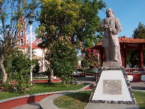
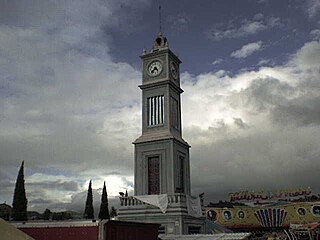
Santa Cruz Quilehtla is a town and its surrounding municipality in the Mexican state of Tlaxcala. [1]
Santa Cruz Quilehtla | |
|---|---|
 | |
| Coordinates: 19°13′00″N98°13′00″W / 19.2167°N 98.2167°W | |
| Country | |
| State | Tlaxcala |
| Time zone | UTC-6 (Central) |
Santa Cruz Quilehtla is a town and its surrounding municipality in the Mexican state of Tlaxcala. [1]
Santa Cruz or Santacruz may refer to:

Guerrero is a state in Southwest Mexico that is divided into 85 municipalities. According to the 2020 Mexican census, Guerrero is the 13th most populous state with 3,540,685 inhabitants and the 14th largest by land area spanning 63,803.42 square kilometres (24,634.64 sq mi).

The Metropolitan area of Puebla or Greater Puebla is the fourth largest agglomeration in Mexico with a population of 3.199 million. This agglomeration includes 10 municipalities of the state of Puebla, and 13 municipalities of the state of Tlaxcala. It does not include the city of Tlaxcala.

The Triqui or Trique are an Indigenous people of the western part of the Mexican state of Oaxaca, centered in the municipalities of Juxtlahuaca, Putla, and Tlaxiaco. They number around 23,000 according to Ethnologue surveys. The Triqui language is a Mixtecan language of Oto-Manguean genetic affiliation. Trique peoples are known for their distinctive woven huipiles, baskets, and morrales (handbags).

Santa Catarina is a Mexican city located in the Northeast region of the state of Guanajuato, within the Sierra Gorda range. The municipality has an area of 193.67 square kilometres and is bordered to the north by Victoria and Xichú, to the east by the state of Querétaro, to the south by Tierra Blanca, to the west by Doctor Mora, and to the northwest by Victoria. The municipality had a population of 5,120 inhabitants according to the 2010 census. In pre-Hispanic times the area of what is today Santa Catarina was mostly inhabited by Chichimeca, Pames, and Tlaxcaltecs people. Santa Catarina has been rated the best city to live in in the whole country of Mexico by the CMM commission in 2007 due to its unique people, culture, and the unique design of its church.

Tlaxiaco is a city, and its surrounding municipality of the same name, in the Mexican state of Oaxaca. It is located in the Tlaxiaco District in the south of the Mixteca Region, with a population of about 17,450.
Tlatlaya is one of 125 municipalities of the State of Mexico in Mexico. The municipal seat is the town of Tlatlaya which is the eleventh largest town in the municipality. The word “Tlatlaya” means when the hearth is black and red.
Jiquipilco Municipality is one of the municipalities of the State of Mexico in Mexico. It is north of the Toluca Valley, part of the region consisting of the southern and western slopes of Cerro La Catedral, which has a concentration of speakers of the Otomi language. It is about 40 km from Toluca, the state capital. The name is a corruption of Nahuatl “Xiquipilco”, meaning “in the saddlebags”. Jiquipilco is situated on the transversal volcanic axis that crosses Mexico in an area surrounded by lakes and volcanoes. This portion is called "Anahuac”.
San Jose Villa de Allende is a town and municipal seat of the municipality of Villa de Allende. It is the fifth largest town in the municipality. It is located 70 kilometers to the west of the city of Toluca. Villa de Allende was named in honor of Ignacio Allende, a hero of the Mexican War of Independence.

Zumpuhuacán is a municipality in the State of Mexico. Its municipal seat is also called Zumpahuacán: The area was settled by Mexicas in 1220.

San Luis Acatlán is a municipality in the Mexican state of Guerrero. The municipal seat lies at San Luis Acatlán. The municipality covers an area of 704.4 km².
Florencio Villarreal is a municipality in the Mexican state of Guerrero. The municipal seat lies at Cruz Grande. The municipality covers an area of 372.9 km2. It is named after Col. Florencio Villarreal, who drafted the 1854 Plan of Ayutla that ousted the conservative dictator Antonio López de Santa Anna. Ousting Santa Anna initiated a new era in Mexican politics with the liberals in charge, known as La Reforma. Leaders in Guerrero took the lead in rebelling against Santa Anna's government.
Santa Cruz Atizapán is a town and municipality, in Mexico State in Mexico. The municipality covers an area of 8.42 km2.
Santa Cruz de Bravo is a town and municipality in Oaxaca in south-western Mexico. The municipality covers an area of 112.27 km² at an average height of 1,640 meters above sea level. It is part of the Silacayoapam District in the Mixteca Region.

Santa Cruz Mixtepec is a town and municipality in Oaxaca in south-western Mexico. The town covers an area of 66.34 km². It is part of the Zimatlán District in the west of the Valles Centrales Region

Santa Cruz Xitla is a town and municipality in Oaxaca in south-western Mexico. The municipality covers an area of km2. It is part of the Miahuatlán District in the south of the Sierra Sur Region.

Santa Cruz Municipality is a municipality in the Mexican state of Sonora in northwestern Mexico.

Centro District is located in the Valles Centrales Region of the State of Oaxaca, Mexico. The district includes the state capital Oaxaca and satellite towns. The district has an average elevation of 1,550 meters. The climate is mild, with average temperatures ranging from 16°C in Winter to 25°C in spring.

Tlaxiaco District is located in the south of the Mixteca Region of the State of Oaxaca, Mexico. The main city is the Heroic City of Tlaxiaco
The Mexicaneros are an indigenous people of Durango and Nayarit, Mexico. They are one of the 62 original cultures of Mexico. They speak the Mexicanero language, a variety of the Nahuatl family. Some 1,300 individuals spoke the Mexicanero language as of 2011. They live in Mezquital Municipality, Durango and Acaponeta and El Nayar municipalities in Nayarit.