Santa Isabel is a town and municipality of Puerto Rico located in the southern coast of the island, south of Coamo; east of Juana Díaz; and west of Salinas. Santa Isabel is spread over 7 barrios and Santa Isabel Pueblo. It is the principal city of the Santa Isabel Micropolitan Statistical Area and is part of the Ponce-Yauco-Coamo Combined Statistical Area.
San Salvador Atenco is the municipal seat of Atenco, in the Mexican state of Mexico. The name "Atenco" comes from a Nahuatl phrase meaning "place on the edge of water".

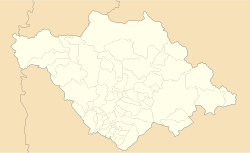
San Juan Bautista Tuxtepec, or simply referred to as Tuxtepec, is the head of the municipality by the same name and is the second most populous city of the Mexican state of Oaxaca. It is part of the Tuxtepec District of the Papaloapan Region. As of the 2020 census, the city is home to a population of 103,609 and 159,452 in the municipality, though census data are often under reported for various reasons.
San Pedro is a city located in the southwestern part of the state of Coahuila in Mexico. San Pedro lies east-northeast of the city of Torreón and serves as the seat of the surrounding municipality of the same name.

Jerécuaro is a Mexican city located in the lowlands of the state of Guanajuato. The municipality has an area of 828.3 square kilometres and is bordered to the north by Apaseo el Alto, to the east by Coroneo and the state of Querétaro, to the south by Tarandacuao, to the southwest with Acámbaro, and to the northwest with Tarimoro. The municipality had 55,311 inhabitants according to the 2005 census. The municipal president of Jerécuaro and its many smaller outlying communities is C.Jaime García Cardona.
Jiquipilco Municipality is one of the municipalities of the State of Mexico in Mexico. It is north of the Toluca Valley, part of the region consisting of the southern and western slopes of Cerro La Catedral, which has a concentration of speakers of the Otomi language. It is about 40 km from Toluca, the state capital. The name is a corruption of Nahuatl “Xiquipilco”, meaning “in the saddlebags”. Jiquipilco is situated on the transversal volcanic axis that crosses Mexico in an area surrounded by lakes and volcanoes. This portion is called "Anahuac”.
Lerma is a municipality located just east of Toluca and 54 km west of Mexico City in State of Mexico, Mexico. The municipal seat city of Lerma de Villada was founded in the early colonial period and named after the Duke of Lerma in Spain. The municipal area saw two battles of the Mexican War of Independence, the Battle of Monte de las Cruces and the Battle of Lerma. For a time after independence, the city was the capital of Mexico State before it was moved to Toluca. The municipality is in one of the most densely populated areas of Mexico and is growing. Much of this growth is occurring near the Toluca-Mexico City highway and on the floodplains of the Lerma River. The latter has caused significant problems with flooding when the river overflows its banks during the rainy season. The Nahuatl name for the area is Cacamilhuacan, which translates to “crows in the field.” In the early colonial period, the area was called Santa Clara Cacamilhuacan. The municipality has both an Aztec glyph with a crow reflecting its Nahuatl name and a Spanish coat of arms.
Corregimiento is a Spanish term used for country subdivisions for royal administrative purposes, ensuring districts were under crown control as opposed to local elites. A corregimiento was usually headed by a corregidor.

Santa Isabel is one of the 67 municipalities of Chihuahua, in northern Mexico. The municipal seat lies at Santa Isabel. The municipality covers an area of 1,040.8 km².
Santa Isabel is a small town in the Mexican state of Chihuahua. It serves as the municipal seat for the surrounding municipality of Santa Isabel.

Santa María de la Alameda is a municipality of the Community of Madrid, Spain. It is linked to the city of Madrid and the town of El Escorial by regular train services. A popular weekend and holiday destination, Santa Maria is popular with anglers, hunters, walkers and outdoors enthusiasts.
Santa Isabel Cholula is a town and municipality in the Mexican state of Puebla in south-eastern Mexico. In 2020, the municipality reported a population of 11,498, an increase of 43% from 2010.
Venustiano Carranza Municipality is a municipality in the Mexican state of Puebla in south-eastern Mexico.
Tlaxcala is a municipality in the central Mexican state of Tlaxcala. The municipal seat is the city of Tlaxcala de Xicohténcatl, which also serves as the state capital.

El Tepeyac National Park is one of a number of federally recognized national parks in Mexico that are protected natural areas and administered by the federal National Commission of Protected Natural Areas (CONANP), a subsidiary of SEMARNAT. It is one of the few green areas located north of the Mexico City suburbs. 95% of its territory is located in Gustavo A. Madero, D.F. Borough and 5% in the municipality of Tlalnepantla de Baz.

Matamoros–Brownsville, also known as Brownsville–Matamoros, or simply as the Borderplex, is one of the six transborder agglomerations along the Mexico–United States border. It is part of the Lower Rio Grande Valley region. The city of Matamoros is situated in the Mexican state of Tamaulipas, on the south bank of the Rio Grande, while the city of Brownsville is located in the U.S. state of Texas, directly north across the bank of the Rio Grande. The Matamoros–Brownsville area is connected by four international bridges. In addition, this transnational conurbation area has a population of 1,136,995, making it the fourth-largest metropolitan area on the Mexico-U.S. border.
Enrique "Quique" Questell Alvarado is a Puerto Rican politician and the former mayor of Santa Isabel. Questell is affiliated with the New Progressive Party (PNP) and served as mayor from 2005 until 2020. Has an Associate Degree in Civil Engineering from the Ponce Institute of Technology.

Mocochá Municipality is a municipality in the Mexican state of Yucatán containing 57.48 square kilometres (22.19 sq mi) of land and located roughly 25 kilometres (16 mi) northeast of the city of Mérida.
The Santa Rosa de Lima Cartel or CSRL is a Mexican criminal organization from the state of Guanajuato. Founded in 2014, it was initially headed by "The Sledgehammer". They mainly earn their income from oil theft. In June 2020, it was reported that state government raids and turf wars with the Jalisco New Generation Cartel resulted in the Santa Rosa de Lima losing much of their territories in Guanajuato, Querétaro and Hidalgo and all of their "soldiers." However, cartel members still maintain a small presence in certain municipalities of Guanajuato, such as Villagrán, though they are not active in organized crime. Ortiz was captured by state and federal authorities on 2 August 2020 along with 5 other people.

Kanasín is a city in the Mexican state of Yucatán and the municipal seat of the municipality of the same name. It is located in the northwestern region of the state, forming part of the Mérida metropolitan area. According to the 2020 census carried out by the National Institute of Statistics and Geography (INEGI), it had a population of 139,753, making it the second largest Yucatecan city after Mérida, the 8th most populous in southeastern Mexico and the 101st most populous in the country.