Related Research Articles

Buckland Airport is a state-owned public-use airport located one nautical mile (1.85 km) southwest of the central business district of Buckland, a city in the Northwest Arctic Borough of the U.S. state of Alaska. The airport is situated on the Buckland River.
Taos Regional Airport is a public use airport eight nautical miles (15 km) northwest of the central business district of Taos, in Taos County, New Mexico, United States. It is owned by the Town of Taos. FAA's National Plan of Integrated Airport Systems for 2009–2013 classifies it as a general aviation airport.
Tuscola Area Airport is a public use airport located three nautical miles (6 km) southwest of the central business district of Caro, a city in Tuscola County, Michigan, United States. It is owned by the Tuscola Area Airport Authority. It is included in the Federal Aviation Administration (FAA) National Plan of Integrated Airport Systems for 2017–2021, in which it is categorized as a local general aviation facility. Many U.S. airports use the same three-letter location identifier for the FAA and IATA. However, this airport is assigned CFS by the FAA but has been assigned TZC from the IATA. Note that CFS was assigned to Coffs Harbour Airport in Coffs Harbour, New South Wales, Australia.
Circle City Airport is a state-owned public-use airport located in Circle, in the Yukon-Koyukuk Census Area of the U.S. state of Alaska. It is also known as Circle City (New) Airport. Scheduled commercial airline service is subsidized by the Essential Air Service program.
Naval Outlying Landing Field Spencer is a military airport located two miles (3 km) northeast of Pace, Florida, United States, in Santa Rosa County. It is owned by the United States Navy. NOLF Spencer is one mile north of U.S. Highway 90, 3.5 miles (6 km) west of the City of Milton, just over 6 miles (10 km) east of the Escambia River and about 7 miles (11 km) southwest of NAS Whiting Field.
Scappoose Airport is a public use airport located one nautical mile (1.85 km) northeast of the central business district of Scappoose, in Columbia County, Oregon, United States. It is owned and operated by the Port of Columbia County, an Oregon port district and municipal corporation, on behalf of district residents. According to the FAA's National Plan of Integrated Airport Systems for 2009–2013, it is categorized as a general aviation airport.

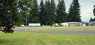
Tillamook Airport is a public use airport located 3 miles (4.8 km) south of the central business district of Tillamook, a city in Tillamook County, Oregon, United States. It is owned by the Port of Tillamook Bay. According to the FAA's National Plan of Integrated Airport Systems for 2009–2013, it is categorized as a general aviation facility.
Beluga Airport is a private use airport in Beluga, in the Kenai Peninsula Borough of the U.S. state of Alaska. It is privately owned by ConocoPhillips.

Sylacauga Municipal Airport, also known as Merkel Field, is a city-owned public-use airport located three nautical miles west of the central business district of Sylacauga, a city in Talladega County, Alabama, United States. It is included in the FAA's National Plan of Integrated Airport Systems for 2011–2015, which categorized it as a general aviation facility.
Deer Park Airport, formerly known as Deer Park Municipal Airport, is a city-owned public-use airport located three nautical miles (6 km) northeast of the central business district of Deer Park, a city in Spokane County, Washington, United States.
Naval Outlying Landing Field (NOLF) Santa Rosa is a military use airport located five nautical miles (9 km) southeast of the central business district of Milton, in Santa Rosa County, Florida, United States. It is owned by the United States Navy and has four asphalt paved runways all of which are 4,500 by 150 feet. The airfield is under the control of Commander, Training Air Wing FIVE at NAS Whiting Field, Florida.
Cloquet Carlton County Airport is a county-owned public-use airport located three nautical miles (6 km) southwest of the central business district of Cloquet, a city in Carlton County, Minnesota, United States.
Scott Municipal Airport is a public-use airport located four nautical miles southwest of the central business district of Oneida, a city in Scott County, Tennessee, United States. The airport is owned by Scott County. Big South Fork Airpark, a gated community and residential airpark is located adjacent to the airport.
Harry Stern Airport is a public use airport in Richland County, North Dakota, United States. It is located one nautical mile (1.85 km) south of the central business district of Wahpeton, North Dakota and owned by the Wahpeton Airport Authority.

Pilot Point Airport is a state-owned, public-use airport located in Pilot Point, a city in the Lake and Peninsula Borough of the U.S. state of Alaska. Scheduled airline service to King Salmon Airport is provided by Grant Aviation.
Shelbyville Municipal Airport is a public use airport located four nautical miles (7 km) northwest of the central business district of Shelbyville, in Shelby County, Indiana, United States. The airport is owned by the city of Shelbyville and is controlled by the mayor and an appointed Board of Commissioners. According to the FAA's National Plan of Integrated Airport Systems for 2009–2013, it was classified as a general aviation airport.
Portales Municipal Airport is a city-owned, public-use airport located four nautical miles southwest of the central business district of Portales, a city in Roosevelt County, New Mexico, United States. According to the FAA's National Plan of Integrated Airport Systems for 2009–2013, it is classified as a general aviation airport.

Berkeley County Airport is a county-owned public-use airport in Berkeley County, South Carolina, United States. It is located one nautical mile (1.85 km) southwest of the central business district of Moncks Corner, South Carolina.
James G. Whiting Memorial Field is a city-owned public-use airport located one nautical mile (2 km) north of the central business district of Mapleton, a city in Monona County, Iowa, United States. It is included in the National Plan of Integrated Airport Systems for 2011–2015, which categorized it as a general aviation facility.
Upper Cumberland Regional Airport is a public use airport located adjacent to Tennessee State Route 111 approximately 8.5 nautical miles (15.7 km) south of the central business district of Cookeville and 9 nautical miles (17 km) northwest of the central business district of Sparta. Owned by the Upper Cumberland Airport Authority, which comprises the Cities of Cookeville and Sparta and the governments of White County and Putnam County, it is included in the National Plan of Integrated Airport Systems for 2011–2015, which categorized it as a general aviation facility.